Olsen Ranch Topo Map Wyoming
To zoom in, hover over the map of Olsen Ranch
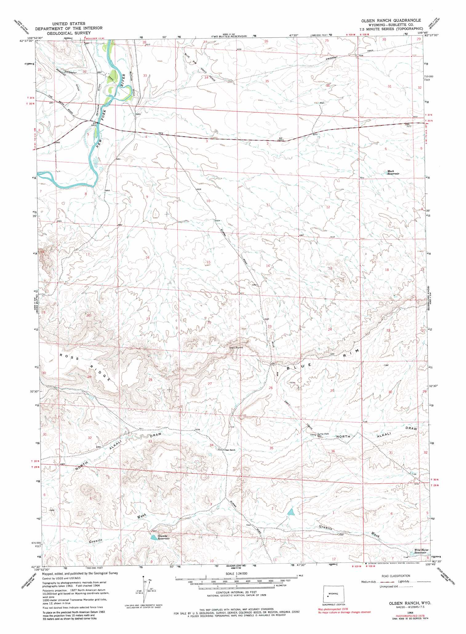
USGS Topo Quad 42109e7 - 1:24,000 scale
| Topo Map Name: | Olsen Ranch |
| USGS Topo Quad ID: | 42109e7 |
| Print Size: | ca. 21 1/4" wide x 27" high |
| Southeast Coordinates: | 42.5° N latitude / 109.75° W longitude |
| Map Center Coordinates: | 42.5625° N latitude / 109.8125° W longitude |
| U.S. State: | WY |
| Filename: | o42109e7.jpg |
| Download Map JPG Image: | Olsen Ranch topo map 1:24,000 scale |
| Map Type: | Topographic |
| Topo Series: | 7.5´ |
| Map Scale: | 1:24,000 |
| Source of Map Images: | United States Geological Survey (USGS) |
| Alternate Map Versions: |
Olsen Ranch WY 1964, updated 1968 Download PDF Buy paper map Olsen Ranch WY 1964, updated 1982 Download PDF Buy paper map Olsen Ranch WY 2012 Download PDF Buy paper map Olsen Ranch WY 2015 Download PDF Buy paper map |
1:24,000 Topo Quads surrounding Olsen Ranch
Daniel |
Mount Airy |
Pinedale |
Boulder Lake |
Scab Creek |
Ball Island |
Mesa Spring |
Two Buttes Reservoir |
Boulder |
Fremont Butte |
Big Piney East |
Ross Butte |
Olsen Ranch |
Gobblers Knob |
Square Top |
Milleson Draw |
Sugar Loaf Nw |
Sugar Loaf Ne |
Stud Horse Butte |
Bull Draw |
La Barge Se |
Oasis Well |
Sugar Loaf |
Teakettle Butte |
Juel Spring |
> Back to 42109e1 at 1:100,000 scale
> Back to 42108a1 at 1:250,000 scale
> Back to U.S. Topo Maps home
Olsen Ranch topo map: Gazetteer
Olsen Ranch: Canals
Bertram Ditch elevation 2091m 6860′Butler Ditch elevation 2105m 6906′
Olsen Ranch: Mines
Rachels Pit elevation 2104m 6902′Olsen Ranch: Reservoirs
Granite Reservoir elevation 2136m 7007′Mack Reservoir elevation 2143m 7030′
Wild Horse Reservoir elevation 2178m 7145′
Olsen Ranch: Wells
Sump Hole Well elevation 2166m 7106′Olsen Ranch digital topo map on disk
Buy this Olsen Ranch topo map showing relief, roads, GPS coordinates and other geographical features, as a high-resolution digital map file on DVD: