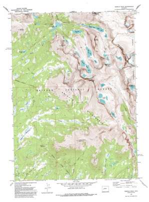
Temple Peak Topo Map Wyoming
To zoom in, hover over the map of Temple Peak
USGS Topo Quad 42109f2 - 1:24,000 scale
| Topo Map Name: | Temple Peak |
| USGS Topo Quad ID: | 42109f2 |
| Print Size: | ca. 21 1/4" wide x 27" high |
| Southeast Coordinates: | 42.625° N latitude / 109.125° W longitude |
| Map Center Coordinates: | 42.6875° N latitude / 109.1875° W longitude |
| U.S. State: | WY |
| Filename: | o42109f2.jpg |
| Download Map JPG Image: | Temple Peak topo map 1:24,000 scale |
| Map Type: | Topographic |
| Topo Series: | 7.5´ |
| Map Scale: | 1:24,000 |
| Source of Map Images: | United States Geological Survey (USGS) |
| Alternate Map Versions: |
Temple Peak WY 1969, updated 1985 Download PDF Buy paper map Temple Peak WY 1969, updated 1992 Download PDF Buy paper map Temple Peak WY 1991, updated 1997 Download PDF Buy paper map Temple Peak WY 2012 Download PDF Buy paper map Temple Peak WY 2015 Download PDF Buy paper map |
| FStopo: | US Forest Service topo Temple Peak is available: Download FStopo PDF Download FStopo TIF |
1:24,000 Topo Quads surrounding Temple Peak
> Back to 42109e1 at 1:100,000 scale
> Back to 42108a1 at 1:250,000 scale
> Back to U.S. Topo Maps home
Temple Peak topo map: Gazetteer
Temple Peak: Dams
Clear Lake Dam elevation 3053m 10016′Temple Peak: Flats
Sedgewick Meadows elevation 2827m 9274′Temple Peak: Lakes
Big Sandy Lake elevation 2955m 9694′Black Joe Lake elevation 3128m 10262′
Blue Lake elevation 3112m 10209′
Clear Lake elevation 3053m 10016′
Deep Lake elevation 3203m 10508′
Diamond Lake elevation 2893m 9491′
Frozen Lakes elevation 3491m 11453′
Miller Lake elevation 3227m 10587′
Rapid Lake elevation 3135m 10285′
Temple Lake elevation 3248m 10656′
Temple Peak: Mines
Temple Peak Deposit elevation 3263m 10705′Temple Peak: Parks
Popo Agie Primitive Area elevation 3499m 11479′Temple Peak: Reservoirs
Clear Lake Reservoir elevation 3053m 10016′Temple Peak: Ridges
Sagebrush Ridge elevation 3236m 10616′Temple Peak: Streams
Black Joe Creek elevation 2959m 9708′Lost Creek elevation 2956m 9698′
North Creek elevation 2957m 9701′
North Temple Creek elevation 2847m 9340′
Rapid Creek elevation 2955m 9694′
Temple Peak: Summits
Bunion Mountain elevation 3614m 11856′Crows Nest elevation 3015m 9891′
East Temple Peak elevation 3822m 12539′
Haystack Mountain elevation 3646m 11961′
Independent Mountain elevation 3536m 11601′
Laturio Mountain elevation 3453m 11328′
Schiestler Peak elevation 3533m 11591′
Temple Peak elevation 3958m 12985′
Wind River Peak elevation 3999m 13120′
Temple Peak: Trails
Big Sunday Trail elevation 2914m 9560′Crows Nest Trail elevation 2910m 9547′
Temple Peak digital topo map on disk
Buy this Temple Peak topo map showing relief, roads, GPS coordinates and other geographical features, as a high-resolution digital map file on DVD:


