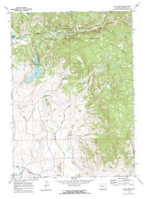
Scab Creek Topo Map Wyoming
To zoom in, hover over the map of Scab Creek
USGS Topo Quad 42109g5 - 1:24,000 scale
| Topo Map Name: | Scab Creek |
| USGS Topo Quad ID: | 42109g5 |
| Print Size: | ca. 21 1/4" wide x 27" high |
| Southeast Coordinates: | 42.75° N latitude / 109.5° W longitude |
| Map Center Coordinates: | 42.8125° N latitude / 109.5625° W longitude |
| U.S. State: | WY |
| Filename: | o42109g5.jpg |
| Download Map JPG Image: | Scab Creek topo map 1:24,000 scale |
| Map Type: | Topographic |
| Topo Series: | 7.5´ |
| Map Scale: | 1:24,000 |
| Source of Map Images: | United States Geological Survey (USGS) |
| Alternate Map Versions: |
Scab Creek WY 1968, updated 1973 Download PDF Buy paper map Scab Creek WY 1968, updated 1973 Download PDF Buy paper map Scab Creek WY 1968, updated 1973 Download PDF Buy paper map Scab Creek WY 1968, updated 1973 Download PDF Buy paper map Scab Creek WY 2012 Download PDF Buy paper map Scab Creek WY 2015 Download PDF Buy paper map |
| FStopo: | US Forest Service topo Scab Creek is available: Download FStopo PDF Download FStopo TIF |
1:24,000 Topo Quads surrounding Scab Creek
> Back to 42109e1 at 1:100,000 scale
> Back to 42108a1 at 1:250,000 scale
> Back to U.S. Topo Maps home
Scab Creek topo map: Gazetteer
Scab Creek: Basins
Hall Basin elevation 2431m 7975′Scab Creek: Canals
Jaycox Number 1 Ditch elevation 2188m 7178′Lovatt Ditch elevation 2187m 7175′
Taylor Ditch elevation 2218m 7276′
Scab Creek: Falls
North Fork Falls elevation 2613m 8572′Scab Creek: Flats
Moonshine Park elevation 2377m 7798′Scab Creek: Lakes
Soda Lake elevation 2259m 7411′Toboggan Lakes elevation 2857m 9373′
Scab Creek: Springs
Steele Hot Springs elevation 2156m 7073′Scab Creek: Streams
Divide Creek elevation 2455m 8054′Lovatt Creek elevation 2163m 7096′
Macs Creek elevation 2357m 7732′
North Fork Boulder Creek elevation 2503m 8211′
Pipestone Creek elevation 2561m 8402′
Scab Creek elevation 2193m 7194′
Spring Creek elevation 2154m 7066′
Scab Creek: Summits
Lovatt Butte elevation 2252m 7388′Scab Creek: Trails
Boulder Canyon Trail elevation 2550m 8366′Scab Lake Trail elevation 2892m 9488′
Scab Creek digital topo map on disk
Buy this Scab Creek topo map showing relief, roads, GPS coordinates and other geographical features, as a high-resolution digital map file on DVD:


