Mount Airy Topo Map Wyoming
To zoom in, hover over the map of Mount Airy
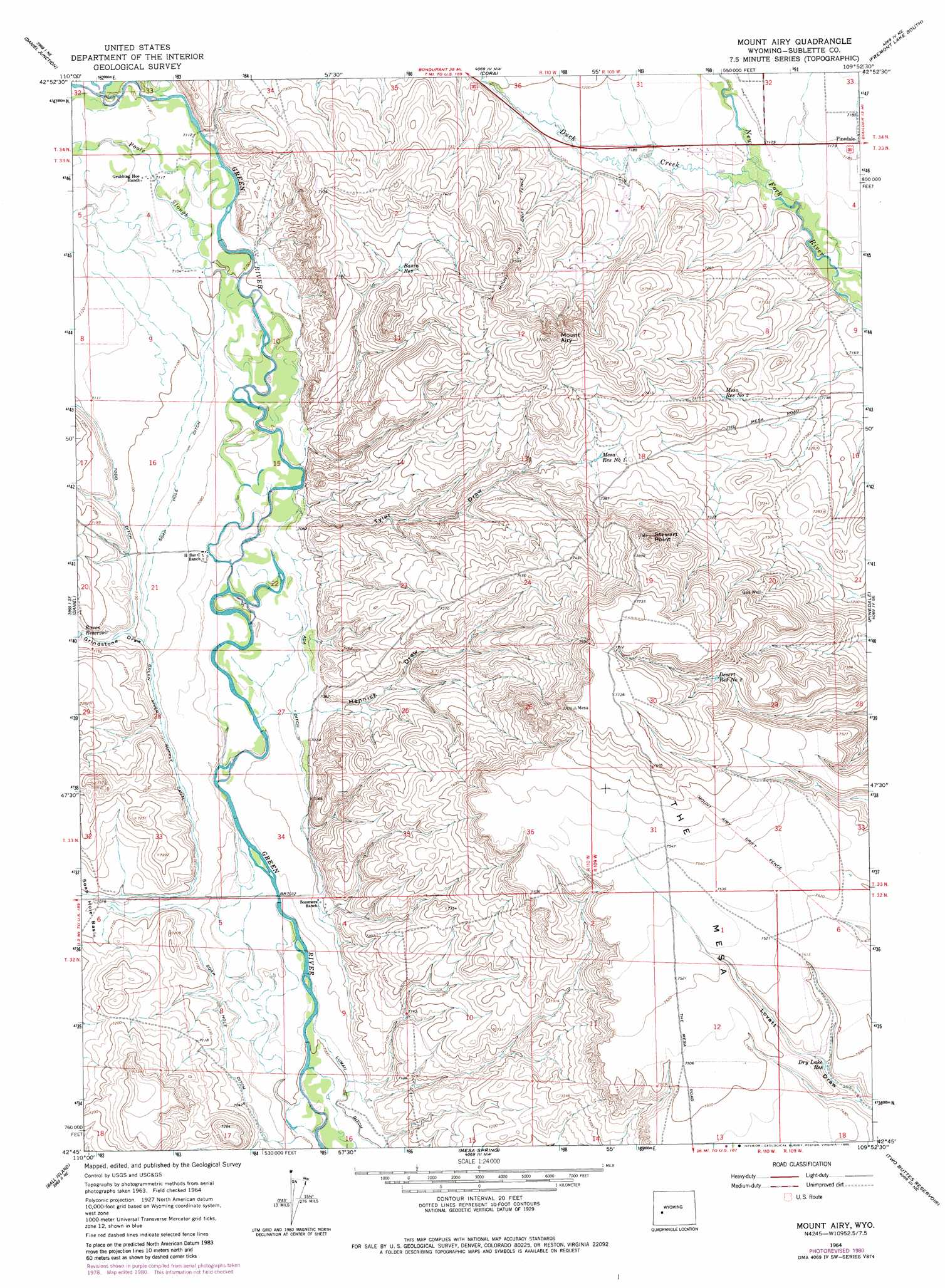
USGS Topo Quad 42109g8 - 1:24,000 scale
| Topo Map Name: | Mount Airy |
| USGS Topo Quad ID: | 42109g8 |
| Print Size: | ca. 21 1/4" wide x 27" high |
| Southeast Coordinates: | 42.75° N latitude / 109.875° W longitude |
| Map Center Coordinates: | 42.8125° N latitude / 109.9375° W longitude |
| U.S. State: | WY |
| Filename: | o42109g8.jpg |
| Download Map JPG Image: | Mount Airy topo map 1:24,000 scale |
| Map Type: | Topographic |
| Topo Series: | 7.5´ |
| Map Scale: | 1:24,000 |
| Source of Map Images: | United States Geological Survey (USGS) |
| Alternate Map Versions: |
Mount Airy WY 1964, updated 1968 Download PDF Buy paper map Mount Airy WY 1964, updated 1980 Download PDF Buy paper map Mount Airy WY 2012 Download PDF Buy paper map Mount Airy WY 2015 Download PDF Buy paper map |
1:24,000 Topo Quads surrounding Mount Airy
Signal Hill |
Warren Bridge |
New Fork Lakes |
Fremont Lake North |
Bridger Lakes |
Webb Draw |
Daniel Junction |
Cora |
Fremont Lake South |
Fayette Lake |
Onion Springs |
Daniel |
Mount Airy |
Pinedale |
Boulder Lake |
Budd Reservoir |
Ball Island |
Mesa Spring |
Two Buttes Reservoir |
Boulder |
Big Piney West |
Big Piney East |
Ross Butte |
Olsen Ranch |
Gobblers Knob |
> Back to 42109e1 at 1:100,000 scale
> Back to 42108a1 at 1:250,000 scale
> Back to U.S. Topo Maps home
Mount Airy topo map: Gazetteer
Mount Airy: Canals
Ada Ditch elevation 2154m 7066′Soap Hole Ditch elevation 2152m 7060′
Mount Airy: Cliffs
Stewart Point elevation 2357m 7732′Mount Airy: Reservoirs
Basin Reservoir elevation 2222m 7290′Desert Reservoir Number 2 elevation 2294m 7526′
Dry Lake Reservoir elevation 2267m 7437′
Mesa Reservoir Number 1 elevation 2233m 7326′
Mesa Reservoir Number 2 elevation 2215m 7267′
Mount Airy: Streams
Duck Creek elevation 2185m 7168′Poole Slough elevation 2163m 7096′
Mount Airy: Summits
Mount Airy elevation 2333m 7654′Mount Airy: Valleys
Grindstone Draw elevation 2163m 7096′Hennick Draw elevation 2147m 7043′
Tyler Draw elevation 2160m 7086′
Mount Airy digital topo map on disk
Buy this Mount Airy topo map showing relief, roads, GPS coordinates and other geographical features, as a high-resolution digital map file on DVD: