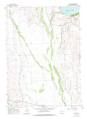
Cora Topo Map Wyoming
To zoom in, hover over the map of Cora
USGS Topo Quad 42109h8 - 1:24,000 scale
| Topo Map Name: | Cora |
| USGS Topo Quad ID: | 42109h8 |
| Print Size: | ca. 21 1/4" wide x 27" high |
| Southeast Coordinates: | 42.875° N latitude / 109.875° W longitude |
| Map Center Coordinates: | 42.9375° N latitude / 109.9375° W longitude |
| U.S. State: | WY |
| Filename: | o42109h8.jpg |
| Download Map JPG Image: | Cora topo map 1:24,000 scale |
| Map Type: | Topographic |
| Topo Series: | 7.5´ |
| Map Scale: | 1:24,000 |
| Source of Map Images: | United States Geological Survey (USGS) |
| Alternate Map Versions: |
Cora WY 1964, updated 1968 Download PDF Buy paper map Cora WY 1964, updated 1978 Download PDF Buy paper map Cora WY 2012 Download PDF Buy paper map Cora WY 2015 Download PDF Buy paper map |
| FStopo: | US Forest Service topo Cora is available: Download FStopo PDF Download FStopo TIF |
1:24,000 Topo Quads surrounding Cora
> Back to 42109e1 at 1:100,000 scale
> Back to 42108a1 at 1:250,000 scale
> Back to U.S. Topo Maps home
Cora topo map: Gazetteer
Cora: Canals
Binning Ditch elevation 2266m 7434′Highline Ditch elevation 2350m 7709′
Jenkins Ditch elevation 2278m 7473′
Rahm Ditch elevation 2274m 7460′
Cora: Dams
Willow Lake Dam elevation 2355m 7726′Cora: Lakes
Chain Lakes elevation 2318m 7604′Cora: Mines
Cora Pit elevation 2256m 7401′F Bar Cross Seventy-six Mine elevation 2264m 7427′
Freds Hill Pit elevation 2243m 7358′
Graveyard Pit elevation 2258m 7408′
Noble Pit elevation 2261m 7417′
Wimple Pit elevation 2262m 7421′
Cora: Populated Places
Cora elevation 2241m 7352′Cora: Streams
Faler Creek elevation 2172m 7125′Lake Creek elevation 2230m 7316′
Willow Creek elevation 2192m 7191′
Cora: Valleys
Hay Gulch elevation 2211m 7253′Spring Gulch elevation 2250m 7381′
Cora digital topo map on disk
Buy this Cora topo map showing relief, roads, GPS coordinates and other geographical features, as a high-resolution digital map file on DVD:


