Wilkinson Creek Topo Map Wyoming
To zoom in, hover over the map of Wilkinson Creek
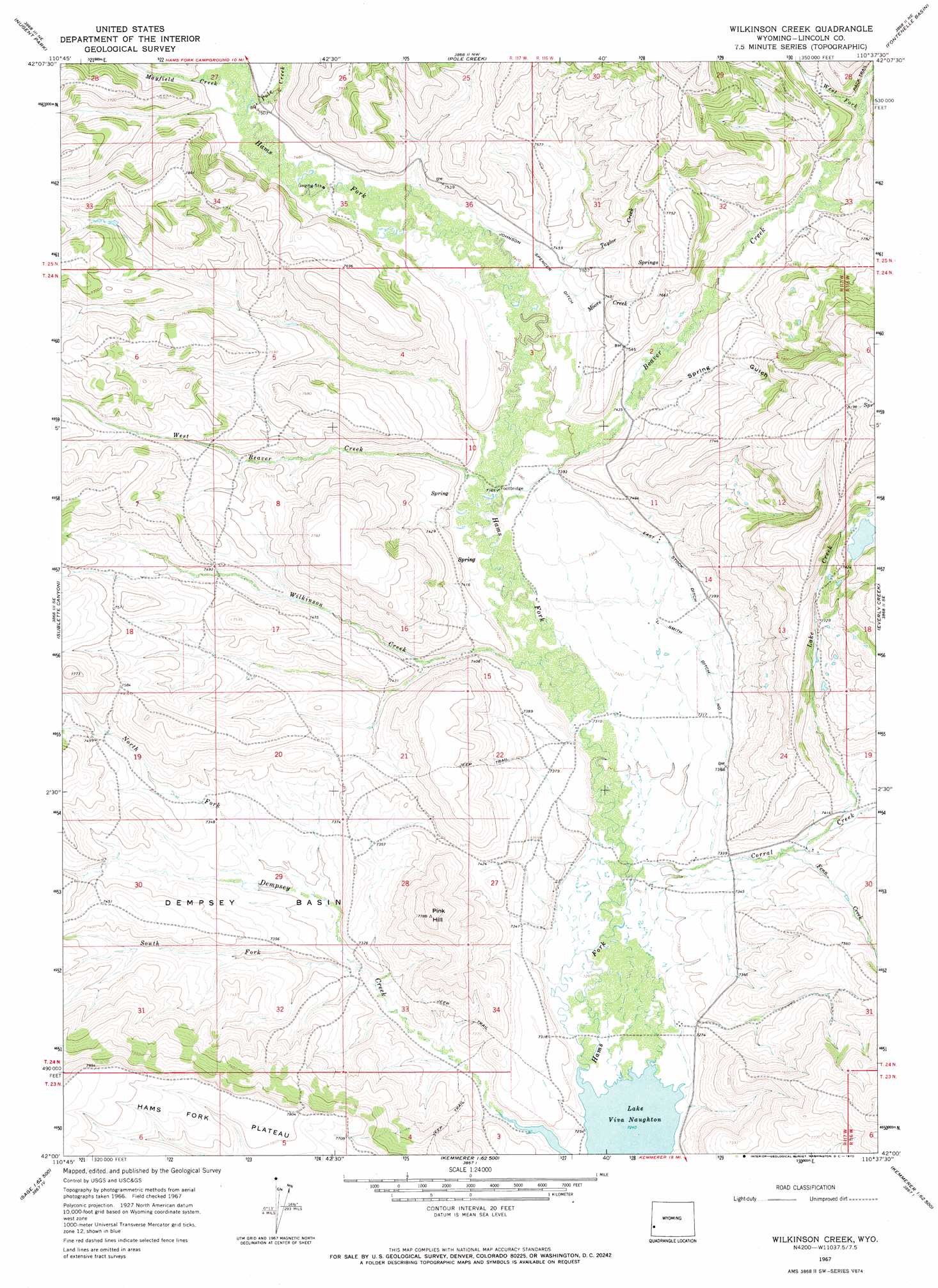
USGS Topo Quad 42110a6 - 1:24,000 scale
| Topo Map Name: | Wilkinson Creek |
| USGS Topo Quad ID: | 42110a6 |
| Print Size: | ca. 21 1/4" wide x 27" high |
| Southeast Coordinates: | 42° N latitude / 110.625° W longitude |
| Map Center Coordinates: | 42.0625° N latitude / 110.6875° W longitude |
| U.S. State: | WY |
| Filename: | o42110a6.jpg |
| Download Map JPG Image: | Wilkinson Creek topo map 1:24,000 scale |
| Map Type: | Topographic |
| Topo Series: | 7.5´ |
| Map Scale: | 1:24,000 |
| Source of Map Images: | United States Geological Survey (USGS) |
| Alternate Map Versions: |
Wilkinson Creek WY 1967, updated 1970 Download PDF Buy paper map Wilkinson Creek WY 2012 Download PDF Buy paper map Wilkinson Creek WY 2015 Download PDF Buy paper map |
1:24,000 Topo Quads surrounding Wilkinson Creek
Huff Lake |
Big Park |
Devils Hole Creek |
Coal Creek |
Lake Mountain |
Marse |
Nugent Park |
Pole Creek |
Fontenelle Basin |
Fort Hill |
Cokeville |
Sublette Canyon |
Wilkinson Creek |
South Fork Mountain |
Fontenelle Gap |
Beckwith |
The Rock Slide |
Kemmerer Reservoir |
Sublet |
Round Mountain |
Sage |
Nugget |
Fossil |
Kemmerer |
Willow Springs |
> Back to 42110a1 at 1:100,000 scale
> Back to 42110a1 at 1:250,000 scale
> Back to U.S. Topo Maps home
Wilkinson Creek topo map: Gazetteer
Wilkinson Creek: Basins
Dempsey Basin elevation 2229m 7312′Wilkinson Creek: Canals
East Stock Ditch elevation 2251m 7385′Johnson Spencer Ditch elevation 2269m 7444′
Smith Ditch Number 1 elevation 2243m 7358′
Wilkinson Creek: Reservoirs
Lake Viva Naughton elevation 2208m 7244′Wilkinson Creek: Streams
Beaver Creek elevation 2245m 7365′Corral Creek elevation 2221m 7286′
Fenn Creek elevation 2244m 7362′
Lake Creek elevation 2251m 7385′
Mayfield Creek elevation 2285m 7496′
Moore Creek elevation 2268m 7440′
North Fork Dempsey Creek elevation 2221m 7286′
Pole Creek elevation 2285m 7496′
South Fork Dempsey Creek elevation 2215m 7267′
Taylor Creek elevation 2257m 7404′
West Beaver Creek elevation 2246m 7368′
West Fork Beaver Creek elevation 2327m 7634′
Wilkinson Creek elevation 2235m 7332′
Wilkinson Creek: Summits
Pink Hill elevation 2366m 7762′Wilkinson Creek: Valleys
Spring Gulch elevation 2280m 7480′Wilkinson Creek digital topo map on disk
Buy this Wilkinson Creek topo map showing relief, roads, GPS coordinates and other geographical features, as a high-resolution digital map file on DVD: