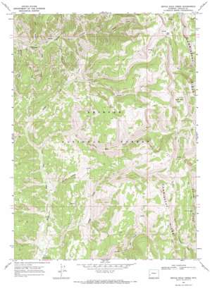
Devils Hole Creek Topo Map Wyoming
To zoom in, hover over the map of Devils Hole Creek
USGS Topo Quad 42110c6 - 1:24,000 scale
| Topo Map Name: | Devils Hole Creek |
| USGS Topo Quad ID: | 42110c6 |
| Print Size: | ca. 21 1/4" wide x 27" high |
| Southeast Coordinates: | 42.25° N latitude / 110.625° W longitude |
| Map Center Coordinates: | 42.3125° N latitude / 110.6875° W longitude |
| U.S. State: | WY |
| Filename: | o42110c6.jpg |
| Download Map JPG Image: | Devils Hole Creek topo map 1:24,000 scale |
| Map Type: | Topographic |
| Topo Series: | 7.5´ |
| Map Scale: | 1:24,000 |
| Source of Map Images: | United States Geological Survey (USGS) |
| Alternate Map Versions: |
Devils Hole Creek WY 1967, updated 1970 Download PDF Buy paper map Devils Hole Creek WY 1967, updated 1971 Download PDF Buy paper map Devils Hole Creek WY 2012 Download PDF Buy paper map Devils Hole Creek WY 2015 Download PDF Buy paper map |
| FStopo: | US Forest Service topo Devils Hole Creek is available: Download FStopo PDF Download FStopo TIF |
1:24,000 Topo Quads surrounding Devils Hole Creek
> Back to 42110a1 at 1:100,000 scale
> Back to 42110a1 at 1:250,000 scale
> Back to U.S. Topo Maps home
Devils Hole Creek topo map: Gazetteer
Devils Hole Creek: Flats
Red Park elevation 2918m 9573′Devils Hole Creek: Lakes
Devils Hole Lakes elevation 2801m 9189′Devils Hole Creek: Streams
Devils Hole Creek elevation 2487m 8159′Fawn Creek elevation 2301m 7549′
Hams Fork Creek elevation 2481m 8139′
Indian Creek elevation 2417m 7929′
Little Indian Creek elevation 2456m 8057′
Mistum Creek elevation 2253m 7391′
Rough Creek elevation 2431m 7975′
Slide Creek elevation 2275m 7463′
South Coantag Creek elevation 2293m 7522′
South Fork Hams Fork elevation 2632m 8635′
Way Creek elevation 2272m 7454′
Devils Hole Creek digital topo map on disk
Buy this Devils Hole Creek topo map showing relief, roads, GPS coordinates and other geographical features, as a high-resolution digital map file on DVD:


