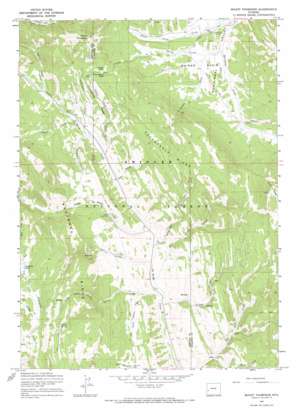
Mount Thompson Topo Map Wyoming
To zoom in, hover over the map of Mount Thompson
USGS Topo Quad 42110d5 - 1:24,000 scale
| Topo Map Name: | Mount Thompson |
| USGS Topo Quad ID: | 42110d5 |
| Print Size: | ca. 21 1/4" wide x 27" high |
| Southeast Coordinates: | 42.375° N latitude / 110.5° W longitude |
| Map Center Coordinates: | 42.4375° N latitude / 110.5625° W longitude |
| U.S. State: | WY |
| Filename: | o42110d5.jpg |
| Download Map JPG Image: | Mount Thompson topo map 1:24,000 scale |
| Map Type: | Topographic |
| Topo Series: | 7.5´ |
| Map Scale: | 1:24,000 |
| Source of Map Images: | United States Geological Survey (USGS) |
| Alternate Map Versions: |
Mount Thompson WY 1967, updated 1971 Download PDF Buy paper map Mount Thompson WY 2012 Download PDF Buy paper map Mount Thompson WY 2015 Download PDF Buy paper map |
| FStopo: | US Forest Service topo Mount Thompson is available: Download FStopo PDF Download FStopo TIF |
1:24,000 Topo Quads surrounding Mount Thompson
> Back to 42110a1 at 1:100,000 scale
> Back to 42110a1 at 1:250,000 scale
> Back to U.S. Topo Maps home
Mount Thompson topo map: Gazetteer
Mount Thompson: Basins
Snyder Basin elevation 2465m 8087′Mount Thompson: Flats
Meridonal Valley elevation 2453m 8047′Mount Thompson: Gaps
Thompson Pass elevation 2669m 8756′Mount Thompson: Parks
Coyote Park elevation 2682m 8799′Mount Thompson: Ridges
Absaroka Ridge elevation 2791m 9156′Packsaddle Ridge elevation 2743m 8999′
Witherspoon Ridge elevation 2603m 8540′
Mount Thompson: Springs
Indian Spring elevation 2749m 9019′Mount Thompson: Streams
Bald Hornet Creek elevation 2382m 7814′Cabin Creek elevation 2454m 8051′
Coyote Park Creek elevation 2450m 8038′
Indian Creek elevation 2411m 7910′
Indian Creek elevation 2488m 8162′
La Barge Creek elevation 2486m 8156′
Little Indian Creek elevation 2503m 8211′
Mack Creek elevation 2703m 8868′
McKay Creek elevation 2435m 7988′
Nameless Creek elevation 2437m 7995′
Packsaddle Creek elevation 2397m 7864′
Pomeroy Creek elevation 2698m 8851′
Porcupine Creek elevation 2422m 7946′
Road Creek elevation 2465m 8087′
Shafer Creek elevation 2388m 7834′
South Indian Creek elevation 2391m 7844′
South La Barge Creek elevation 2395m 7857′
Spring Creek elevation 2435m 7988′
Spring Creek elevation 2477m 8126′
Turkey Creek elevation 2373m 7785′
Twin Creek elevation 2669m 8756′
Witherspoon Creek elevation 2455m 8054′
Mount Thompson: Summits
Mount Thompson elevation 2947m 9668′Mount Thompson: Trails
Emigrant Trail elevation 2512m 8241′Mount Thompson: Valleys
Deer Gulch elevation 2445m 8021′Mount Thompson digital topo map on disk
Buy this Mount Thompson topo map showing relief, roads, GPS coordinates and other geographical features, as a high-resolution digital map file on DVD:


