Budd Reservoir Topo Map Wyoming
To zoom in, hover over the map of Budd Reservoir
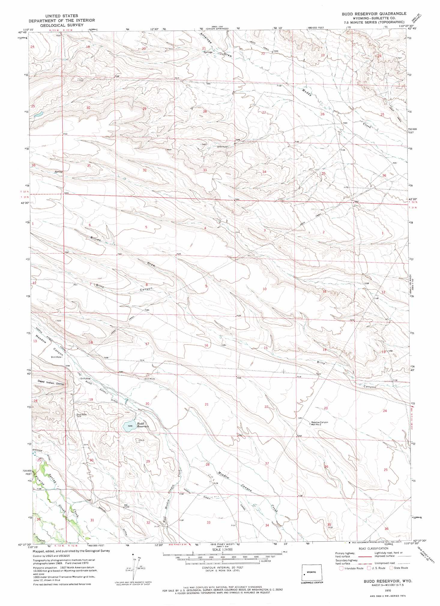
USGS Topo Quad 42110f2 - 1:24,000 scale
| Topo Map Name: | Budd Reservoir |
| USGS Topo Quad ID: | 42110f2 |
| Print Size: | ca. 21 1/4" wide x 27" high |
| Southeast Coordinates: | 42.625° N latitude / 110.125° W longitude |
| Map Center Coordinates: | 42.6875° N latitude / 110.1875° W longitude |
| U.S. State: | WY |
| Filename: | o42110f2.jpg |
| Download Map JPG Image: | Budd Reservoir topo map 1:24,000 scale |
| Map Type: | Topographic |
| Topo Series: | 7.5´ |
| Map Scale: | 1:24,000 |
| Source of Map Images: | United States Geological Survey (USGS) |
| Alternate Map Versions: |
Budd Reservoir WY 1970, updated 1973 Download PDF Buy paper map Budd Reservoir WY 2012 Download PDF Buy paper map Budd Reservoir WY 2015 Download PDF Buy paper map |
1:24,000 Topo Quads surrounding Budd Reservoir
Prospect Peak |
Merna Butte |
Webb Draw |
Daniel Junction |
Cora |
Maki Creek |
Halfway |
Onion Springs |
Daniel |
Mount Airy |
Red Castle Creek |
Meadow Canyon |
Budd Reservoir |
Ball Island |
Mesa Spring |
Springman Creek |
Deer Hill |
Big Piney West |
Big Piney East |
Ross Butte |
Pine Grove Ridge |
Cretaceous Mountain |
Chimney Butte |
Milleson Draw |
Sugar Loaf Nw |
> Back to 42110e1 at 1:100,000 scale
> Back to 42110a1 at 1:250,000 scale
> Back to U.S. Topo Maps home
Budd Reservoir topo map: Gazetteer
Budd Reservoir: Canals
Gravel Ditch elevation 2183m 7162′Joe Budd Supply Ditch elevation 2213m 7260′
Spencer Ditch elevation 2201m 7221′
Budd Reservoir: Dams
Joe Budd Dam elevation 2207m 7240′Budd Reservoir: Reservoirs
Budd Reservoir elevation 2204m 7230′Joe Budd Reservoir elevation 2207m 7240′
Budd Reservoir: Streams
Fleming Slough elevation 2180m 7152′Budd Reservoir: Valleys
Antelope Draw elevation 2188m 7178′Billies Draw elevation 2256m 7401′
Meadow Canyon elevation 2218m 7276′
Ryegrass Draw elevation 2278m 7473′
Budd Reservoir: Wells
Meadow Canyon Well Number 2 elevation 2221m 7286′Budd Reservoir digital topo map on disk
Buy this Budd Reservoir topo map showing relief, roads, GPS coordinates and other geographical features, as a high-resolution digital map file on DVD: