Meadow Canyon Topo Map Wyoming
To zoom in, hover over the map of Meadow Canyon
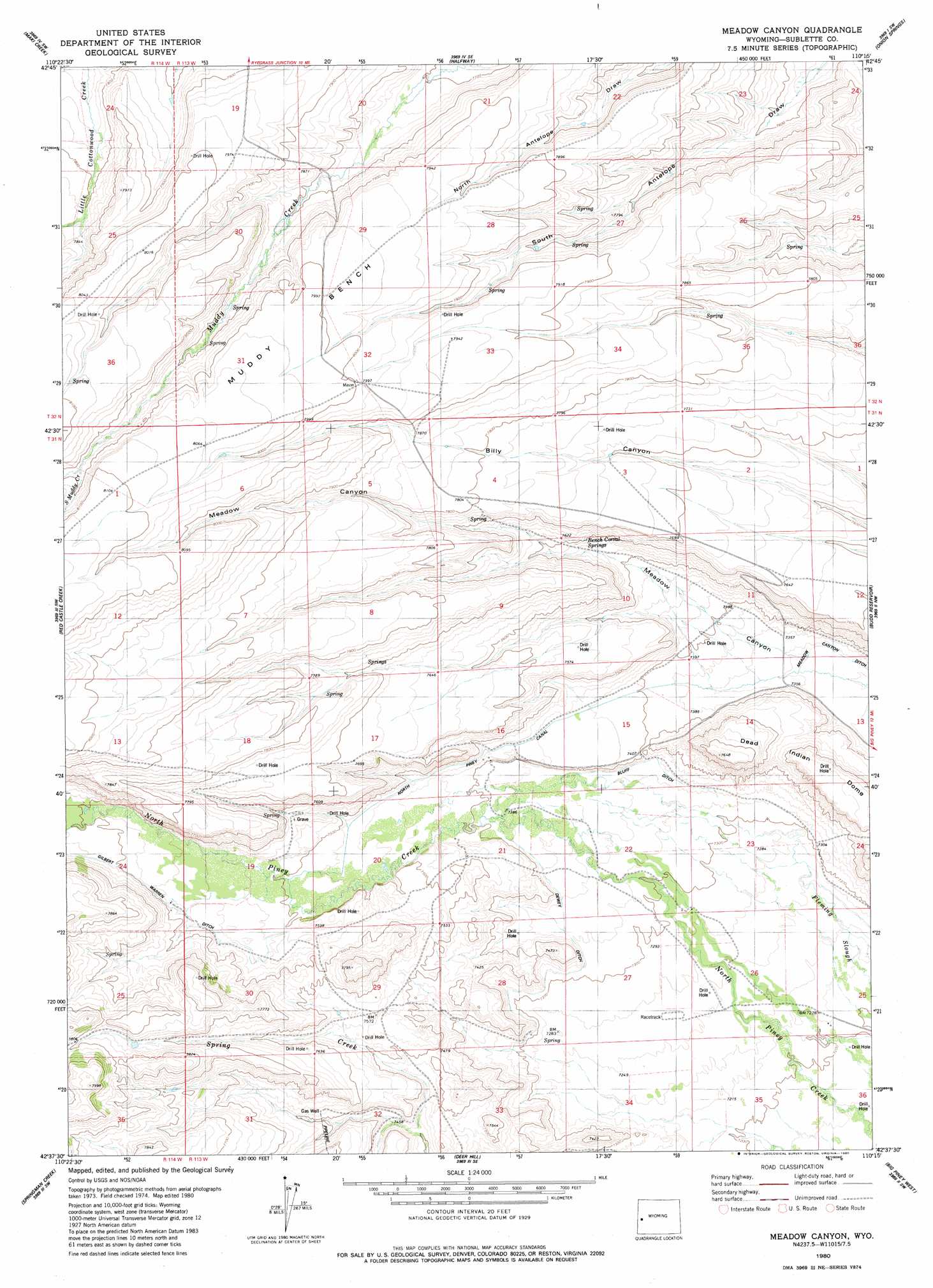
USGS Topo Quad 42110f3 - 1:24,000 scale
| Topo Map Name: | Meadow Canyon |
| USGS Topo Quad ID: | 42110f3 |
| Print Size: | ca. 21 1/4" wide x 27" high |
| Southeast Coordinates: | 42.625° N latitude / 110.25° W longitude |
| Map Center Coordinates: | 42.6875° N latitude / 110.3125° W longitude |
| U.S. State: | WY |
| Filename: | o42110f3.jpg |
| Download Map JPG Image: | Meadow Canyon topo map 1:24,000 scale |
| Map Type: | Topographic |
| Topo Series: | 7.5´ |
| Map Scale: | 1:24,000 |
| Source of Map Images: | United States Geological Survey (USGS) |
| Alternate Map Versions: |
Meadow Canyon WY 1980, updated 1980 Download PDF Buy paper map Meadow Canyon WY 2012 Download PDF Buy paper map Meadow Canyon WY 2015 Download PDF Buy paper map |
1:24,000 Topo Quads surrounding Meadow Canyon
Lookout Mountain |
Prospect Peak |
Merna Butte |
Webb Draw |
Daniel Junction |
Triple Peak |
Maki Creek |
Halfway |
Onion Springs |
Daniel |
Mount Schidler |
Red Castle Creek |
Meadow Canyon |
Budd Reservoir |
Ball Island |
Wyoming Peak |
Springman Creek |
Deer Hill |
Big Piney West |
Big Piney East |
Mount Thompson |
Pine Grove Ridge |
Cretaceous Mountain |
Chimney Butte |
Milleson Draw |
> Back to 42110e1 at 1:100,000 scale
> Back to 42110a1 at 1:250,000 scale
> Back to U.S. Topo Maps home
Meadow Canyon topo map: Gazetteer
Meadow Canyon: Benches
Muddy Bench elevation 2445m 8021′Meadow Canyon: Canals
Bluff Ditch elevation 2243m 7358′Dewey Ditch elevation 2235m 7332′
Gilbert Warren Ditch elevation 2305m 7562′
Meadow Canyon Ditch elevation 2238m 7342′
North Piney Canal elevation 2238m 7342′
Meadow Canyon: Springs
Bench Corral Springs elevation 2319m 7608′Meadow Canyon: Streams
South Muddy Creek elevation 2433m 7982′Meadow Canyon: Summits
Dead Indian Dome elevation 2303m 7555′Meadow Canyon digital topo map on disk
Buy this Meadow Canyon topo map showing relief, roads, GPS coordinates and other geographical features, as a high-resolution digital map file on DVD: