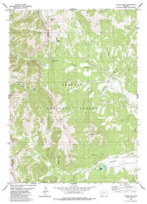
Triple Peak Topo Map Wyoming
To zoom in, hover over the map of Triple Peak
USGS Topo Quad 42110g5 - 1:24,000 scale
| Topo Map Name: | Triple Peak |
| USGS Topo Quad ID: | 42110g5 |
| Print Size: | ca. 21 1/4" wide x 27" high |
| Southeast Coordinates: | 42.75° N latitude / 110.5° W longitude |
| Map Center Coordinates: | 42.8125° N latitude / 110.5625° W longitude |
| U.S. State: | WY |
| Filename: | o42110g5.jpg |
| Download Map JPG Image: | Triple Peak topo map 1:24,000 scale |
| Map Type: | Topographic |
| Topo Series: | 7.5´ |
| Map Scale: | 1:24,000 |
| Source of Map Images: | United States Geological Survey (USGS) |
| Alternate Map Versions: |
Triple Peak WY 1980, updated 1980 Download PDF Buy paper map Triple Peak WY 1980, updated 1980 Download PDF Buy paper map Triple Peak WY 1980, updated 1980 Download PDF Buy paper map Triple Peak WY 2012 Download PDF Buy paper map Triple Peak WY 2015 Download PDF Buy paper map |
| FStopo: | US Forest Service topo Triple Peak is available: Download FStopo PDF Download FStopo TIF |
1:24,000 Topo Quads surrounding Triple Peak
> Back to 42110e1 at 1:100,000 scale
> Back to 42110a1 at 1:250,000 scale
> Back to U.S. Topo Maps home
Triple Peak topo map: Gazetteer
Triple Peak: Flats
Foster Meadows elevation 2516m 8254′Triple Peak: Lakes
Soda Lake elevation 2531m 8303′Triple Peak: Mines
Cottonwood Mine elevation 2710m 8891′Cottonwood Mine elevation 2932m 9619′
Kleinstick Mine elevation 2701m 8861′
New Cottonwood Mine elevation 2695m 8841′
Sheep Creek Divide Mine elevation 2876m 9435′
Smith Mine elevation 2901m 9517′
Triple Peak: Streams
Chase Creek elevation 2462m 8077′Dry Basin Creek elevation 2590m 8497′
Eagle Creek elevation 2601m 8533′
Hardin Creek elevation 2440m 8005′
Hidden Basin Creek elevation 2560m 8398′
Lander Creek elevation 2523m 8277′
McDougal Creek elevation 2483m 8146′
Nylanden Creek elevation 2463m 8080′
Ole Creek elevation 2466m 8090′
Sjhoberg Creek elevation 2503m 8211′
Snowdrift Creek elevation 2581m 8467′
South Fork South Cottonwood Creek elevation 2583m 8474′
Trailer Creek elevation 2543m 8343′
Triple Peak: Summits
Lander Peak elevation 3182m 10439′Mount McDougal elevation 3257m 10685′
Triple Peak elevation 3388m 11115′
Triple Peak digital topo map on disk
Buy this Triple Peak topo map showing relief, roads, GPS coordinates and other geographical features, as a high-resolution digital map file on DVD:


