Rock Lake Peak Topo Map Wyoming
To zoom in, hover over the map of Rock Lake Peak
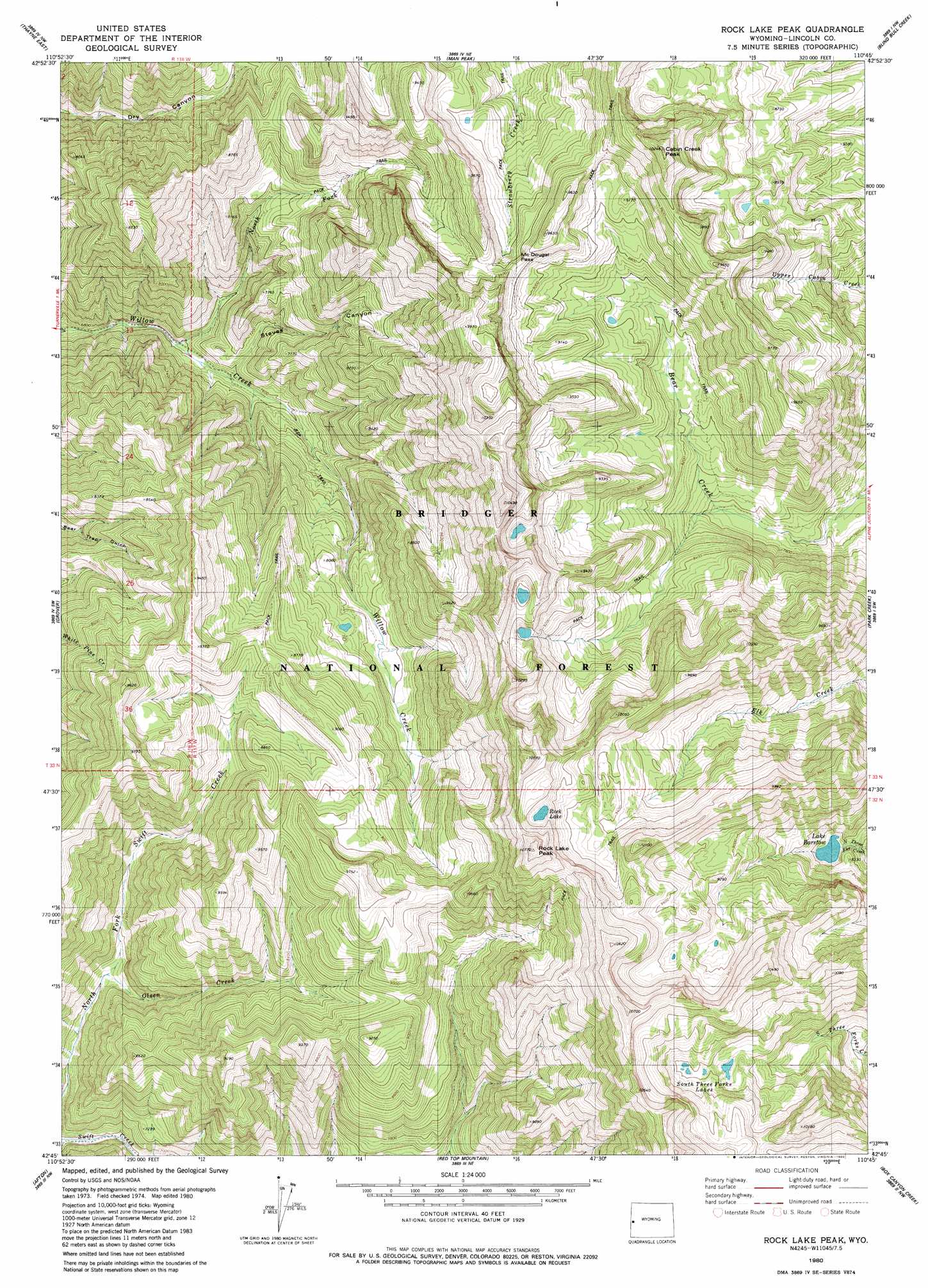
USGS Topo Quad 42110g7 - 1:24,000 scale
| Topo Map Name: | Rock Lake Peak |
| USGS Topo Quad ID: | 42110g7 |
| Print Size: | ca. 21 1/4" wide x 27" high |
| Southeast Coordinates: | 42.75° N latitude / 110.75° W longitude |
| Map Center Coordinates: | 42.8125° N latitude / 110.8125° W longitude |
| U.S. State: | WY |
| Filename: | o42110g7.jpg |
| Download Map JPG Image: | Rock Lake Peak topo map 1:24,000 scale |
| Map Type: | Topographic |
| Topo Series: | 7.5´ |
| Map Scale: | 1:24,000 |
| Source of Map Images: | United States Geological Survey (USGS) |
| Alternate Map Versions: |
Rock Lake Peak WY 1980, updated 1980 Download PDF Buy paper map Rock Lake Peak WY 1980, updated 1980 Download PDF Buy paper map Rock Lake Peak WY 2012 Download PDF Buy paper map Rock Lake Peak WY 2015 Download PDF Buy paper map |
| FStopo: | US Forest Service topo Rock Lake Peak is available: Download FStopo PDF Download FStopo TIF |
1:24,000 Topo Quads surrounding Rock Lake Peak
Etna |
Stewart Peak |
Deer Creek |
Pickle Pass |
Hoback Peak |
Thayne West |
Thayne East |
Man Peak |
Blind Bull Creek |
Lookout Mountain |
Auburn |
Grover |
Rock Lake Peak |
Park Creek |
Triple Peak |
Sage Valley |
Afton |
Red Top Mountain |
Box Canyon Creek |
Mount Schidler |
Elk Valley |
Smoot |
Mount Wagner |
Poison Meadows |
Wyoming Peak |
> Back to 42110e1 at 1:100,000 scale
> Back to 42110a1 at 1:250,000 scale
> Back to U.S. Topo Maps home
Rock Lake Peak topo map: Gazetteer
Rock Lake Peak: Forests
Bridger National Forest elevation 2860m 9383′Rock Lake Peak: Gaps
McDougal Pass elevation 2799m 9183′Rock Lake Peak: Lakes
Lake Bastow elevation 2473m 8113′Rock Lake elevation 3006m 9862′
South Three Forks Lakes elevation 2829m 9281′
Rock Lake Peak: Mines
Dry Canyon Mine elevation 2464m 8083′McDouglas Pass Mine elevation 2795m 9169′
Rock Lake Peak: Ranges
Salt River Range elevation 2236m 7335′Rock Lake Peak: Streams
North Fork Willow Creek elevation 2066m 6778′Olsen Creek elevation 2210m 7250′
Rock Creek elevation 2414m 7919′
Rock Lake Peak: Summits
Cabin Creek Peak elevation 3105m 10187′Rock Lake Peak elevation 3263m 10705′
Rock Lake Peak: Valleys
Steves Canyon elevation 2096m 6876′Rock Lake Peak digital topo map on disk
Buy this Rock Lake Peak topo map showing relief, roads, GPS coordinates and other geographical features, as a high-resolution digital map file on DVD: