Pegram Creek Topo Map Idaho
To zoom in, hover over the map of Pegram Creek
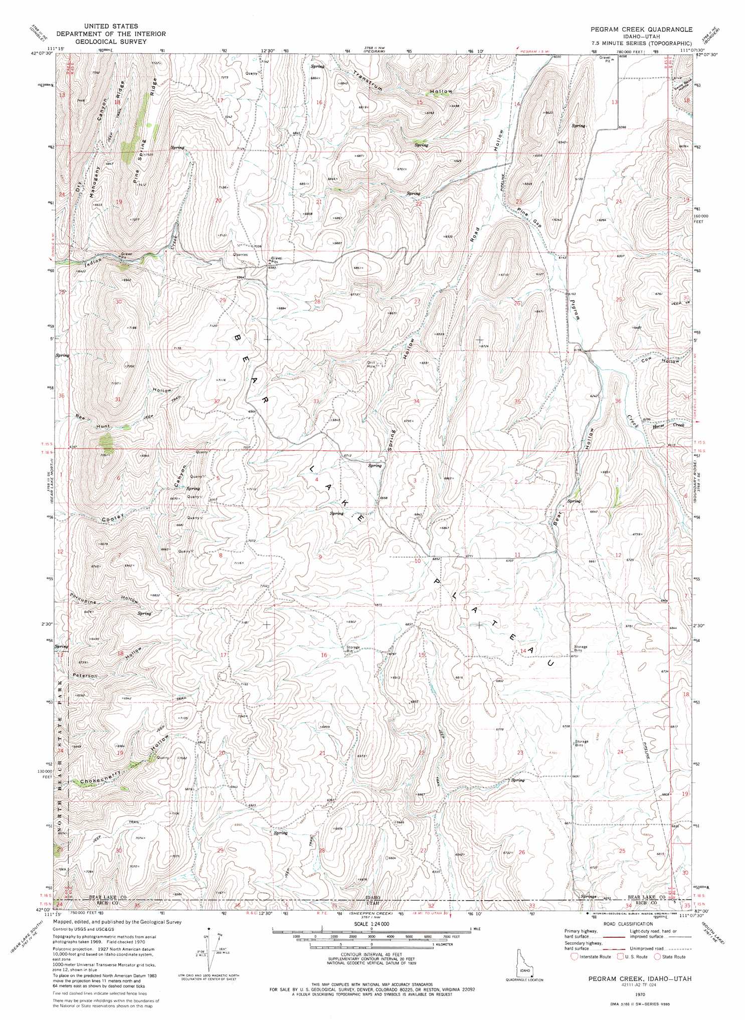
USGS Topo Quad 42111a2 - 1:24,000 scale
| Topo Map Name: | Pegram Creek |
| USGS Topo Quad ID: | 42111a2 |
| Print Size: | ca. 21 1/4" wide x 27" high |
| Southeast Coordinates: | 42° N latitude / 111.125° W longitude |
| Map Center Coordinates: | 42.0625° N latitude / 111.1875° W longitude |
| U.S. States: | ID, UT |
| Filename: | o42111a2.jpg |
| Download Map JPG Image: | Pegram Creek topo map 1:24,000 scale |
| Map Type: | Topographic |
| Topo Series: | 7.5´ |
| Map Scale: | 1:24,000 |
| Source of Map Images: | United States Geological Survey (USGS) |
| Alternate Map Versions: |
Pegram Creek ID 1970, updated 1973 Download PDF Buy paper map Pegram Creek ID 1970, updated 1986 Download PDF Buy paper map Pegram Creek ID 2011 Download PDF Buy paper map Pegram Creek ID 2013 Download PDF Buy paper map |
1:24,000 Topo Quads surrounding Pegram Creek
Ovid |
Montpelier |
Montpelier Canyon |
Geneva |
Huff Lake |
Paris |
Dingle |
Pegram |
Border |
Marse |
Saint Charles |
Bear Lake North |
Pegram Creek |
Boundary Ridge |
Cokeville |
Garden City |
Bear Lake South |
Sheeppen Creek |
South Lake |
Beckwith |
Meadowville |
Laketown |
Sage Creek |
Leefe |
Sage |
> Back to 42111a1 at 1:100,000 scale
> Back to 42110a1 at 1:250,000 scale
> Back to U.S. Topo Maps home
Pegram Creek topo map: Gazetteer
Pegram Creek: Areas
Bear Lake Plateau elevation 2026m 6646′Pegram Creek: Gaps
Pine Gap elevation 1866m 6122′Pegram Creek: Ridges
Mahogany Ridge elevation 2111m 6925′Pegram Creek: Streams
Horse Creek elevation 1921m 6302′Sweetwater Creek elevation 1887m 6190′
Pegram Creek: Valleys
Bear Hollow elevation 1898m 6227′Cow Hollow elevation 1903m 6243′
Dry Canyon elevation 1878m 6161′
Spring Hollow elevation 1842m 6043′
Swine Bend Hollow elevation 1872m 6141′
Transtrum Hollow elevation 1850m 6069′
Pegram Creek digital topo map on disk
Buy this Pegram Creek topo map showing relief, roads, GPS coordinates and other geographical features, as a high-resolution digital map file on DVD: