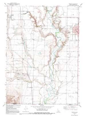
Weston Topo Map Idaho
To zoom in, hover over the map of Weston
USGS Topo Quad 42111a8 - 1:24,000 scale
| Topo Map Name: | Weston |
| USGS Topo Quad ID: | 42111a8 |
| Print Size: | ca. 21 1/4" wide x 27" high |
| Southeast Coordinates: | 42° N latitude / 111.875° W longitude |
| Map Center Coordinates: | 42.0625° N latitude / 111.9375° W longitude |
| U.S. State: | ID |
| Filename: | o42111a8.jpg |
| Download Map JPG Image: | Weston topo map 1:24,000 scale |
| Map Type: | Topographic |
| Topo Series: | 7.5´ |
| Map Scale: | 1:24,000 |
| Source of Map Images: | United States Geological Survey (USGS) |
| Alternate Map Versions: |
Weston ID 1969, updated 1973 Download PDF Buy paper map Weston ID 1969, updated 1991 Download PDF Buy paper map Weston ID 2011 Download PDF Buy paper map Weston ID 2013 Download PDF Buy paper map |
1:24,000 Topo Quads surrounding Weston
> Back to 42111a1 at 1:100,000 scale
> Back to 42110a1 at 1:250,000 scale
> Back to U.S. Topo Maps home
Weston topo map: Gazetteer
Weston: Airports
Preston Airport elevation 1440m 4724′Weston: Canals
East Canal elevation 1377m 4517′Lower Canal elevation 1379m 4524′
Twin Lakes Canal West Lateral elevation 1472m 4829′
Upper Canal elevation 1390m 4560′
West Canal elevation 1377m 4517′
Weston: Dams
Five Mile Erosion Control Dam elevation 1443m 4734′Nash Dam elevation 1448m 4750′
Nielson Dam elevation 1425m 4675′
Tingey Dam elevation 1396m 4580′
Weston: Populated Places
Anderson elevation 1392m 4566′Dayton elevation 1470m 4822′
Fairview elevation 1377m 4517′
Preston elevation 1437m 4714′
Silver Star elevation 1436m 4711′
Thorenson elevation 1450m 4757′
Weston elevation 1446m 4744′
Weston: Springs
Squaw Springs elevation 1366m 4481′Weston: Streams
Fivemile Creek elevation 1359m 4458′Weston Creek elevation 1354m 4442′
Weston digital topo map on disk
Buy this Weston topo map showing relief, roads, GPS coordinates and other geographical features, as a high-resolution digital map file on DVD:


