Banida Topo Map Idaho
To zoom in, hover over the map of Banida
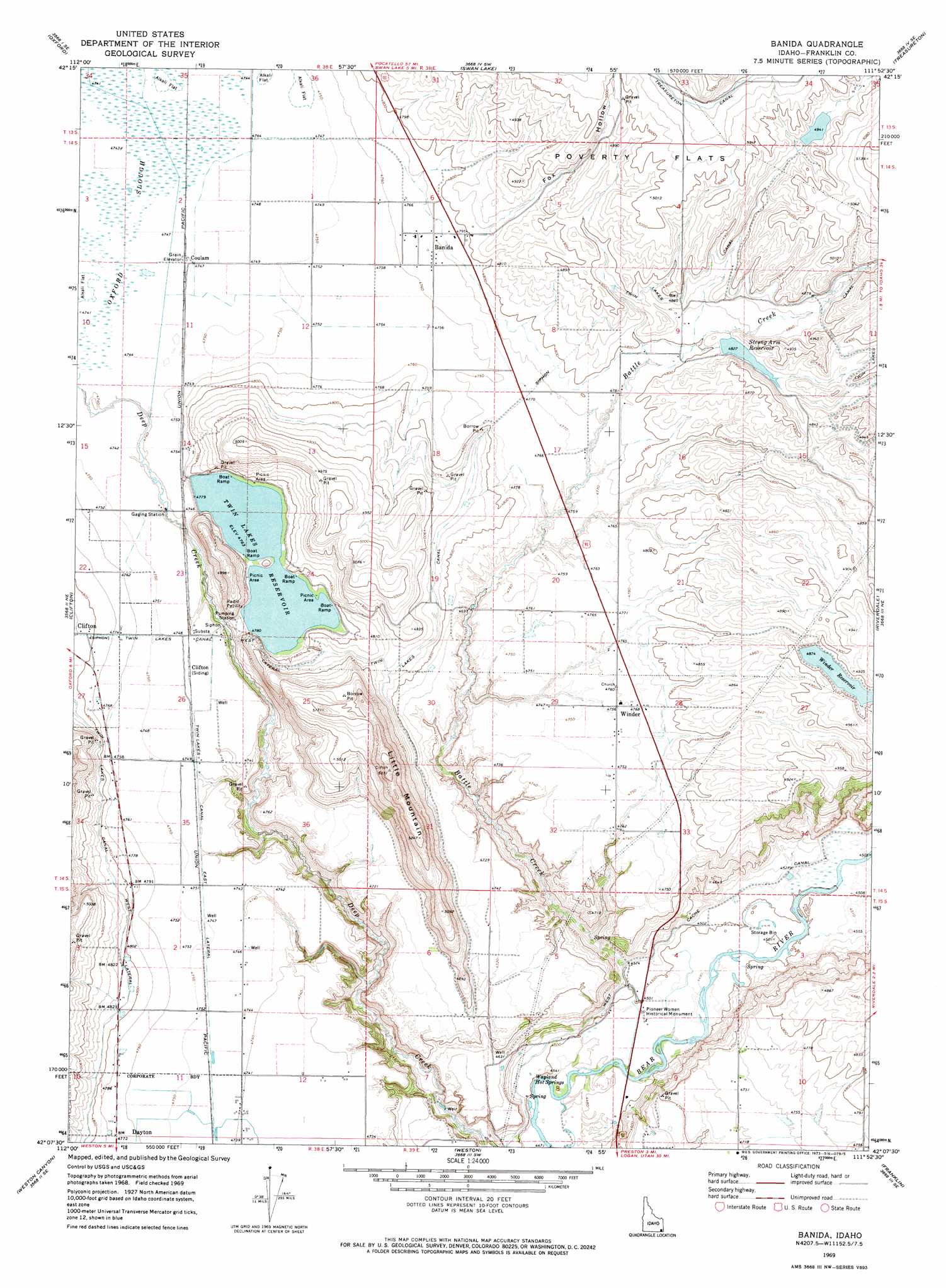
USGS Topo Quad 42111b8 - 1:24,000 scale
| Topo Map Name: | Banida |
| USGS Topo Quad ID: | 42111b8 |
| Print Size: | ca. 21 1/4" wide x 27" high |
| Southeast Coordinates: | 42.125° N latitude / 111.875° W longitude |
| Map Center Coordinates: | 42.1875° N latitude / 111.9375° W longitude |
| U.S. State: | ID |
| Filename: | o42111b8.jpg |
| Download Map JPG Image: | Banida topo map 1:24,000 scale |
| Map Type: | Topographic |
| Topo Series: | 7.5´ |
| Map Scale: | 1:24,000 |
| Source of Map Images: | United States Geological Survey (USGS) |
| Alternate Map Versions: |
Banida ID 1969, updated 1973 Download PDF Buy paper map Banida ID 2010 Download PDF Buy paper map Banida ID 2013 Download PDF Buy paper map |
1:24,000 Topo Quads surrounding Banida
Downey West |
Downey East |
Cottonwood Peak |
Thatcher Hill |
Thatcher |
Malad Summit |
Oxford |
Swan Lake |
Treasureton |
Oneida Narrows Reservoir |
Malad City East |
Clifton |
Banida |
Riverdale |
Mink Creek |
Henderson Creek |
Weston Canyon |
Weston |
Franklin |
Mapleton |
Portage |
Clarkston |
Trenton |
Richmond |
Naomi Peak |
> Back to 42111a1 at 1:100,000 scale
> Back to 42110a1 at 1:250,000 scale
> Back to U.S. Topo Maps home
Banida topo map: Gazetteer
Banida: Canals
Twin Lakes Canal East Lateral elevation 1447m 4747′West Cache Canal elevation 1383m 4537′
Banida: Dams
Casperson Dam elevation 1513m 4963′Strongarm Reservoir Number Two Dam elevation 1472m 4829′
Twin Lakes Northwest Dam elevation 1451m 4760′
Twin Lakes Southwest Dam elevation 1453m 4767′
Winder Dam elevation 1487m 4878′
Banida: Flats
Poverty Flats elevation 1527m 5009′Banida: Gaps
Beers Spur elevation 1424m 4671′Banida: Parks
Pioneer Women Historical Monument elevation 1370m 4494′Banida: Populated Places
Banida elevation 1461m 4793′Coulam elevation 1448m 4750′
Winder elevation 1451m 4760′
Banida: Reservoirs
Strong Arm Reservoir elevation 1470m 4822′Twin Lakes Reservoir elevation 1451m 4760′
Winder Reservoir elevation 1487m 4878′
Banida: Springs
Wayland Hot Springs elevation 1367m 4484′Banida: Streams
Battle Creek elevation 1367m 4484′Banida: Summits
Little Mountain elevation 1637m 5370′Banida: Swamps
Oxford Slough elevation 1447m 4747′Banida: Valleys
Fox Hollow elevation 1468m 4816′Banida digital topo map on disk
Buy this Banida topo map showing relief, roads, GPS coordinates and other geographical features, as a high-resolution digital map file on DVD: