Ovid Topo Map Idaho
To zoom in, hover over the map of Ovid
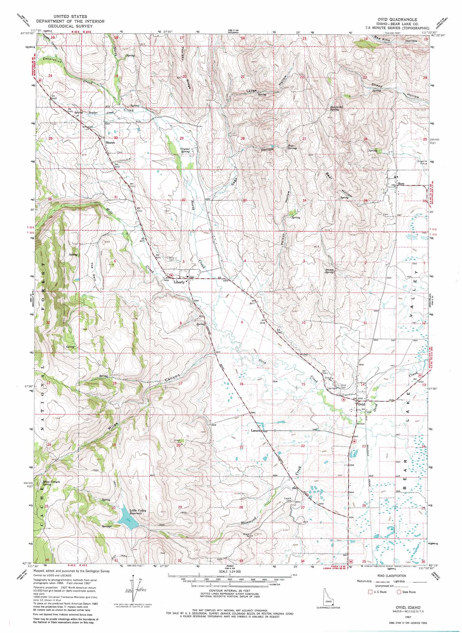
USGS Topo Quad 42111c4 - 1:24,000 scale
| Topo Map Name: | Ovid |
| USGS Topo Quad ID: | 42111c4 |
| Print Size: | ca. 21 1/4" wide x 27" high |
| Southeast Coordinates: | 42.25° N latitude / 111.375° W longitude |
| Map Center Coordinates: | 42.3125° N latitude / 111.4375° W longitude |
| U.S. State: | ID |
| Filename: | o42111c4.jpg |
| Download Map JPG Image: | Ovid topo map 1:24,000 scale |
| Map Type: | Topographic |
| Topo Series: | 7.5´ |
| Map Scale: | 1:24,000 |
| Source of Map Images: | United States Geological Survey (USGS) |
| Alternate Map Versions: |
Ovid ID 1967, updated 1968 Download PDF Buy paper map Ovid ID 2005, updated 2007 Download PDF Buy paper map Ovid ID 2011 Download PDF Buy paper map Ovid ID 2013 Download PDF Buy paper map |
| FStopo: | US Forest Service topo Ovid is available: Download FStopo PDF Download FStopo TIF |
1:24,000 Topo Quads surrounding Ovid
Grace |
Soda Peak |
Fossil Canyon |
Harrington Peak |
Snowdrift Mountain |
Thatcher |
North Canyon |
Nounan |
Georgetown |
Meade Peak |
Oneida Narrows Reservoir |
Midnight Mountain |
Ovid |
Montpelier |
Montpelier Canyon |
Mink Creek |
Paris Peak |
Paris |
Dingle |
Pegram |
Mapleton |
Egan Basin |
Saint Charles |
Bear Lake North |
Pegram Creek |
> Back to 42111a1 at 1:100,000 scale
> Back to 42110a1 at 1:250,000 scale
> Back to U.S. Topo Maps home
Ovid topo map: Gazetteer
Ovid: Dams
Hammond Dam elevation 1998m 6555′Ovid: Populated Places
Bern elevation 1819m 5967′Lanark elevation 1815m 5954′
Liberty elevation 1825m 5987′
Ovid elevation 1810m 5938′
Sharon elevation 1916m 6286′
Ovid: Reservoirs
Little Valley Reservoir elevation 1998m 6555′Ovid: Ridges
Poulsen Ridge elevation 2027m 6650′Ovid: Springs
Crystal Spring elevation 1852m 6076′Hoopgobel Spring elevation 2036m 6679′
Jensen Spring elevation 1896m 6220′
Miles Canyon Spring elevation 2121m 6958′
Sago Spring elevation 1999m 6558′
Ovid: Streams
Emigration Creek elevation 1884m 6181′Hammond Creek elevation 1809m 5935′
Mill Creek elevation 1815m 5954′
North Creek elevation 1815m 5954′
Snyder Creek elevation 1883m 6177′
Ovid: Valleys
Bear Hollow elevation 1824m 5984′Ledge Hollow elevation 1897m 6223′
Miles Canyon elevation 1823m 5980′
Morgan Canyon elevation 1933m 6341′
Poison Hollow elevation 1839m 6033′
Sago Hollow elevation 1838m 6030′
Ovid digital topo map on disk
Buy this Ovid topo map showing relief, roads, GPS coordinates and other geographical features, as a high-resolution digital map file on DVD: