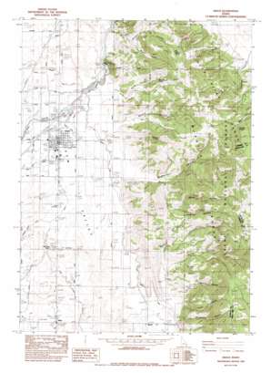
Grace Topo Map Idaho
To zoom in, hover over the map of Grace
USGS Topo Quad 42111e6 - 1:24,000 scale
| Topo Map Name: | Grace |
| USGS Topo Quad ID: | 42111e6 |
| Print Size: | ca. 21 1/4" wide x 27" high |
| Southeast Coordinates: | 42.5° N latitude / 111.625° W longitude |
| Map Center Coordinates: | 42.5625° N latitude / 111.6875° W longitude |
| U.S. State: | ID |
| Filename: | o42111e6.jpg |
| Download Map JPG Image: | Grace topo map 1:24,000 scale |
| Map Type: | Topographic |
| Topo Series: | 7.5´ |
| Map Scale: | 1:24,000 |
| Source of Map Images: | United States Geological Survey (USGS) |
| Alternate Map Versions: |
Grace ID 1982, updated 1982 Download PDF Buy paper map Grace ID 2005, updated 2007 Download PDF Buy paper map Grace ID 2011 Download PDF Buy paper map Grace ID 2013 Download PDF Buy paper map |
| FStopo: | US Forest Service topo Grace is available: Download FStopo PDF Download FStopo TIF |
1:24,000 Topo Quads surrounding Grace
> Back to 42111e1 at 1:100,000 scale
> Back to 42110a1 at 1:250,000 scale
> Back to U.S. Topo Maps home
Grace topo map: Gazetteer
Grace: Airports
Grace Airport elevation 1705m 5593′Grace: Canals
Allen and Cherry Ditch elevation 1684m 5524′Bench A Canal elevation 1696m 5564′
Bench B Canal elevation 1692m 5551′
Bench Canal elevation 1679m 5508′
Brown Ditch elevation 1650m 5413′
Last Chance Canal elevation 1721m 5646′
Peterson Hanson Ditch elevation 1679m 5508′
Grace: Dams
Grace Dam elevation 1695m 5561′Last Chance Dam elevation 1708m 5603′
Grace: Parks
Nelson Game Enclosure elevation 1858m 6095′Grace: Populated Places
Bench elevation 1673m 5488′Grace elevation 1687m 5534′
Niter elevation 1649m 5410′
Grace: Springs
King Canyon Spring elevation 1996m 6548′Nelson Spring elevation 2190m 7185′
Winchell Spring elevation 2082m 6830′
Grace: Streams
Burton Creek elevation 1740m 5708′Nelson Creek elevation 1719m 5639′
Grace: Summits
Ice Cave Knoll elevation 1708m 5603′Soda Peak elevation 2707m 8881′
Grace: Valleys
Bluff Hollow elevation 1787m 5862′Burton Canyon elevation 1736m 5695′
Christensen Canyon elevation 1709m 5606′
Dry Hollow elevation 1730m 5675′
Egbert Canyon elevation 1715m 5626′
Franks Canyon elevation 1741m 5711′
Hawkins Hollow elevation 1916m 6286′
King Canyon elevation 1756m 5761′
McPherson Canyon elevation 1728m 5669′
Nelson Canyon elevation 1719m 5639′
Polethief Canyon elevation 1733m 5685′
Right Fork Nelson Canyon elevation 1817m 5961′
Water Canyon elevation 1785m 5856′
Water Hollow elevation 1900m 6233′
Grace digital topo map on disk
Buy this Grace topo map showing relief, roads, GPS coordinates and other geographical features, as a high-resolution digital map file on DVD:


