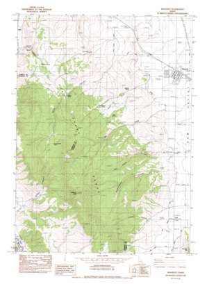
Bancroft Topo Map Idaho
To zoom in, hover over the map of Bancroft
USGS Topo Quad 42111f8 - 1:24,000 scale
| Topo Map Name: | Bancroft |
| USGS Topo Quad ID: | 42111f8 |
| Print Size: | ca. 21 1/4" wide x 27" high |
| Southeast Coordinates: | 42.625° N latitude / 111.875° W longitude |
| Map Center Coordinates: | 42.6875° N latitude / 111.9375° W longitude |
| U.S. State: | ID |
| Filename: | o42111f8.jpg |
| Download Map JPG Image: | Bancroft topo map 1:24,000 scale |
| Map Type: | Topographic |
| Topo Series: | 7.5´ |
| Map Scale: | 1:24,000 |
| Source of Map Images: | United States Geological Survey (USGS) |
| Alternate Map Versions: |
Bancroft ID 1982, updated 1983 Download PDF Buy paper map Bancroft ID 2010 Download PDF Buy paper map Bancroft ID 2013 Download PDF Buy paper map |
1:24,000 Topo Quads surrounding Bancroft
> Back to 42111e1 at 1:100,000 scale
> Back to 42110a1 at 1:250,000 scale
> Back to U.S. Topo Maps home
Bancroft topo map: Gazetteer
Bancroft: Populated Places
Bancroft elevation 1653m 5423′Lund elevation 1677m 5501′
Bancroft: Springs
Clark Spring elevation 1829m 6000′Josie Spring elevation 1880m 6167′
Milkshake Spring elevation 1877m 6158′
Railroad Spring elevation 1735m 5692′
School House Spring elevation 2038m 6686′
Toolson Spring elevation 1845m 6053′
Bancroft: Streams
Mill Creek elevation 1684m 5524′Squaw Creek elevation 1688m 5538′
Bancroft: Summits
Petticoat Peak elevation 2418m 7933′Bancroft: Valleys
Hadley Canyon elevation 1631m 5351′Lundgren Canyon elevation 1698m 5570′
North Canyon elevation 1675m 5495′
Red House Canyon elevation 1723m 5652′
Rindlishbaker Canyon elevation 1708m 5603′
Smith Canyon elevation 1626m 5334′
Bancroft: Wells
Conklin Well elevation 1704m 5590′Pebble Well elevation 1654m 5426′
Bancroft digital topo map on disk
Buy this Bancroft topo map showing relief, roads, GPS coordinates and other geographical features, as a high-resolution digital map file on DVD:


