Reservoir Mountain Topo Map Idaho
To zoom in, hover over the map of Reservoir Mountain
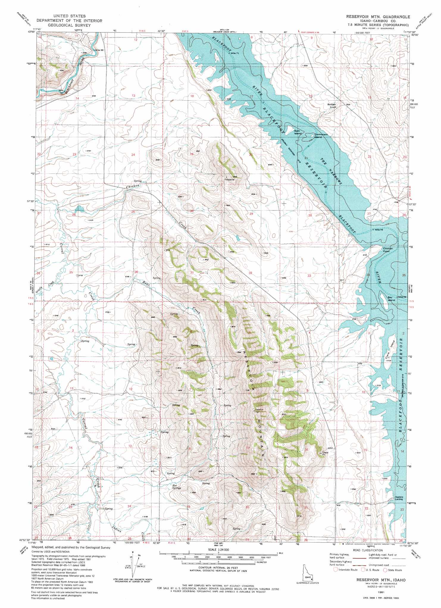
USGS Topo Quad 42111h6 - 1:24,000 scale
| Topo Map Name: | Reservoir Mountain |
| USGS Topo Quad ID: | 42111h6 |
| Print Size: | ca. 21 1/4" wide x 27" high |
| Southeast Coordinates: | 42.875° N latitude / 111.625° W longitude |
| Map Center Coordinates: | 42.9375° N latitude / 111.6875° W longitude |
| U.S. State: | ID |
| Filename: | o42111h6.jpg |
| Download Map JPG Image: | Reservoir Mountain topo map 1:24,000 scale |
| Map Type: | Topographic |
| Topo Series: | 7.5´ |
| Map Scale: | 1:24,000 |
| Source of Map Images: | United States Geological Survey (USGS) |
| Alternate Map Versions: |
Reservoir Mtn ID 1981, updated 1982 Download PDF Buy paper map Reservoir Mountain ID 2010 Download PDF Buy paper map Reservoir Mountain ID 2013 Download PDF Buy paper map |
1:24,000 Topo Quads surrounding Reservoir Mountain
Miner Creek |
Poison Creek |
Long Valley |
Homer Valley |
Herman |
Dunn Basin |
Paradise Valley |
Meadow Creek Mountain |
Little Valley Hills |
Bear Island |
Chesterfield Res |
Grizzly Creek |
Reservoir Mountain |
Henry |
Wayan West |
Chesterfield |
Hatch |
The Dip |
China Hat |
Lower Valley |
Bancroft |
Talmage |
Alexander |
Soda Springs |
Johnson Creek |
> Back to 42111e1 at 1:100,000 scale
> Back to 42110a1 at 1:250,000 scale
> Back to U.S. Topo Maps home
Reservoir Mountain topo map: Gazetteer
Reservoir Mountain: Capes
Chicken Point elevation 1868m 6128′Reservoir Mountain: Islands
Bay Island elevation 1867m 6125′Cormorant Island elevation 1867m 6125′
Crane Island elevation 1867m 6125′
Split Island elevation 1867m 6125′
Reservoir Mountain: Lakes
The Narrows elevation 1866m 6122′Reservoir Mountain: Streams
Bear Creek elevation 1860m 6102′Chicken Creek elevation 1854m 6082′
Grizzly Creek elevation 1854m 6082′
Indian Creek elevation 1860m 6102′
Reservoir Mountain: Summits
Badger Knoll elevation 1916m 6286′Reservoir Mountain elevation 2167m 7109′
Reservoir Mountain digital topo map on disk
Buy this Reservoir Mountain topo map showing relief, roads, GPS coordinates and other geographical features, as a high-resolution digital map file on DVD: