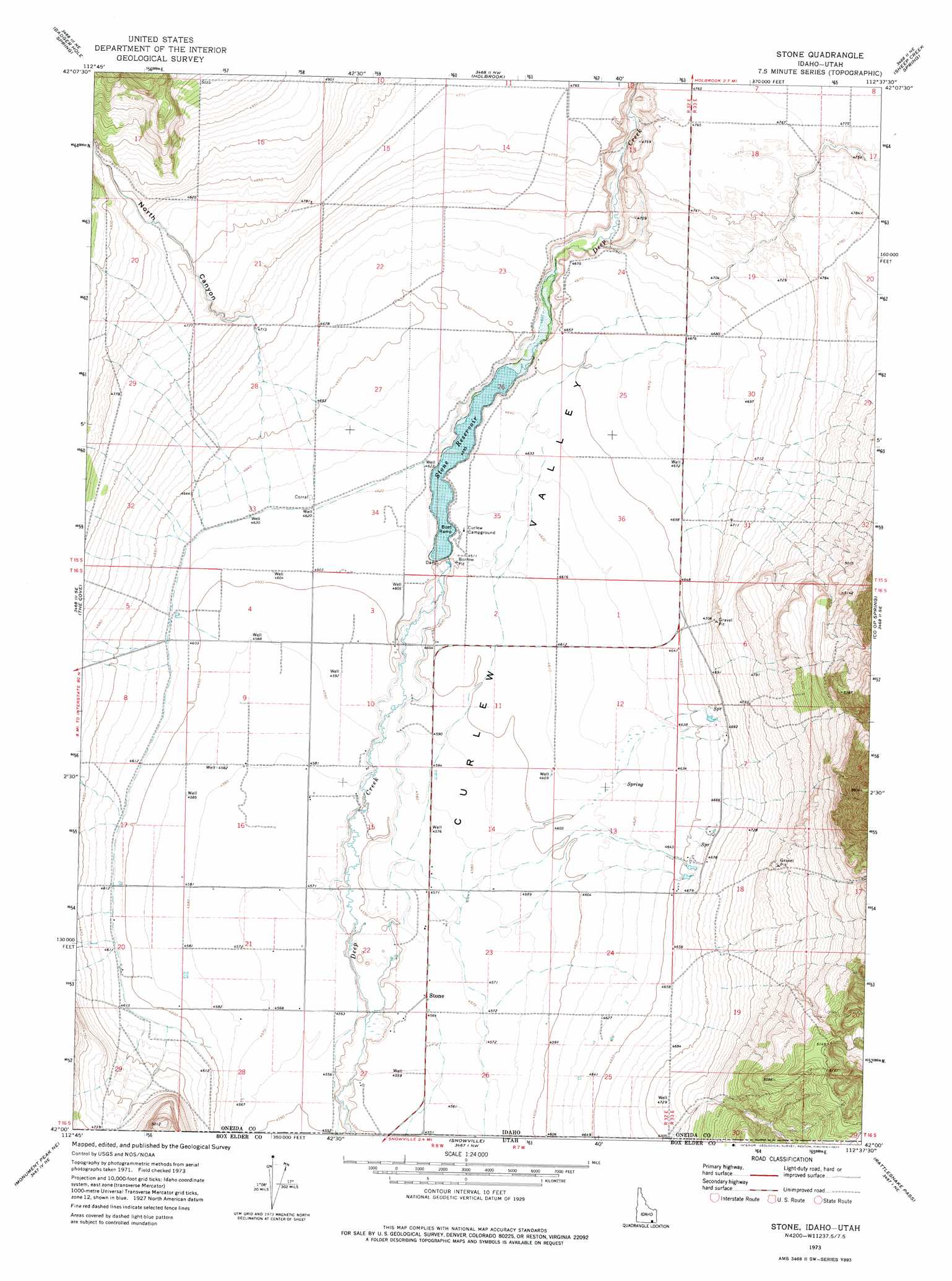
Stone Topo Map Idaho
To zoom in, hover over the map of Stone
USGS Topo Quad 42112a6 - 1:24,000 scale
| Topo Map Name: | Stone |
| USGS Topo Quad ID: | 42112a6 |
| Print Size: | ca. 21 1/4" wide x 27" high |
| Southeast Coordinates: | 42° N latitude / 112.625° W longitude |
| Map Center Coordinates: | 42.0625° N latitude / 112.6875° W longitude |
| U.S. States: | ID, UT |
| Filename: | o42112a6.jpg |
| Download Map JPG Image: | Stone topo map 1:24,000 scale |
| Map Type: | Topographic |
| Topo Series: | 7.5´ |
| Map Scale: | 1:24,000 |
| Source of Map Images: | United States Geological Survey (USGS) |
| Alternate Map Versions: |
Stone ID 1973, updated 1977 Download PDF Buy paper map Stone ID 2011 Download PDF Buy paper map Stone ID 2013 Download PDF Buy paper map |
| FStopo: | US Forest Service topo Stone is available: Download FStopo PDF Download FStopo TIF |
1:24,000 Topo Quads surrounding Stone
Sublett Troughs |
Roy |
Cedarhill |
Buist |
Daniels |
Juniper |
Badger Hole Spring |
Holbrook |
Sheep Creek Spring |
Ireland Springs |
Black Pine |
The Cove |
Stone |
Co-Op Spring |
Grover Canyon |
Monument Peak Nw |
Monument Peak Ne |
Snowville |
Rattlesnake Pass |
Ridgedale Pass |
Monument Peak Sw |
Monument Peak |
Salt Wells |
Bulls Pass |
Howell |
> Back to 42112a1 at 1:100,000 scale
> Back to 42112a1 at 1:250,000 scale
> Back to U.S. Topo Maps home
Stone topo map: Gazetteer
Stone: Populated Places
Nelson (historical) elevation 1425m 4675′Stone elevation 1392m 4566′
Stone: Reservoirs
Stone Reservoir elevation 1401m 4596′Sweeten Reservoir elevation 1449m 4753′
Stone: Valleys
North Canyon elevation 1439m 4721′Stone digital topo map on disk
Buy this Stone topo map showing relief, roads, GPS coordinates and other geographical features, as a high-resolution digital map file on DVD: