The Cove Topo Map Idaho
To zoom in, hover over the map of The Cove
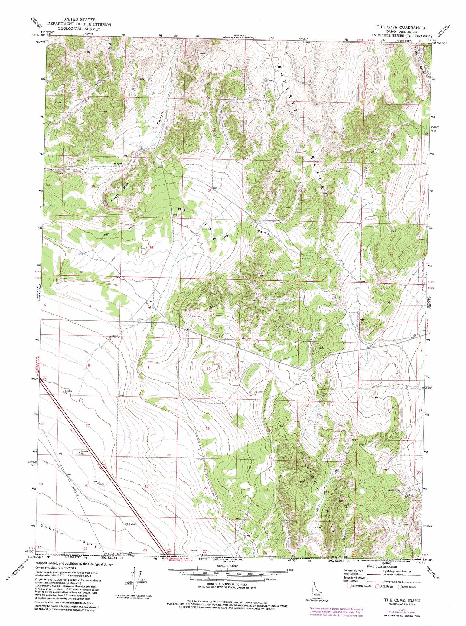
USGS Topo Quad 42112a7 - 1:24,000 scale
| Topo Map Name: | The Cove |
| USGS Topo Quad ID: | 42112a7 |
| Print Size: | ca. 21 1/4" wide x 27" high |
| Southeast Coordinates: | 42° N latitude / 112.75° W longitude |
| Map Center Coordinates: | 42.0625° N latitude / 112.8125° W longitude |
| U.S. States: | ID, UT |
| Filename: | o42112a7.jpg |
| Download Map JPG Image: | The Cove topo map 1:24,000 scale |
| Map Type: | Topographic |
| Topo Series: | 7.5´ |
| Map Scale: | 1:24,000 |
| Source of Map Images: | United States Geological Survey (USGS) |
| Alternate Map Versions: |
The Cove ID 1973, updated 1976 Download PDF Buy paper map The Cove ID 1973, updated 1984 Download PDF Buy paper map The Cove ID 2011 Download PDF Buy paper map The Cove ID 2013 Download PDF Buy paper map |
| FStopo: | US Forest Service topo The Cove is available: Download FStopo PDF Download FStopo TIF |
1:24,000 Topo Quads surrounding The Cove
Sublett Reservoir |
Sublett Troughs |
Roy |
Cedarhill |
Buist |
Sweetzer Canyon |
Juniper |
Badger Hole Spring |
Holbrook |
Sheep Creek Spring |
Black Pine Peak |
Black Pine |
The Cove |
Stone |
Co-Op Spring |
Curlew Junction |
Monument Peak Nw |
Monument Peak Ne |
Snowville |
Rattlesnake Pass |
Kelton Pass Se |
Monument Peak Sw |
Monument Peak |
Salt Wells |
Bulls Pass |
> Back to 42112a1 at 1:100,000 scale
> Back to 42112a1 at 1:250,000 scale
> Back to U.S. Topo Maps home
The Cove topo map: Gazetteer
The Cove: Ranges
Stone Hills elevation 1668m 5472′The Cove: Summits
Table Mountain elevation 1655m 5429′The Cove: Valleys
Dry Canyon elevation 1484m 4868′The Cove elevation 1461m 4793′
The Cove digital topo map on disk
Buy this The Cove topo map showing relief, roads, GPS coordinates and other geographical features, as a high-resolution digital map file on DVD: