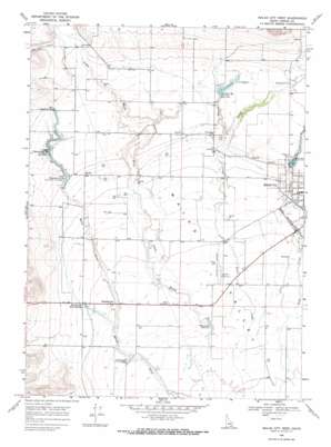
Malad City West Topo Map Idaho
To zoom in, hover over the map of Malad City West
USGS Topo Quad 42112b3 - 1:24,000 scale
| Topo Map Name: | Malad City West |
| USGS Topo Quad ID: | 42112b3 |
| Print Size: | ca. 21 1/4" wide x 27" high |
| Southeast Coordinates: | 42.125° N latitude / 112.25° W longitude |
| Map Center Coordinates: | 42.1875° N latitude / 112.3125° W longitude |
| U.S. State: | ID |
| Filename: | o42112b3.jpg |
| Download Map JPG Image: | Malad City West topo map 1:24,000 scale |
| Map Type: | Topographic |
| Topo Series: | 7.5´ |
| Map Scale: | 1:24,000 |
| Source of Map Images: | United States Geological Survey (USGS) |
| Alternate Map Versions: |
Malad City West ID 1968, updated 1971 Download PDF Buy paper map Malad City West ID 2011 Download PDF Buy paper map Malad City West ID 2013 Download PDF Buy paper map |
| FStopo: | US Forest Service topo Malad City West is available: Download FStopo PDF Download FStopo TIF |
1:24,000 Topo Quads surrounding Malad City West
> Back to 42112a1 at 1:100,000 scale
> Back to 42112a1 at 1:250,000 scale
> Back to U.S. Topo Maps home
Malad City West topo map: Gazetteer
Malad City West: Airports
Malad City Airport elevation 1368m 4488′Malad City West: Dams
Crowther Dam elevation 1439m 4721′Saint John Dam elevation 1443m 4734′
Samaria Number One Lower Dam elevation 1428m 4685′
Samaria Number Two Upper Dam elevation 1436m 4711′
Malad City West: Populated Places
Gwenford elevation 1354m 4442′Malad City elevation 1387m 4550′
Pleasantview elevation 1367m 4484′
Saint Johns elevation 1435m 4708′
Malad City West: Reservoirs
Billy Snipe Reservoir elevation 1349m 4425′Crowthers Reservoir elevation 1439m 4721′
Lower Pleasantview Reservoir elevation 1428m 4685′
Saint Johns Reservoir elevation 1443m 4734′
Upper Pleasantview Reservoir elevation 1432m 4698′
Malad City West: Springs
Big Malad Spring elevation 1441m 4727′Pleasantview Warm Springs elevation 1372m 4501′
Malad City West: Streams
Davis Creek elevation 1419m 4655′Deep Creek elevation 1346m 4416′
Spring Creek elevation 1439m 4721′
Malad City West: Valleys
John Evans Canyon elevation 1481m 4858′Malad City West digital topo map on disk
Buy this Malad City West topo map showing relief, roads, GPS coordinates and other geographical features, as a high-resolution digital map file on DVD:


