Badger Hole Spring Topo Map Idaho
To zoom in, hover over the map of Badger Hole Spring
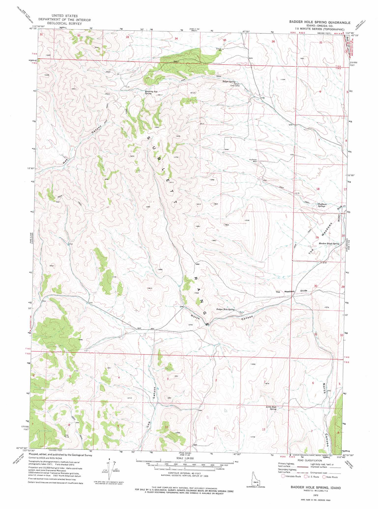
USGS Topo Quad 42112b7 - 1:24,000 scale
| Topo Map Name: | Badger Hole Spring |
| USGS Topo Quad ID: | 42112b7 |
| Print Size: | ca. 21 1/4" wide x 27" high |
| Southeast Coordinates: | 42.125° N latitude / 112.75° W longitude |
| Map Center Coordinates: | 42.1875° N latitude / 112.8125° W longitude |
| U.S. State: | ID |
| Filename: | o42112b7.jpg |
| Download Map JPG Image: | Badger Hole Spring topo map 1:24,000 scale |
| Map Type: | Topographic |
| Topo Series: | 7.5´ |
| Map Scale: | 1:24,000 |
| Source of Map Images: | United States Geological Survey (USGS) |
| Alternate Map Versions: |
Badger Hole Spring ID 1973, updated 1977 Download PDF Buy paper map Badger Hole Spring ID 2011 Download PDF Buy paper map Badger Hole Spring ID 2013 Download PDF Buy paper map |
| FStopo: | US Forest Service topo Badger Hole Spring is available: Download FStopo PDF Download FStopo TIF |
1:24,000 Topo Quads surrounding Badger Hole Spring
North Heglar Canyon |
Hartley Peak |
Roy Ne |
Deep Creek Peak |
Arbon |
Sublett Reservoir |
Sublett Troughs |
Roy |
Cedarhill |
Buist |
Sweetzer Canyon |
Juniper |
Badger Hole Spring |
Holbrook |
Sheep Creek Spring |
Black Pine Peak |
Black Pine |
The Cove |
Stone |
Co-Op Spring |
Curlew Junction |
Monument Peak Nw |
Monument Peak Ne |
Snowville |
Rattlesnake Pass |
> Back to 42112a1 at 1:100,000 scale
> Back to 42112a1 at 1:250,000 scale
> Back to U.S. Topo Maps home
Badger Hole Spring topo map: Gazetteer
Badger Hole Spring: Flats
The Meadows elevation 1580m 5183′Badger Hole Spring: Forests
Curlew National Grassland elevation 1548m 5078′Badger Hole Spring: Gaps
The Meadows Divide elevation 1640m 5380′Badger Hole Spring: Springs
Badger Hole Spring elevation 1660m 5446′Huffman Springs elevation 1552m 5091′
Little Rock Spring elevation 1622m 5321′
Meadow Brook Spring elevation 1562m 5124′
Quaking Asphalt Spring elevation 1799m 5902′
Salyer Spring elevation 1665m 5462′
Badger Hole Spring: Wells
Huffman Well elevation 1651m 5416′Badger Hole Spring digital topo map on disk
Buy this Badger Hole Spring topo map showing relief, roads, GPS coordinates and other geographical features, as a high-resolution digital map file on DVD: