Daniels Topo Map Idaho
To zoom in, hover over the map of Daniels
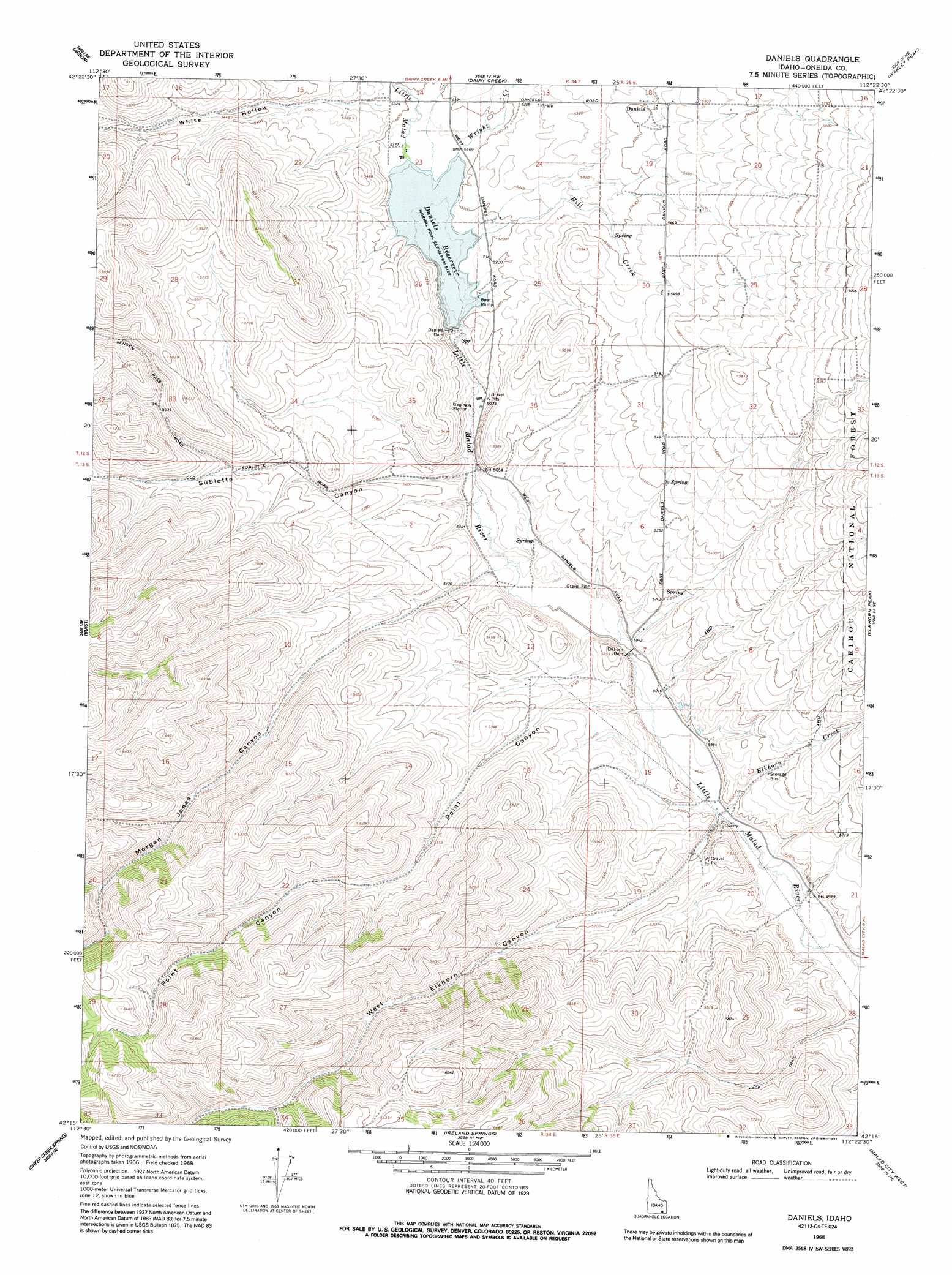
USGS Topo Quad 42112c4 - 1:24,000 scale
| Topo Map Name: | Daniels |
| USGS Topo Quad ID: | 42112c4 |
| Print Size: | ca. 21 1/4" wide x 27" high |
| Southeast Coordinates: | 42.25° N latitude / 112.375° W longitude |
| Map Center Coordinates: | 42.3125° N latitude / 112.4375° W longitude |
| U.S. State: | ID |
| Filename: | o42112c4.jpg |
| Download Map JPG Image: | Daniels topo map 1:24,000 scale |
| Map Type: | Topographic |
| Topo Series: | 7.5´ |
| Map Scale: | 1:24,000 |
| Source of Map Images: | United States Geological Survey (USGS) |
| Alternate Map Versions: |
Daniels ID 1963, updated 1993 Download PDF Buy paper map Daniels ID 1968, updated 1971 Download PDF Buy paper map Daniels ID 2011 Download PDF Buy paper map Daniels ID 2013 Download PDF Buy paper map |
| FStopo: | US Forest Service topo Daniels is available: Download FStopo PDF Download FStopo TIF |
1:24,000 Topo Quads surrounding Daniels
Bannock Peak |
Pauline |
Bradley Mountain |
Hawkins |
Arimo |
Deep Creek Peak |
Arbon |
Dairy Creek |
Wakley Peak |
Downey West |
Cedarhill |
Buist |
Daniels |
Elkhorn Peak |
Malad Summit |
Holbrook |
Sheep Creek Spring |
Ireland Springs |
Malad City West |
Malad City East |
Stone |
Co-Op Spring |
Grover Canyon |
Samaria |
Henderson Creek |
> Back to 42112a1 at 1:100,000 scale
> Back to 42112a1 at 1:250,000 scale
> Back to U.S. Topo Maps home
Daniels topo map: Gazetteer
Daniels: Dams
Daniels Dam elevation 1579m 5180′Elkhorn Dam elevation 1523m 4996′
Daniels: Populated Places
Daniels elevation 1644m 5393′Daniels: Ranges
Pleasantview Hills elevation 1944m 6377′Daniels: Reservoirs
Daniels Reservoir elevation 1579m 5180′Devils Creek Reservoir elevation 1930m 6332′
Daniels: Streams
Elkhorn Creek elevation 1507m 4944′Hill Creek elevation 1575m 5167′
Wright Creek elevation 1575m 5167′
Daniels: Valleys
Bill Morgan Canyon elevation 1692m 5551′Danish Canyon elevation 1693m 5554′
Morgan Jones Canyon elevation 1536m 5039′
Point Canyon elevation 1523m 4996′
Sublette Canyon elevation 1544m 5065′
West Elkhorn Canyon elevation 1510m 4954′
White Hollow elevation 1597m 5239′
Daniels digital topo map on disk
Buy this Daniels topo map showing relief, roads, GPS coordinates and other geographical features, as a high-resolution digital map file on DVD: