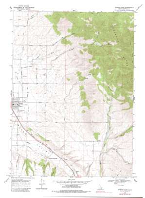
Downey East Topo Map Idaho
To zoom in, hover over the map of Downey East
USGS Topo Quad 42112d1 - 1:24,000 scale
| Topo Map Name: | Downey East |
| USGS Topo Quad ID: | 42112d1 |
| Print Size: | ca. 21 1/4" wide x 27" high |
| Southeast Coordinates: | 42.375° N latitude / 112° W longitude |
| Map Center Coordinates: | 42.4375° N latitude / 112.0625° W longitude |
| U.S. State: | ID |
| Filename: | o42112d1.jpg |
| Download Map JPG Image: | Downey East topo map 1:24,000 scale |
| Map Type: | Topographic |
| Topo Series: | 7.5´ |
| Map Scale: | 1:24,000 |
| Source of Map Images: | United States Geological Survey (USGS) |
| Alternate Map Versions: |
Downey East ID 1968, updated 1971 Download PDF Buy paper map Downey East ID 1968, updated 1982 Download PDF Buy paper map Downey East ID 2010 Download PDF Buy paper map Downey East ID 2013 Download PDF Buy paper map |
1:24,000 Topo Quads surrounding Downey East
> Back to 42112a1 at 1:100,000 scale
> Back to 42112a1 at 1:250,000 scale
> Back to U.S. Topo Maps home
Downey East topo map: Gazetteer
Downey East: Airports
Downey Airport elevation 1497m 4911′Downey East: Populated Places
Cambridge elevation 1497m 4911′Downata Hot Springs elevation 1455m 4773′
Downey elevation 1483m 4865′
Zenda elevation 1461m 4793′
Downey East: Streams
Brush Creek elevation 1504m 4934′Coalpit Creek elevation 1451m 4760′
Left Hand Fork Marsh Creek elevation 1571m 5154′
Lone Pine Creek elevation 1549m 5082′
Ninemile Creek elevation 1584m 5196′
Right Hand Fork Marsh Creek elevation 1570m 5150′
Downey East: Valleys
North Fork Reed Canyon elevation 2017m 6617′Downey East digital topo map on disk
Buy this Downey East topo map showing relief, roads, GPS coordinates and other geographical features, as a high-resolution digital map file on DVD:


