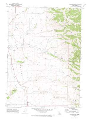
Rockland East Topo Map Idaho
To zoom in, hover over the map of Rockland East
USGS Topo Quad 42112e7 - 1:24,000 scale
| Topo Map Name: | Rockland East |
| USGS Topo Quad ID: | 42112e7 |
| Print Size: | ca. 21 1/4" wide x 27" high |
| Southeast Coordinates: | 42.5° N latitude / 112.75° W longitude |
| Map Center Coordinates: | 42.5625° N latitude / 112.8125° W longitude |
| U.S. State: | ID |
| Filename: | o42112e7.jpg |
| Download Map JPG Image: | Rockland East topo map 1:24,000 scale |
| Map Type: | Topographic |
| Topo Series: | 7.5´ |
| Map Scale: | 1:24,000 |
| Source of Map Images: | United States Geological Survey (USGS) |
| Alternate Map Versions: |
Rockland East ID 1971, updated 1973 Download PDF Buy paper map Rockland East ID 2010 Download PDF Buy paper map Rockland East ID 2013 Download PDF Buy paper map |
1:24,000 Topo Quads surrounding Rockland East
> Back to 42112e1 at 1:100,000 scale
> Back to 42112a1 at 1:250,000 scale
> Back to U.S. Topo Maps home
Rockland East topo map: Gazetteer
Rockland East: Canals
Bench Ditch elevation 1512m 4960′Rockland East: Streams
Warm Springs Creek elevation 1428m 4685′Rockland East: Summits
Mollys Nipple elevation 1576m 5170′Rockland East: Valleys
Dry Hollow elevation 1465m 4806′East Fork Canyon elevation 1649m 5410′
Green Canyon elevation 1695m 5561′
Hunter Canyon elevation 1500m 4921′
Hutchinson Canyon elevation 1634m 5360′
Left Fork Dry Hollow elevation 1671m 5482′
Left Fork Sand Hollow elevation 1674m 5492′
Lewis Canyon elevation 1573m 5160′
Mill Canyon elevation 1562m 5124′
Right Fork Dry Hollow elevation 1671m 5482′
Right Fork East Fork Canyon elevation 1654m 5426′
Right Fork Sand Hollow elevation 1658m 5439′
Sand Hollow elevation 1457m 4780′
Water Canyon elevation 1612m 5288′
Well Canyon elevation 1611m 5285′
Rockland East digital topo map on disk
Buy this Rockland East topo map showing relief, roads, GPS coordinates and other geographical features, as a high-resolution digital map file on DVD:


