Mccammon Topo Map Idaho
To zoom in, hover over the map of Mccammon
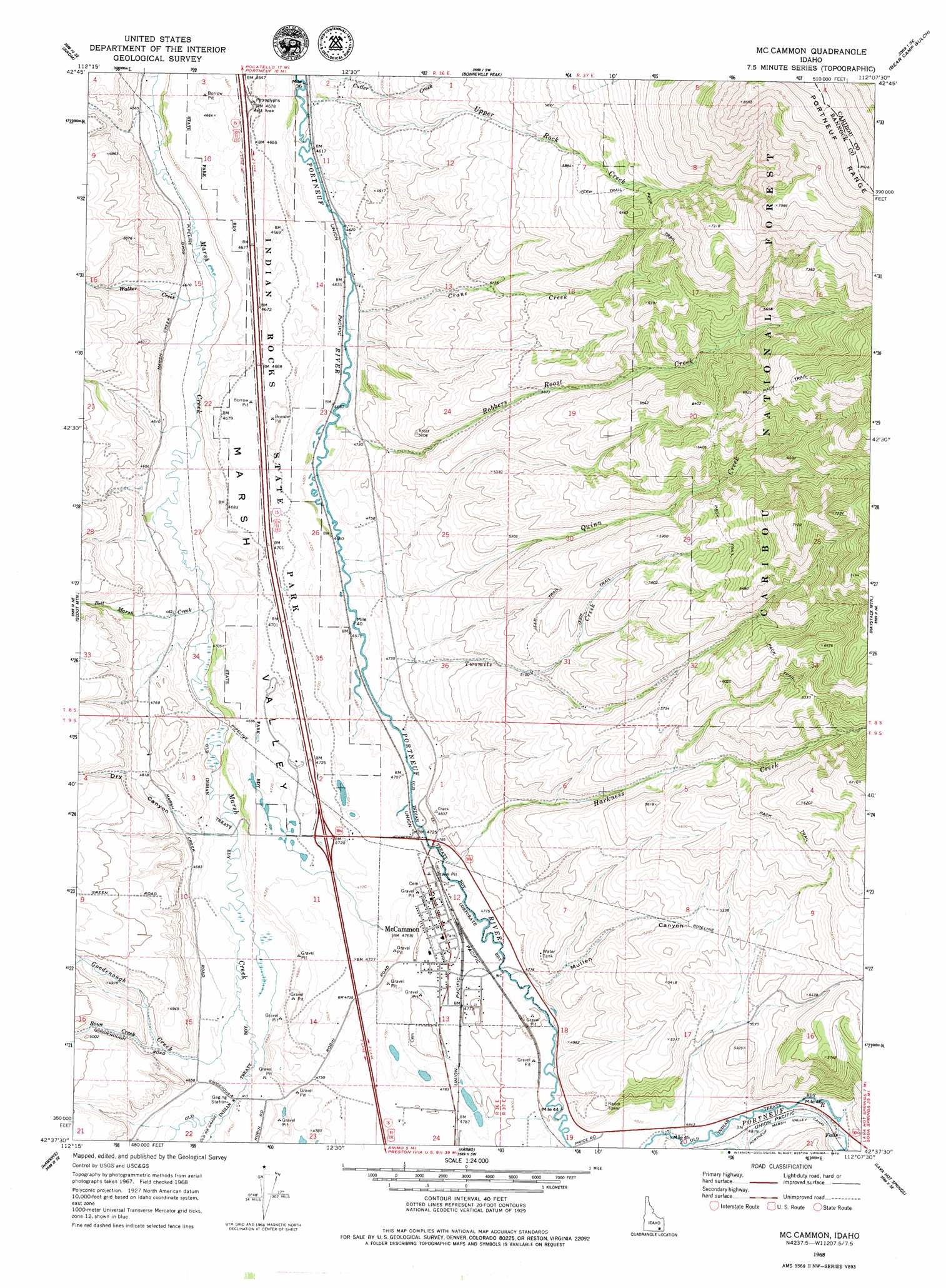
USGS Topo Quad 42112f2 - 1:24,000 scale
| Topo Map Name: | Mccammon |
| USGS Topo Quad ID: | 42112f2 |
| Print Size: | ca. 21 1/4" wide x 27" high |
| Southeast Coordinates: | 42.625° N latitude / 112.125° W longitude |
| Map Center Coordinates: | 42.6875° N latitude / 112.1875° W longitude |
| U.S. State: | ID |
| Filename: | o42112f2.jpg |
| Download Map JPG Image: | Mccammon topo map 1:24,000 scale |
| Map Type: | Topographic |
| Topo Series: | 7.5´ |
| Map Scale: | 1:24,000 |
| Source of Map Images: | United States Geological Survey (USGS) |
| Alternate Map Versions: |
Mc Cammon ID 1968, updated 1973 Download PDF Buy paper map Mc Cammon ID 1968, updated 1979 Download PDF Buy paper map McCammon ID 2011 Download PDF Buy paper map McCammon ID 2013 Download PDF Buy paper map |
| FStopo: | US Forest Service topo McCammon is available: Download FStopo PDF Download FStopo TIF |
1:24,000 Topo Quads surrounding Mccammon
Pocatello North |
Moonlight Mountain |
South Putnam Mountain |
Jeff Cabin Creek |
Chesterfield Res |
Pocatello South |
Inkom |
Bonneville Peak |
Bear Camp Gulch |
Chesterfield |
Clifton Creek |
Scout Mountain |
Mccammon |
Haystack Mountain |
Bancroft |
Bradley Mountain |
Hawkins |
Arimo |
Lava Hot Springs |
Sedgwick Peak |
Dairy Creek |
Wakley Peak |
Downey West |
Downey East |
Cottonwood Peak |
> Back to 42112e1 at 1:100,000 scale
> Back to 42112a1 at 1:250,000 scale
> Back to U.S. Topo Maps home
Mccammon topo map: Gazetteer
Mccammon: Parks
Indian Rocks State Park elevation 1429m 4688′Mccammon: Populated Places
McCammon elevation 1458m 4783′Mccammon: Streams
Bell Marsh Creek elevation 1399m 4589′Crane Creek elevation 1408m 4619′
Goodenough Creek elevation 1409m 4622′
Harkness Creek elevation 1445m 4740′
Quinn Creek elevation 1421m 4662′
Robbers Roost Creek elevation 1428m 4685′
Rowe Creek elevation 1439m 4721′
Twomile Creek elevation 1429m 4688′
Upper Rock Creek elevation 1402m 4599′
Walker Creek elevation 1391m 4563′
Mccammon: Valleys
Dry Canyon elevation 1426m 4678′Mullen Canyon elevation 1469m 4819′
Mccammon digital topo map on disk
Buy this Mccammon topo map showing relief, roads, GPS coordinates and other geographical features, as a high-resolution digital map file on DVD: