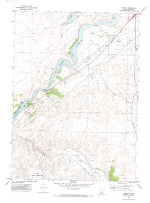
Neeley Topo Map Idaho
To zoom in, hover over the map of Neeley
USGS Topo Quad 42112f8 - 1:24,000 scale
| Topo Map Name: | Neeley |
| USGS Topo Quad ID: | 42112f8 |
| Print Size: | ca. 21 1/4" wide x 27" high |
| Southeast Coordinates: | 42.625° N latitude / 112.875° W longitude |
| Map Center Coordinates: | 42.6875° N latitude / 112.9375° W longitude |
| U.S. State: | ID |
| Filename: | o42112f8.jpg |
| Download Map JPG Image: | Neeley topo map 1:24,000 scale |
| Map Type: | Topographic |
| Topo Series: | 7.5´ |
| Map Scale: | 1:24,000 |
| Source of Map Images: | United States Geological Survey (USGS) |
| Alternate Map Versions: |
Neeley ID 1971, updated 1974 Download PDF Buy paper map Neeley ID 2010 Download PDF Buy paper map Neeley ID 2013 Download PDF Buy paper map |
1:24,000 Topo Quads surrounding Neeley
> Back to 42112e1 at 1:100,000 scale
> Back to 42112a1 at 1:250,000 scale
> Back to U.S. Topo Maps home
Neeley topo map: Gazetteer
Neeley: Canals
Lower West Ditch elevation 1382m 4534′Main West Canal elevation 1359m 4458′
U S Ditch elevation 1396m 4580′
US Ditch elevation 1386m 4547′
W 4.2 Lateral elevation 1349m 4425′
West Canal elevation 1362m 4468′
Neeley: Dams
Lamb-Weston Dam elevation 1339m 4393′Neeley: Islands
Beaver Island elevation 1282m 4206′Goat Island elevation 1287m 4222′
Neeley: Parks
Massacre Rocks State Park elevation 1311m 4301′Neeley: Populated Places
Neeley elevation 1317m 4320′Neeley: Streams
Cold Creek elevation 1366m 4481′Little Creek elevation 1301m 4268′
Warm Creek elevation 1300m 4265′
Neeley: Summits
Eagle Rock elevation 1340m 4396′Little Table Mountain elevation 1539m 5049′
Massacre Rocks elevation 1304m 4278′
Neeley: Valleys
Rockland Valley elevation 1349m 4425′Neeley digital topo map on disk
Buy this Neeley topo map showing relief, roads, GPS coordinates and other geographical features, as a high-resolution digital map file on DVD:


