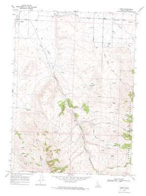
Basin Topo Map Idaho
To zoom in, hover over the map of Basin
USGS Topo Quad 42113b7 - 1:24,000 scale
| Topo Map Name: | Basin |
| USGS Topo Quad ID: | 42113b7 |
| Print Size: | ca. 21 1/4" wide x 27" high |
| Southeast Coordinates: | 42.125° N latitude / 113.75° W longitude |
| Map Center Coordinates: | 42.1875° N latitude / 113.8125° W longitude |
| U.S. State: | ID |
| Filename: | o42113b7.jpg |
| Download Map JPG Image: | Basin topo map 1:24,000 scale |
| Map Type: | Topographic |
| Topo Series: | 7.5´ |
| Map Scale: | 1:24,000 |
| Source of Map Images: | United States Geological Survey (USGS) |
| Alternate Map Versions: |
Basin ID 1968, updated 1972 Download PDF Buy paper map Basin ID 1968, updated 1972 Download PDF Buy paper map Basin ID 2001, updated 2006 Download PDF Buy paper map Basin ID 2011 Download PDF Buy paper map Basin ID 2013 Download PDF Buy paper map |
| FStopo: | US Forest Service topo Basin is available: Download FStopo PDF Download FStopo TIF |
1:24,000 Topo Quads surrounding Basin
> Back to 42113a1 at 1:100,000 scale
> Back to 42112a1 at 1:250,000 scale
> Back to U.S. Topo Maps home
Basin topo map: Gazetteer
Basin: Canals
Summit Creek Ditch elevation 1664m 5459′Basin: Pillars
Camel Rock elevation 1897m 6223′Basin: Populated Places
Basin elevation 1523m 4996′Basin: Springs
Hot Spring elevation 1626m 5334′Warm Spring elevation 1579m 5180′
Basin: Streams
Birch Creek elevation 1406m 4612′Fairchild Creek elevation 1540m 5052′
Fish Creek elevation 1768m 5800′
Lake Creek elevation 1679m 5508′
North Carson Creek elevation 1586m 5203′
South Carson Creek elevation 1626m 5334′
Spring Creek elevation 1533m 5029′
Summit Creek elevation 1395m 4576′
Summit Station Creek elevation 1674m 5492′
Basin digital topo map on disk
Buy this Basin topo map showing relief, roads, GPS coordinates and other geographical features, as a high-resolution digital map file on DVD:


