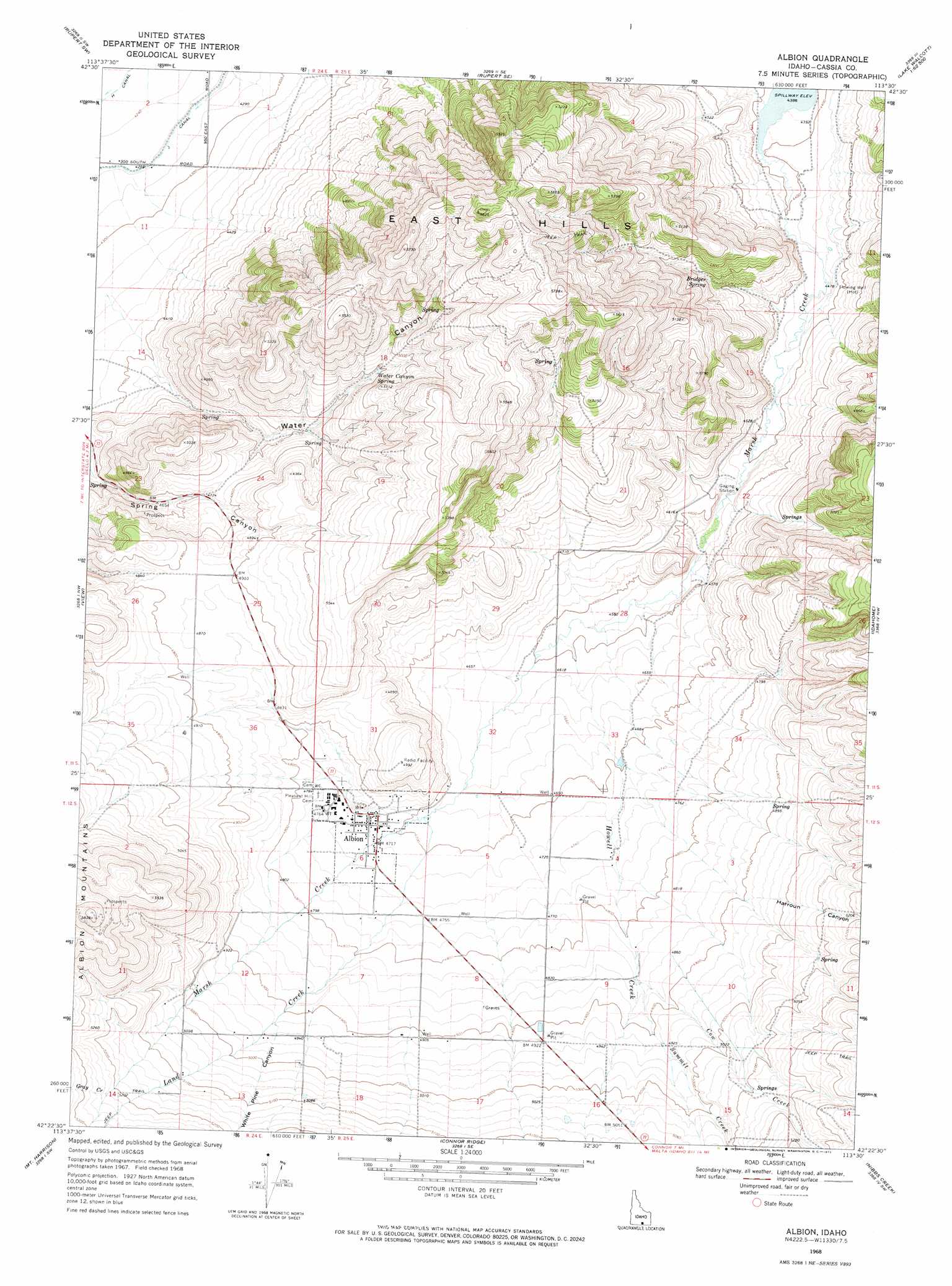
Albion Topo Map Idaho
To zoom in, hover over the map of Albion
USGS Topo Quad 42113d5 - 1:24,000 scale
| Topo Map Name: | Albion |
| USGS Topo Quad ID: | 42113d5 |
| Print Size: | ca. 21 1/4" wide x 27" high |
| Southeast Coordinates: | 42.375° N latitude / 113.5° W longitude |
| Map Center Coordinates: | 42.4375° N latitude / 113.5625° W longitude |
| U.S. State: | ID |
| Filename: | o42113d5.jpg |
| Download Map JPG Image: | Albion topo map 1:24,000 scale |
| Map Type: | Topographic |
| Topo Series: | 7.5´ |
| Map Scale: | 1:24,000 |
| Source of Map Images: | United States Geological Survey (USGS) |
| Alternate Map Versions: |
Albion ID 1968, updated 1972 Download PDF Buy paper map Albion ID 2010 Download PDF Buy paper map Albion ID 2013 Download PDF Buy paper map |
1:24,000 Topo Quads surrounding Albion
Burley Ne |
Rupert Nw |
Acequia |
Lake Walcott West |
Lake Walcott East |
Burley |
Rupert |
Rupert Se |
Lake Walcott Sw |
Lake Walcott Se |
Kenyon |
View |
Albion |
Idahome |
Malta Ne |
Marion Se |
Mount Harrison |
Connor Ridge |
Nibbs Creek |
Malta |
Basin |
Cache Peak |
Elba |
Kane Canyon |
Bridge |
> Back to 42113a1 at 1:100,000 scale
> Back to 42112a1 at 1:250,000 scale
> Back to U.S. Topo Maps home
Albion topo map: Gazetteer
Albion: Airports
Albion Municipal Airport elevation 1460m 4790′Albion: Canals
H 6 Lateral elevation 1288m 4225′J 7 Lateral elevation 1298m 4258′
J 8 Lateral elevation 1298m 4258′
J 9 Lateral elevation 1298m 4258′
Albion: Populated Places
Albion elevation 1440m 4724′Albion: Ranges
East Hills elevation 1769m 5803′Albion: Springs
Bridger Spring elevation 1419m 4655′Water Canyon Spring elevation 1482m 4862′
Albion: Streams
Cow Creek elevation 1477m 4845′Gray Creek elevation 1592m 5223′
Howell Creek elevation 1397m 4583′
Land Creek elevation 1431m 4694′
Summit Creek elevation 1476m 4842′
Albion: Valleys
Harroun Canyon elevation 1433m 4701′Water Canyon elevation 1341m 4399′
White Pine Canyon elevation 1503m 4931′
Albion digital topo map on disk
Buy this Albion topo map showing relief, roads, GPS coordinates and other geographical features, as a high-resolution digital map file on DVD: