Burley Sw Topo Map Idaho
To zoom in, hover over the map of Burley Sw
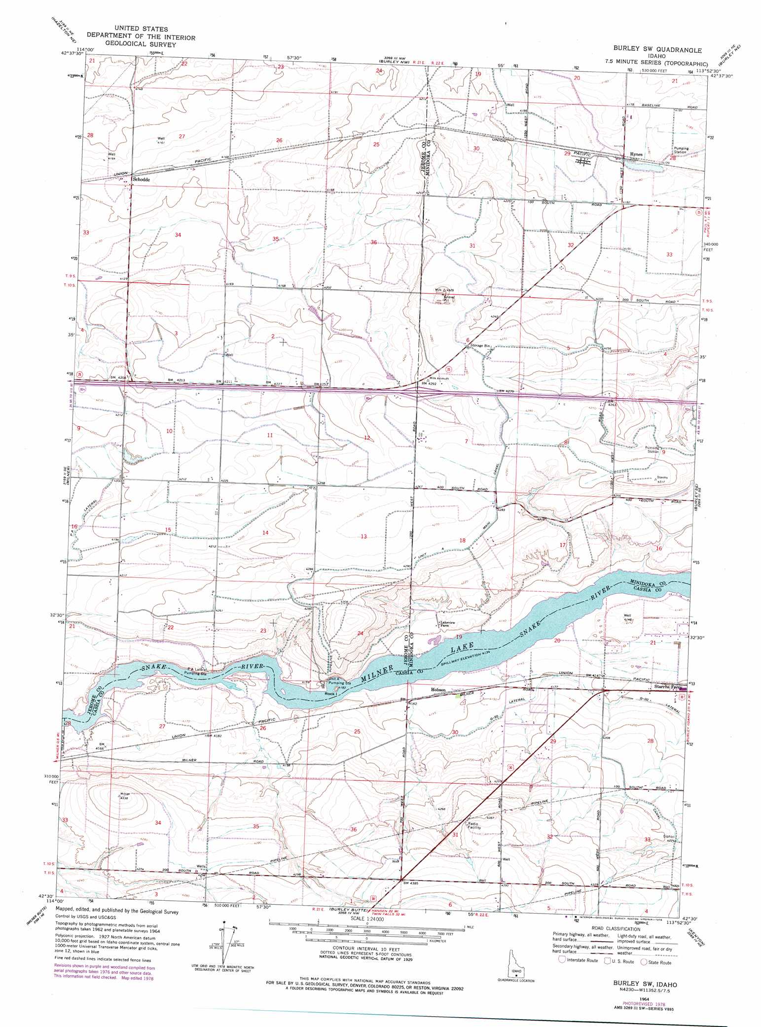
USGS Topo Quad 42113e8 - 1:24,000 scale
| Topo Map Name: | Burley Sw |
| USGS Topo Quad ID: | 42113e8 |
| Print Size: | ca. 21 1/4" wide x 27" high |
| Southeast Coordinates: | 42.5° N latitude / 113.875° W longitude |
| Map Center Coordinates: | 42.5625° N latitude / 113.9375° W longitude |
| U.S. State: | ID |
| Filename: | o42113e8.jpg |
| Download Map JPG Image: | Burley Sw topo map 1:24,000 scale |
| Map Type: | Topographic |
| Topo Series: | 7.5´ |
| Map Scale: | 1:24,000 |
| Source of Map Images: | United States Geological Survey (USGS) |
| Alternate Map Versions: |
Burley SW ID 1964, updated 1965 Download PDF Buy paper map Burley SW ID 1964, updated 1978 Download PDF Buy paper map Burley SW ID 2010 Download PDF Buy paper map Burley SW ID 2013 Download PDF Buy paper map |
1:24,000 Topo Quads surrounding Burley Sw
Star Lake |
Owinza Butte |
Kimama Butte |
Kimama |
Norland |
Hunt |
Eden Ne |
Burley Nw |
Burley Ne |
Rupert Nw |
Eden |
Milner |
Burley Sw |
Burley |
Rupert |
Murtaugh |
Milner Butte |
Burley Butte |
Kenyon |
View |
Rams Horn Ridge |
Buckhorn Canyon |
Marion |
Marion Se |
Mount Harrison |
> Back to 42113e1 at 1:100,000 scale
> Back to 42112a1 at 1:250,000 scale
> Back to U.S. Topo Maps home
Burley Sw topo map: Gazetteer
Burley Sw: Canals
G 19 D Lateral elevation 1265m 4150′G 20 C Lateral elevation 1266m 4153′
G 20 Drain elevation 1264m 4146′
G 20 Lateral elevation 1266m 4153′
G Waste elevation 1267m 4156′
J 36 Pipeline elevation 1290m 4232′
J 39 B Lateral elevation 1287m 4222′
J 39 Lateral elevation 1287m 4222′
J 40 Lateral elevation 1286m 4219′
J Waste elevation 1262m 4140′
S Main Drain elevation 1284m 4212′
Swig Pipeline elevation 1284m 4212′
Burley Sw: Lakes
J 36 Pond elevation 1290m 4232′J Waste Pond elevation 1261m 4137′
Burley Sw: Populated Places
Hobson elevation 1264m 4146′Hynes elevation 1274m 4179′
Schodde elevation 1272m 4173′
Burley Sw digital topo map on disk
Buy this Burley Sw topo map showing relief, roads, GPS coordinates and other geographical features, as a high-resolution digital map file on DVD: