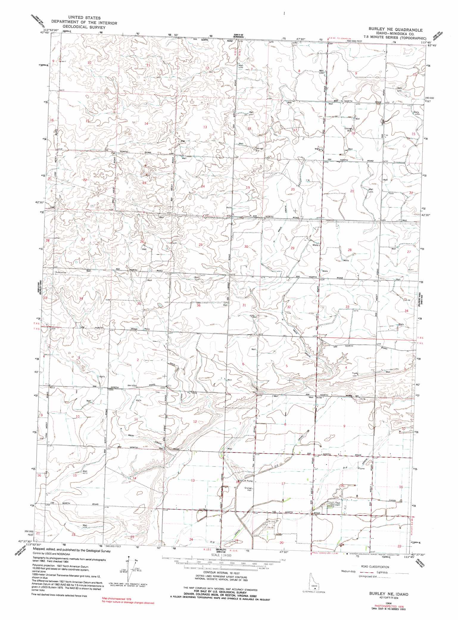
Burley Ne Topo Map Idaho
To zoom in, hover over the map of Burley Ne
USGS Topo Quad 42113f7 - 1:24,000 scale
| Topo Map Name: | Burley Ne |
| USGS Topo Quad ID: | 42113f7 |
| Print Size: | ca. 21 1/4" wide x 27" high |
| Southeast Coordinates: | 42.625° N latitude / 113.75° W longitude |
| Map Center Coordinates: | 42.6875° N latitude / 113.8125° W longitude |
| U.S. State: | ID |
| Filename: | o42113f7.jpg |
| Download Map JPG Image: | Burley Ne topo map 1:24,000 scale |
| Map Type: | Topographic |
| Topo Series: | 7.5´ |
| Map Scale: | 1:24,000 |
| Source of Map Images: | United States Geological Survey (USGS) |
| Alternate Map Versions: |
Burley NE ID 1964, updated 1965 Download PDF Buy paper map Burley NE ID 1964, updated 1991 Download PDF Buy paper map Burley NE ID 2010 Download PDF Buy paper map Burley NE ID 2013 Download PDF Buy paper map |
1:24,000 Topo Quads surrounding Burley Ne
Owinza |
Senter |
Shale Butte |
Community Lake |
Larkspur Park |
Owinza Butte |
Kimama Butte |
Kimama |
Norland |
Max |
Eden Ne |
Burley Nw |
Burley Ne |
Rupert Nw |
Acequia |
Milner |
Burley Sw |
Burley |
Rupert |
Rupert Se |
Milner Butte |
Burley Butte |
Kenyon |
View |
Albion |
> Back to 42113e1 at 1:100,000 scale
> Back to 42112a1 at 1:250,000 scale
> Back to U.S. Topo Maps home
Burley Ne topo map: Gazetteer
Burley Ne: Airports
Klosterman Landing Area elevation 1283m 4209′Burley Ne: Canals
C-1 Canal elevation 1266m 4153′C-2 Canal elevation 1266m 4153′
D-Nine Drain elevation 1264m 4146′
H Main Drain elevation 1284m 4212′
J Main Drain elevation 1281m 4202′
K Main Drain elevation 1275m 4183′
Burley Ne digital topo map on disk
Buy this Burley Ne topo map showing relief, roads, GPS coordinates and other geographical features, as a high-resolution digital map file on DVD: