Pillar Butte Topo Map Idaho
To zoom in, hover over the map of Pillar Butte
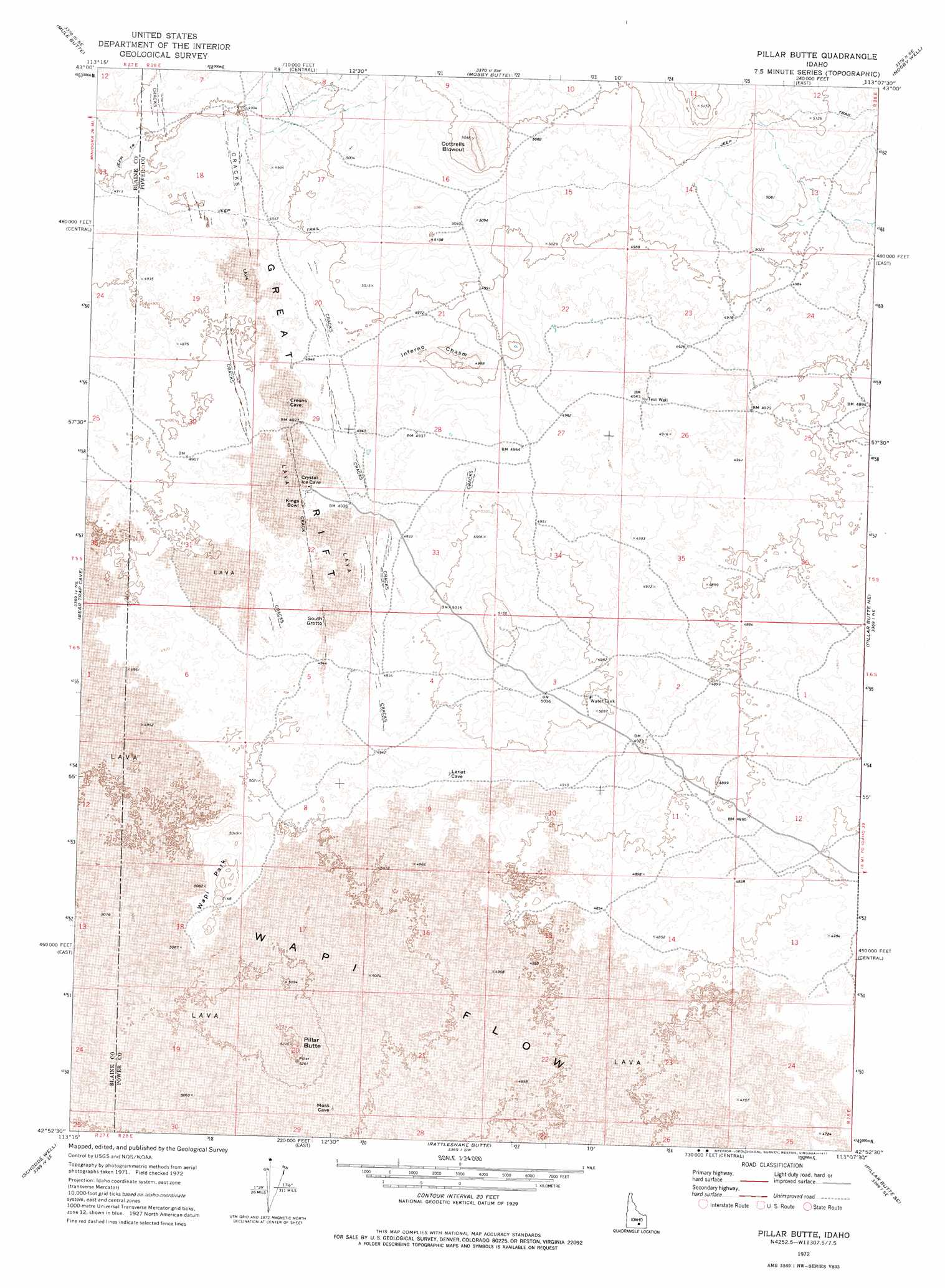
USGS Topo Quad 42113h2 - 1:24,000 scale
| Topo Map Name: | Pillar Butte |
| USGS Topo Quad ID: | 42113h2 |
| Print Size: | ca. 21 1/4" wide x 27" high |
| Southeast Coordinates: | 42.875° N latitude / 113.125° W longitude |
| Map Center Coordinates: | 42.9375° N latitude / 113.1875° W longitude |
| U.S. State: | ID |
| Filename: | o42113h2.jpg |
| Download Map JPG Image: | Pillar Butte topo map 1:24,000 scale |
| Map Type: | Topographic |
| Topo Series: | 7.5´ |
| Map Scale: | 1:24,000 |
| Source of Map Images: | United States Geological Survey (USGS) |
| Alternate Map Versions: |
Pillar Butte ID 1972, updated 1977 Download PDF Buy paper map Pillar Butte ID 2010 Download PDF Buy paper map Pillar Butte ID 2013 Download PDF Buy paper map |
1:24,000 Topo Quads surrounding Pillar Butte
Bear Park West |
Bear Park East |
Antelope Lake |
Split Top |
Coffee Point |
Bear Park Sw |
Mule Butte |
Mosby Butte |
Mosby Well |
Coffee Point Sw |
Brigham Point |
Bear Trap Cave |
Pillar Butte |
Pillar Butte Ne |
American Falls Nw |
Minidoka |
Schodde Well |
Rattlesnake Butte |
Pillar Butte Se |
American Falls Sw |
Lake Walcott West |
Lake Walcott East |
Gifford Spring |
Register Rock |
Neeley |
> Back to 42113e1 at 1:100,000 scale
> Back to 42112a1 at 1:250,000 scale
> Back to U.S. Topo Maps home
Pillar Butte topo map: Gazetteer
Pillar Butte: Basins
Kings Bowl elevation 1496m 4908′The Frying Pan elevation 1531m 5022′
Pillar Butte: Craters
Cottrells Blowout elevation 1570m 5150′Pillar Butte: Summits
Pillar Butte elevation 1583m 5193′Wapi Park elevation 1565m 5134′
Pillar Butte: Valleys
Great Rift elevation 1506m 4940′Inferno Chasm elevation 1515m 4970′
Pillar Butte digital topo map on disk
Buy this Pillar Butte topo map showing relief, roads, GPS coordinates and other geographical features, as a high-resolution digital map file on DVD: