Hollister Topo Map Idaho
To zoom in, hover over the map of Hollister
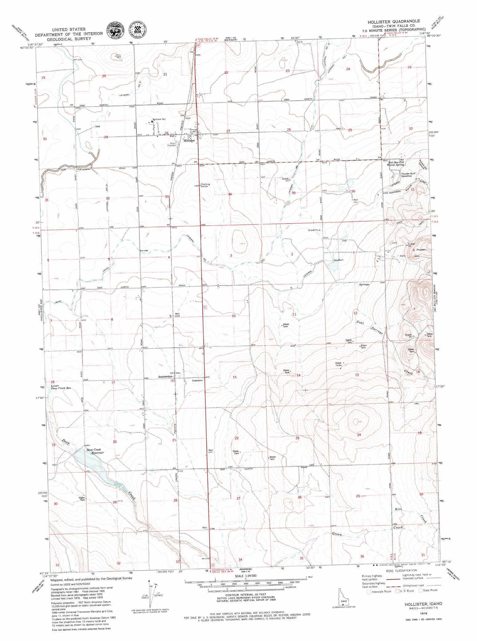
USGS Topo Quad 42114c5 - 1:24,000 scale
| Topo Map Name: | Hollister |
| USGS Topo Quad ID: | 42114c5 |
| Print Size: | ca. 21 1/4" wide x 27" high |
| Southeast Coordinates: | 42.25° N latitude / 114.5° W longitude |
| Map Center Coordinates: | 42.3125° N latitude / 114.5625° W longitude |
| U.S. State: | ID |
| Filename: | o42114c5.jpg |
| Download Map JPG Image: | Hollister topo map 1:24,000 scale |
| Map Type: | Topographic |
| Topo Series: | 7.5´ |
| Map Scale: | 1:24,000 |
| Source of Map Images: | United States Geological Survey (USGS) |
| Alternate Map Versions: |
Hollister ID 1965, updated 1966 Download PDF Buy paper map Hollister ID 2010 Download PDF Buy paper map Hollister ID 2013 Download PDF Buy paper map |
1:24,000 Topo Quads surrounding Hollister
Buhl |
Clover |
Filer |
Twin Falls |
Kimberly |
Roseworth Ne |
Berger Butte |
Berger |
Hub Butte |
Stricker Butte |
Roseworth Se |
Hollister Sw |
Hollister |
Mcmullen Basin |
Grand View Peak |
Browns Bench North |
Salmon Butte |
Rogerson |
Hopper Gulch |
Pike Mountain |
Browns Bench South |
Norton Canyon |
Magic Hot Springs |
Big Creek Ranch |
Timber Butte |
> Back to 42114a1 at 1:100,000 scale
> Back to 42114a1 at 1:250,000 scale
> Back to U.S. Topo Maps home
Hollister topo map: Gazetteer
Hollister: Canals
Lateral No 13 elevation 1391m 4563′Main Canal elevation 1361m 4465′
Hollister: Dams
Deep Creek Number Two Dam elevation 1428m 4685′Hollister: Populated Places
Amsterdam elevation 1428m 4685′Hollister elevation 1379m 4524′
Hollister: Reservoirs
Deep Creek Reservoir elevation 1428m 4685′Hollister: Springs
Nat-Soo-Pah Warm Spring elevation 1384m 4540′Hollister: Streams
Cottonwood Creek elevation 1438m 4717′Goat Springs Creek elevation 1412m 4632′
Rice Creek elevation 1520m 4986′
Hollister: Valleys
Squaw Joe Canyon elevation 1388m 4553′Hollister digital topo map on disk
Buy this Hollister topo map showing relief, roads, GPS coordinates and other geographical features, as a high-resolution digital map file on DVD: