Hub Butte Topo Map Idaho
To zoom in, hover over the map of Hub Butte
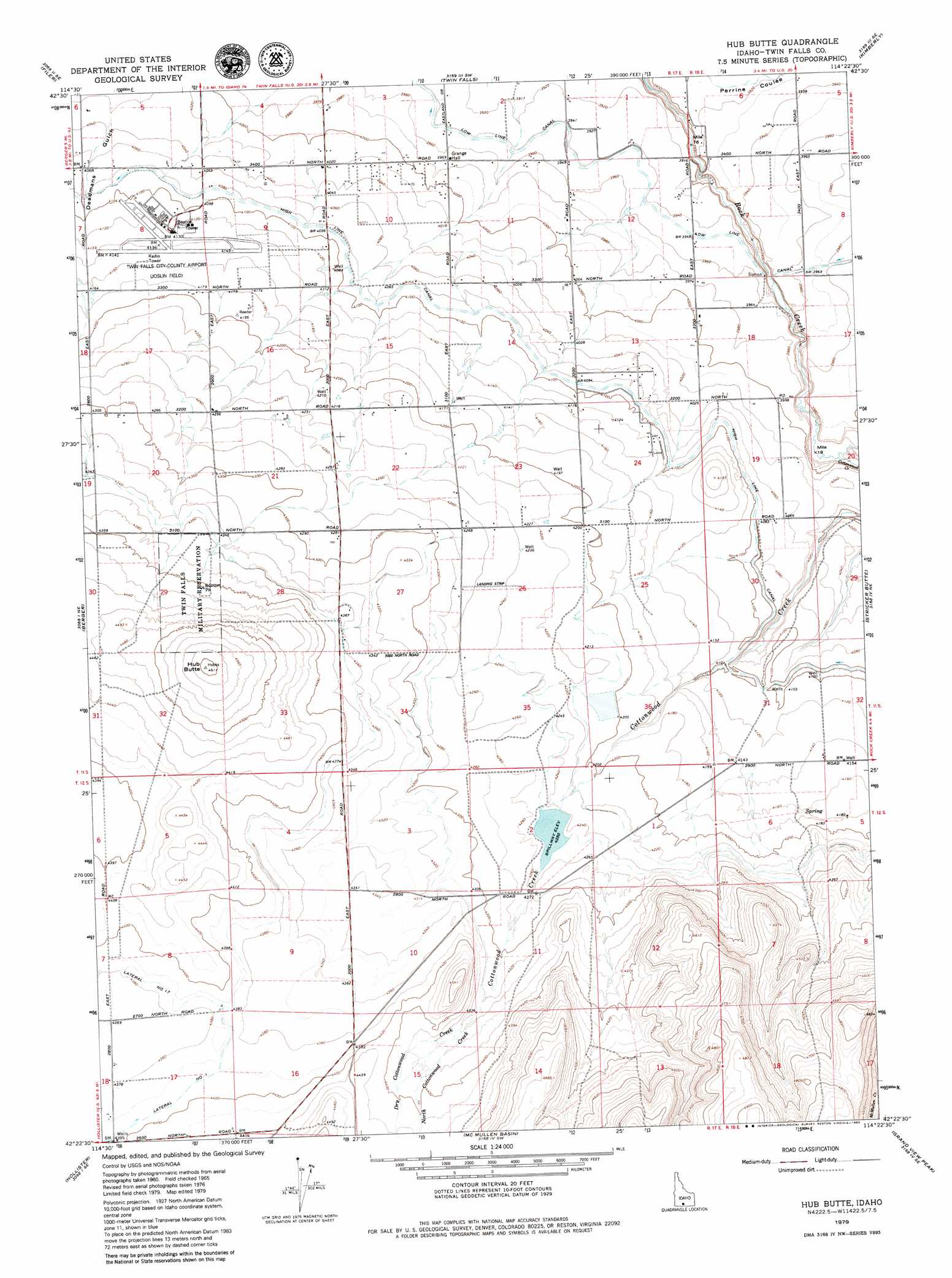
USGS Topo Quad 42114d4 - 1:24,000 scale
| Topo Map Name: | Hub Butte |
| USGS Topo Quad ID: | 42114d4 |
| Print Size: | ca. 21 1/4" wide x 27" high |
| Southeast Coordinates: | 42.375° N latitude / 114.375° W longitude |
| Map Center Coordinates: | 42.4375° N latitude / 114.4375° W longitude |
| U.S. State: | ID |
| Filename: | o42114d4.jpg |
| Download Map JPG Image: | Hub Butte topo map 1:24,000 scale |
| Map Type: | Topographic |
| Topo Series: | 7.5´ |
| Map Scale: | 1:24,000 |
| Source of Map Images: | United States Geological Survey (USGS) |
| Alternate Map Versions: |
Hub Butte ID 1965, updated 1966 Download PDF Buy paper map Hub Butte ID 1979, updated 1980 Download PDF Buy paper map Hub Butte ID 2010 Download PDF Buy paper map Hub Butte ID 2013 Download PDF Buy paper map |
1:24,000 Topo Quads surrounding Hub Butte
Niagara Springs |
Jerome |
Falls City |
Twin Falls Ne |
Hunt |
Clover |
Filer |
Twin Falls |
Kimberly |
Eden |
Berger Butte |
Berger |
Hub Butte |
Stricker Butte |
Murtaugh |
Hollister Sw |
Hollister |
Mcmullen Basin |
Grand View Peak |
Rams Horn Ridge |
Salmon Butte |
Rogerson |
Hopper Gulch |
Pike Mountain |
Trapper Peak |
> Back to 42114a1 at 1:100,000 scale
> Back to 42114a1 at 1:250,000 scale
> Back to U.S. Topo Maps home
Hub Butte topo map: Gazetteer
Hub Butte: Airports
Twin Falls Airport elevation 1262m 4140′Hub Butte: Dams
McMullen Creek Dam elevation 1296m 4251′Hub Butte: Streams
Cottonwood Creek elevation 1200m 3937′Dry Cottonwood Creek elevation 1320m 4330′
North Cottonwood Creek elevation 1320m 4330′
Hub Butte: Summits
Hub Butte elevation 1404m 4606′Hub Butte: Valleys
Deadmans Gulch elevation 1227m 4025′Hub Butte digital topo map on disk
Buy this Hub Butte topo map showing relief, roads, GPS coordinates and other geographical features, as a high-resolution digital map file on DVD: