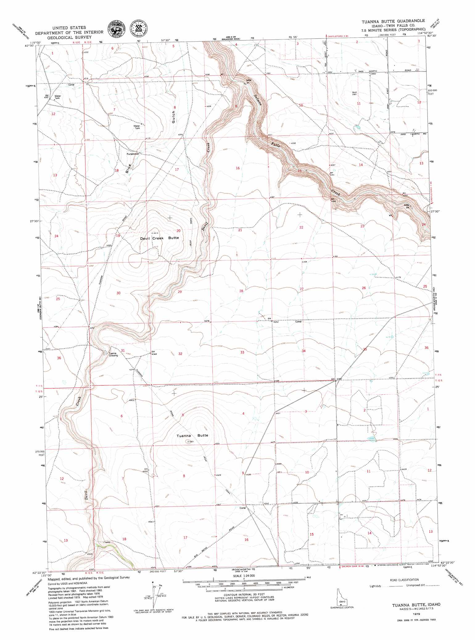
Tuanna Butte Topo Map Idaho
To zoom in, hover over the map of Tuanna Butte
USGS Topo Quad 42114d8 - 1:24,000 scale
| Topo Map Name: | Tuanna Butte |
| USGS Topo Quad ID: | 42114d8 |
| Print Size: | ca. 21 1/4" wide x 27" high |
| Southeast Coordinates: | 42.375° N latitude / 114.875° W longitude |
| Map Center Coordinates: | 42.4375° N latitude / 114.9375° W longitude |
| U.S. State: | ID |
| Filename: | o42114d8.jpg |
| Download Map JPG Image: | Tuanna Butte topo map 1:24,000 scale |
| Map Type: | Topographic |
| Topo Series: | 7.5´ |
| Map Scale: | 1:24,000 |
| Source of Map Images: | United States Geological Survey (USGS) |
| Alternate Map Versions: |
Tuanna Butte ID 1965, updated 1966 Download PDF Buy paper map Tuanna Butte ID 1979, updated 1980 Download PDF Buy paper map Tuanna Butte ID 2010 Download PDF Buy paper map Tuanna Butte ID 2013 Download PDF Buy paper map |
1:24,000 Topo Quads surrounding Tuanna Butte
Notch Butte |
Crows Nest Ne |
Yahoo Creek |
Thousand Springs |
Niagara Springs |
Crows Nest |
Castleford Butte |
Balanced Rock |
Buhl |
Clover |
Horse Butte |
Coonskin Butte Ne |
Tuanna Butte |
Roseworth Ne |
Berger Butte |
Coonskin Butte |
Big Bend Crossing |
Roseworth |
Roseworth Se |
Hollister Sw |
Salls Crossing |
Grassy Hills |
Cedar Creek Reservoir |
Browns Bench North |
Salmon Butte |
> Back to 42114a1 at 1:100,000 scale
> Back to 42114a1 at 1:250,000 scale
> Back to U.S. Topo Maps home
Tuanna Butte topo map: Gazetteer
Tuanna Butte: Crossings
Tuanna Crossing elevation 1289m 4229′Tuanna Butte: Streams
Devil Creek elevation 1070m 3510′Tuanna Butte: Summits
Devil Creek Butte elevation 1349m 4425′Tuanna Butte elevation 1404m 4606′
Tuanna Butte digital topo map on disk
Buy this Tuanna Butte topo map showing relief, roads, GPS coordinates and other geographical features, as a high-resolution digital map file on DVD: