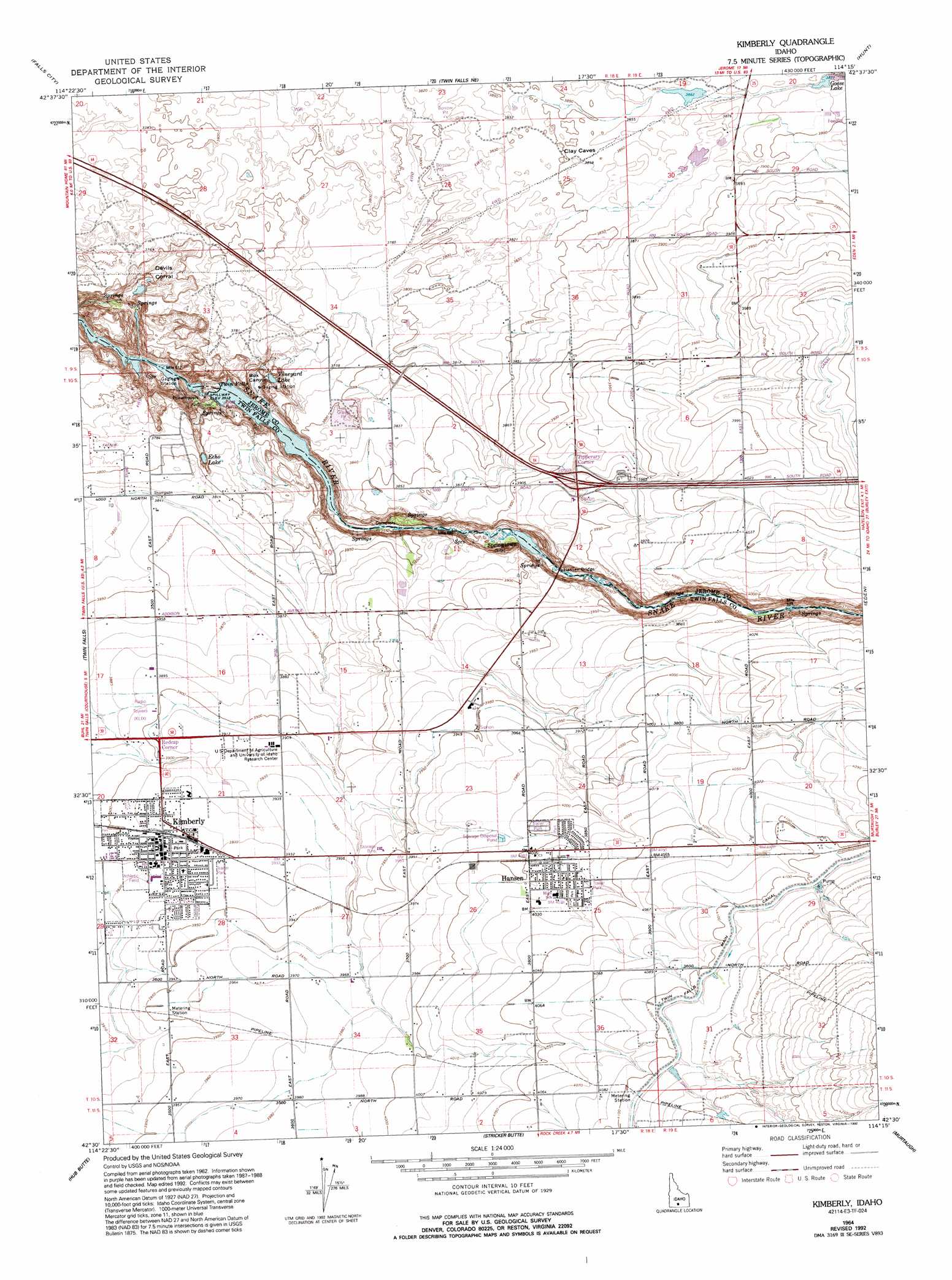
Kimberly Topo Map Idaho
To zoom in, hover over the map of Kimberly
USGS Topo Quad 42114e3 - 1:24,000 scale
| Topo Map Name: | Kimberly |
| USGS Topo Quad ID: | 42114e3 |
| Print Size: | ca. 21 1/4" wide x 27" high |
| Southeast Coordinates: | 42.5° N latitude / 114.25° W longitude |
| Map Center Coordinates: | 42.5625° N latitude / 114.3125° W longitude |
| U.S. State: | ID |
| Filename: | o42114e3.jpg |
| Download Map JPG Image: | Kimberly topo map 1:24,000 scale |
| Map Type: | Topographic |
| Topo Series: | 7.5´ |
| Map Scale: | 1:24,000 |
| Source of Map Images: | United States Geological Survey (USGS) |
| Alternate Map Versions: |
Kimberly ID 1964, updated 1965 Download PDF Buy paper map Kimberly ID 1964, updated 1992 Download PDF Buy paper map Kimberly ID 1979, updated 1980 Download PDF Buy paper map Kimberly ID 2010 Download PDF Buy paper map Kimberly ID 2013 Download PDF Buy paper map |
1:24,000 Topo Quads surrounding Kimberly
Gooding Se |
Shoshone Sw |
Shoshone Se |
Star Lake |
Owinza Butte |
Jerome |
Falls City |
Twin Falls Ne |
Hunt |
Eden Ne |
Filer |
Twin Falls |
Kimberly |
Eden |
Milner |
Berger |
Hub Butte |
Stricker Butte |
Murtaugh |
Milner Butte |
Hollister |
Mcmullen Basin |
Grand View Peak |
Rams Horn Ridge |
Buckhorn Canyon |
> Back to 42114e1 at 1:100,000 scale
> Back to 42114a1 at 1:250,000 scale
> Back to U.S. Topo Maps home
Kimberly topo map: Gazetteer
Kimberly: Bridges
Hansen Bridge elevation 1090m 3576′Kimberly: Canals
C-55 Spill elevation 1173m 3848′C-Spill elevation 1185m 3887′
Lateral C-33 elevation 1195m 3920′
Lateral C-39 elevation 1231m 4038′
Lateral C-40 elevation 1205m 3953′
Lateral C-44 elevation 1203m 3946′
Lateral C-48 elevation 1174m 3851′
Lateral C-52 elevation 1187m 3894′
Lateral C-55 elevation 1181m 3874′
Kimberly: Dams
Twin Falls Dam elevation 1085m 3559′Kimberly: Falls
Twin Falls elevation 1072m 3517′Kimberly: Lakes
Echo Lake elevation 1120m 3674′Kimberly: Populated Places
Bills elevation 1237m 4058′Hansen elevation 1228m 4028′
Kimberly elevation 1196m 3923′
Tipperary Corner elevation 1201m 3940′
Kimberly: Reservoirs
Goose Lake elevation 1183m 3881′Vineyard Lake elevation 1105m 3625′
Kimberly: Valleys
Box Canyon elevation 1074m 3523′Kimberly digital topo map on disk
Buy this Kimberly topo map showing relief, roads, GPS coordinates and other geographical features, as a high-resolution digital map file on DVD: