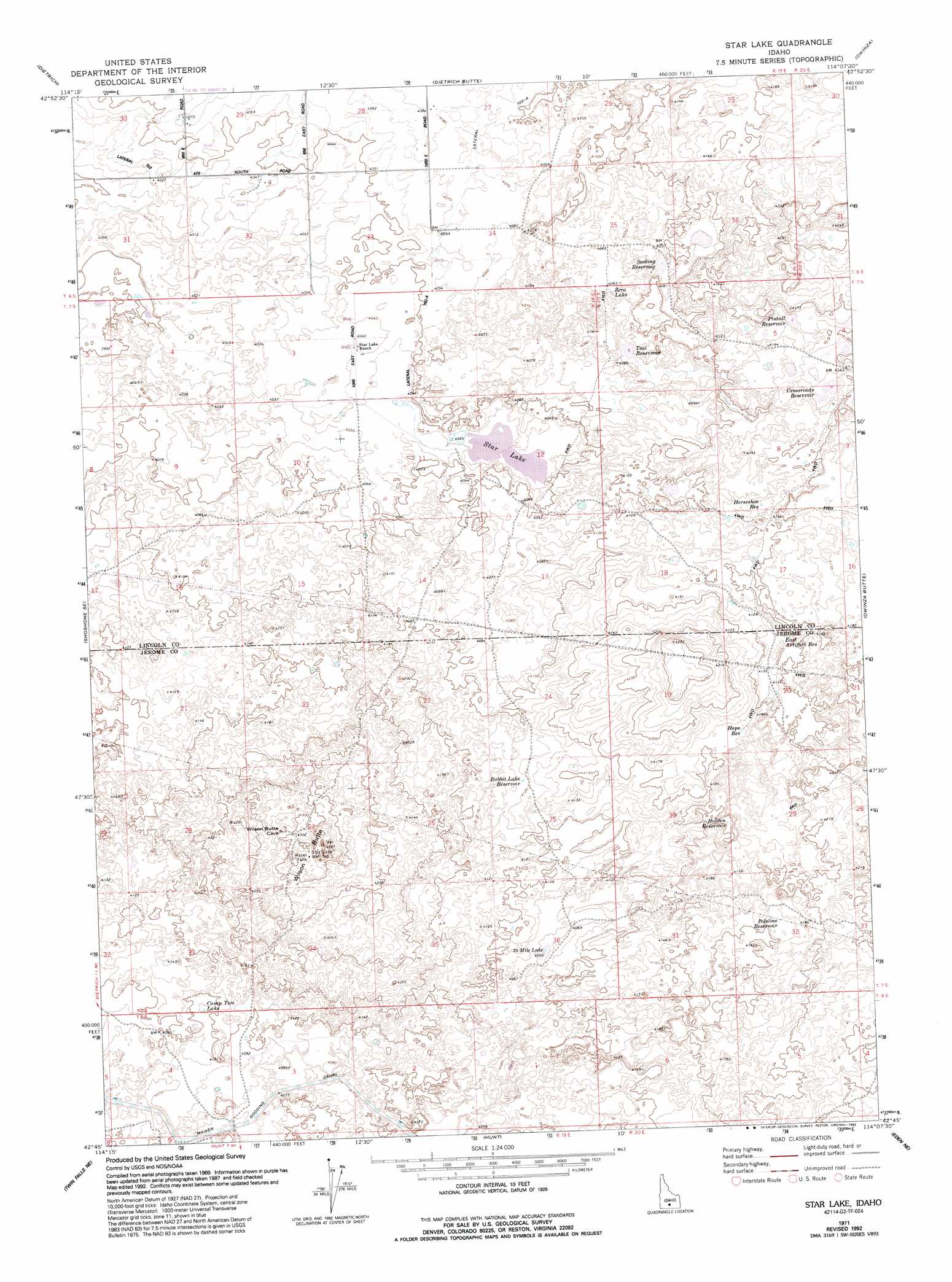
Star Lake Topo Map Idaho
To zoom in, hover over the map of Star Lake
USGS Topo Quad 42114g2 - 1:24,000 scale
| Topo Map Name: | Star Lake |
| USGS Topo Quad ID: | 42114g2 |
| Print Size: | ca. 21 1/4" wide x 27" high |
| Southeast Coordinates: | 42.75° N latitude / 114.125° W longitude |
| Map Center Coordinates: | 42.8125° N latitude / 114.1875° W longitude |
| U.S. State: | ID |
| Filename: | o42114g2.jpg |
| Download Map JPG Image: | Star Lake topo map 1:24,000 scale |
| Map Type: | Topographic |
| Topo Series: | 7.5´ |
| Map Scale: | 1:24,000 |
| Source of Map Images: | United States Geological Survey (USGS) |
| Alternate Map Versions: |
Star Lake ID 1971, updated 1973 Download PDF Buy paper map Star Lake ID 1971, updated 1992 Download PDF Buy paper map Star Lake ID 2010 Download PDF Buy paper map Star Lake ID 2013 Download PDF Buy paper map |
1:24,000 Topo Quads surrounding Star Lake
Mammoth Cave |
Kinzie Butte |
Richfield |
Pagari |
Black Ridge Crater |
Shoshone |
Dietrich |
Dietrich Butte |
Owinza |
Senter |
Shoshone Sw |
Shoshone Se |
Star Lake |
Owinza Butte |
Kimama Butte |
Falls City |
Twin Falls Ne |
Hunt |
Eden Ne |
Burley Nw |
Twin Falls |
Kimberly |
Eden |
Milner |
Burley Sw |
> Back to 42114e1 at 1:100,000 scale
> Back to 42114a1 at 1:250,000 scale
> Back to U.S. Topo Maps home
Star Lake topo map: Gazetteer
Star Lake: Lakes
26 Mile Lake elevation 1241m 4071′Camp Two Lake elevation 1247m 4091′
Star Lake elevation 1227m 4025′
Zero Lake elevation 1238m 4061′
Star Lake: Reservoirs
Crossroads Reservoir elevation 1260m 4133′East Artifact Reservoir elevation 1260m 4133′
Hidden Reservoir elevation 1265m 4150′
Hope Reservoir elevation 1268m 4160′
Horseshoe Reservoir elevation 1256m 4120′
Pintail Reservoir elevation 1260m 4133′
Poleline Reservoir elevation 1271m 4169′
Rabbit Lake Reservoir elevation 1256m 4120′
Seeding Reservoir elevation 1244m 4081′
Teal Reservoir elevation 1237m 4058′
Star Lake: Summits
Wilson Butte elevation 1334m 4376′Star Lake: Wells
Star Lake Well Number 1 elevation 1317m 4320′Star Lake digital topo map on disk
Buy this Star Lake topo map showing relief, roads, GPS coordinates and other geographical features, as a high-resolution digital map file on DVD: