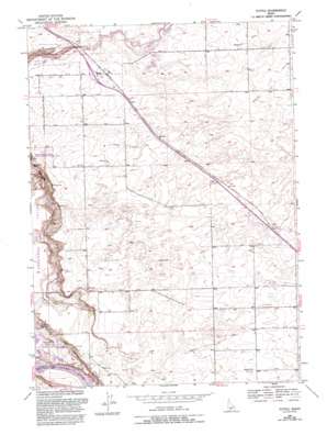
Tuttle Topo Map Idaho
To zoom in, hover over the map of Tuttle
USGS Topo Quad 42114g7 - 1:24,000 scale
| Topo Map Name: | Tuttle |
| USGS Topo Quad ID: | 42114g7 |
| Print Size: | ca. 21 1/4" wide x 27" high |
| Southeast Coordinates: | 42.75° N latitude / 114.75° W longitude |
| Map Center Coordinates: | 42.8125° N latitude / 114.8125° W longitude |
| U.S. State: | ID |
| Filename: | o42114g7.jpg |
| Download Map JPG Image: | Tuttle topo map 1:24,000 scale |
| Map Type: | Topographic |
| Topo Series: | 7.5´ |
| Map Scale: | 1:24,000 |
| Source of Map Images: | United States Geological Survey (USGS) |
| Alternate Map Versions: |
Tuttle ID 1949, updated 1968 Download PDF Buy paper map Tuttle ID 1949, updated 1978 Download PDF Buy paper map Tuttle ID 1949, updated 1993 Download PDF Buy paper map Tuttle ID 1951 Download PDF Buy paper map Tuttle ID 2010 Download PDF Buy paper map Tuttle ID 2013 Download PDF Buy paper map |
1:24,000 Topo Quads surrounding Tuttle
> Back to 42114e1 at 1:100,000 scale
> Back to 42114a1 at 1:250,000 scale
> Back to U.S. Topo Maps home
Tuttle topo map: Gazetteer
Tuttle: Areas
Devils Wash Bowl elevation 959m 3146′Tuttle: Canals
Lateral W-26 elevation 982m 3221′Lateral W-34 elevation 1007m 3303′
Lateral W-35 elevation 1013m 3323′
Lateral W-36 elevation 1023m 3356′
Lateral W-37 elevation 1017m 3336′
Lateral W-40 elevation 1010m 3313′
Lateral W-45 elevation 1007m 3303′
Lateral W-46 elevation 997m 3270′
Lateral W-47 elevation 995m 3264′
Lateral W-54 elevation 1032m 3385′
Lateral W-57 elevation 996m 3267′
Lateral X-10 elevation 1044m 3425′
Lateral X-11 elevation 1061m 3480′
Lateral X-14 elevation 1059m 3474′
Lateral X-15 elevation 1016m 3333′
Lateral X-18 elevation 1025m 3362′
Lateral X-19 elevation 1013m 3323′
Lateral X-24 elevation -1m -4′
Lateral X-29 elevation 1010m 3313′
Lateral X-30 elevation 1017m 3336′
Lateral X-32 elevation 1019m 3343′
Lateral X-33 elevation 1008m 3307′
Lateral X-5 elevation 1055m 3461′
Tuttle: Parks
Malad Gorge State Park elevation 937m 3074′Tuttle: Populated Places
Tuttle elevation 1008m 3307′Tuttle: Slopes
Johnson Grade elevation 922m 3024′Vader Grade elevation 968m 3175′
Tuttle: Springs
Bickel Spring elevation 908m 2979′Big Springs elevation 944m 3097′
Bridal Wreath Springs elevation 896m 2939′
Tucker Springs elevation 901m 2956′
Tuttle: Streams
Riley Creek elevation 879m 2883′Tuttle digital topo map on disk
Buy this Tuttle topo map showing relief, roads, GPS coordinates and other geographical features, as a high-resolution digital map file on DVD:


