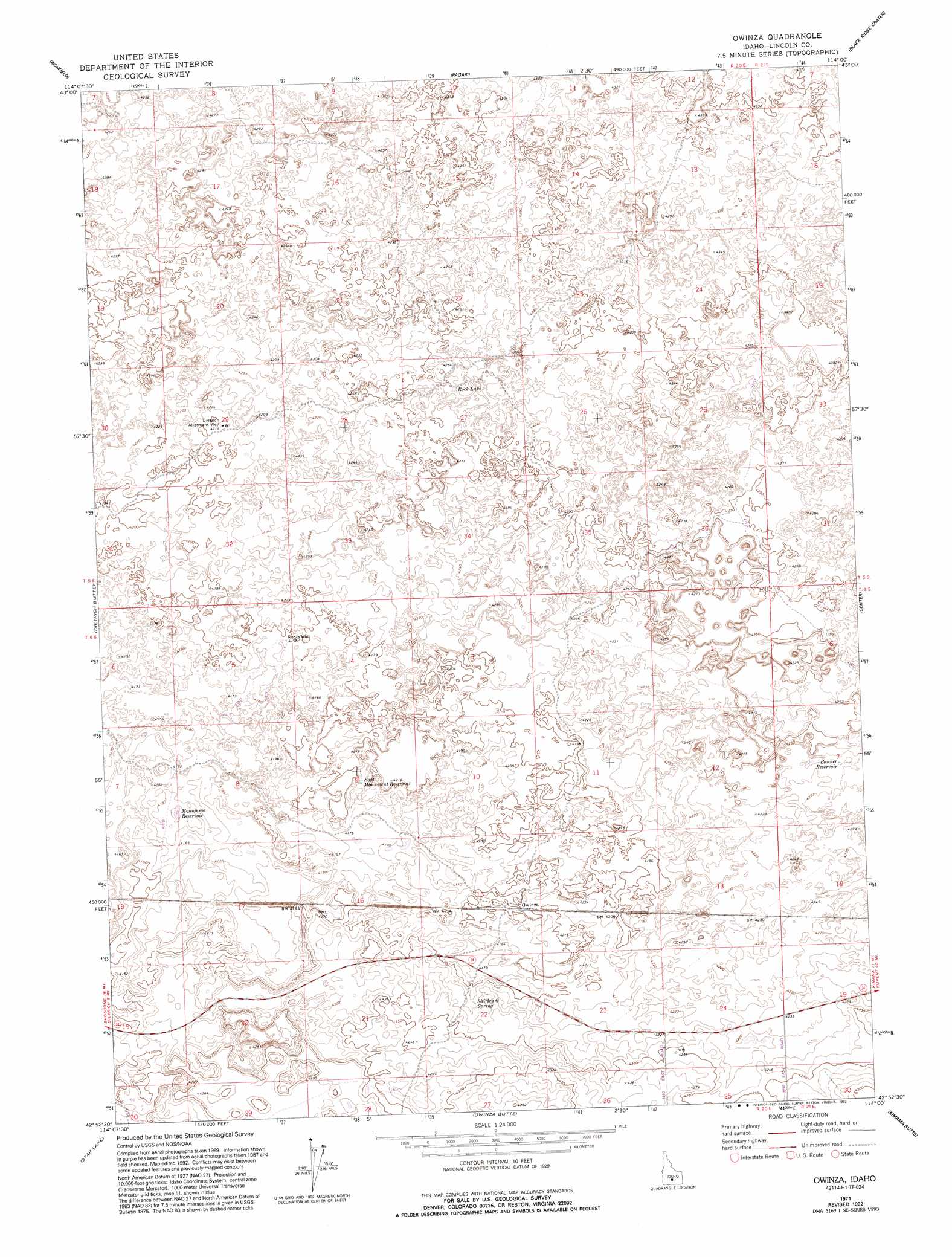
Owinza Topo Map Idaho
To zoom in, hover over the map of Owinza
USGS Topo Quad 42114h1 - 1:24,000 scale
| Topo Map Name: | Owinza |
| USGS Topo Quad ID: | 42114h1 |
| Print Size: | ca. 21 1/4" wide x 27" high |
| Southeast Coordinates: | 42.875° N latitude / 114° W longitude |
| Map Center Coordinates: | 42.9375° N latitude / 114.0625° W longitude |
| U.S. State: | ID |
| Filename: | o42114h1.jpg |
| Download Map JPG Image: | Owinza topo map 1:24,000 scale |
| Map Type: | Topographic |
| Topo Series: | 7.5´ |
| Map Scale: | 1:24,000 |
| Source of Map Images: | United States Geological Survey (USGS) |
| Alternate Map Versions: |
Owinza ID 1971, updated 1974 Download PDF Buy paper map Owinza ID 1971, updated 1992 Download PDF Buy paper map Owinza ID 2010 Download PDF Buy paper map Owinza ID 2013 Download PDF Buy paper map |
1:24,000 Topo Quads surrounding Owinza
Shoshone Ice Cave |
Tapper Lake |
Tikura |
Pagari Well |
Wagon Butte |
Kinzie Butte |
Richfield |
Pagari |
Black Ridge Crater |
Halfway Lake |
Dietrich |
Dietrich Butte |
Owinza |
Senter |
Shale Butte |
Shoshone Se |
Star Lake |
Owinza Butte |
Kimama Butte |
Kimama |
Twin Falls Ne |
Hunt |
Eden Ne |
Burley Nw |
Burley Ne |
> Back to 42114e1 at 1:100,000 scale
> Back to 42114a1 at 1:250,000 scale
> Back to U.S. Topo Maps home
Owinza topo map: Gazetteer
Owinza: Lakes
Rock Lake elevation 1304m 4278′Owinza: Populated Places
Owinza elevation 1282m 4206′Owinza: Reservoirs
Banner Reservoir elevation 1286m 4219′East Monument Reservoir elevation 1275m 4183′
Monument Reservoir elevation 1275m 4183′
Owinza: Springs
Shirley G Spring elevation 1286m 4219′Owinza: Wells
Dietrich Allotment Well elevation 1284m 4212′Rocks Well elevation 1279m 4196′
Owinza digital topo map on disk
Buy this Owinza topo map showing relief, roads, GPS coordinates and other geographical features, as a high-resolution digital map file on DVD: