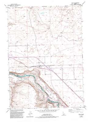
Bliss Topo Map Idaho
To zoom in, hover over the map of Bliss
USGS Topo Quad 42114h8 - 1:24,000 scale
| Topo Map Name: | Bliss |
| USGS Topo Quad ID: | 42114h8 |
| Print Size: | ca. 21 1/4" wide x 27" high |
| Southeast Coordinates: | 42.875° N latitude / 114.875° W longitude |
| Map Center Coordinates: | 42.9375° N latitude / 114.9375° W longitude |
| U.S. State: | ID |
| Filename: | o42114h8.jpg |
| Download Map JPG Image: | Bliss topo map 1:24,000 scale |
| Map Type: | Topographic |
| Topo Series: | 7.5´ |
| Map Scale: | 1:24,000 |
| Source of Map Images: | United States Geological Survey (USGS) |
| Alternate Map Versions: |
Bliss ID 1949, updated 1958 Download PDF Buy paper map Bliss ID 1949, updated 1978 Download PDF Buy paper map Bliss ID 1949, updated 1978 Download PDF Buy paper map Bliss ID 1949, updated 1992 Download PDF Buy paper map Bliss ID 1950 Download PDF Buy paper map Bliss ID 2010 Download PDF Buy paper map Bliss ID 2013 Download PDF Buy paper map |
1:24,000 Topo Quads surrounding Bliss
> Back to 42114e1 at 1:100,000 scale
> Back to 42114a1 at 1:250,000 scale
> Back to U.S. Topo Maps home
Bliss topo map: Gazetteer
Bliss: Canals
Lateral Y-4 elevation 1011m 3316′Lateral Z-4 elevation 999m 3277′
Lateral Z-6 elevation 999m 3277′
Y Canal elevation 1015m 3330′
Z Canal elevation 999m 3277′
Bliss: Capes
Bliss Point elevation 1059m 3474′Bliss: Populated Places
Bliss elevation 997m 3270′Bliss: Reservoirs
Last Chance Reservoir elevation 1042m 3418′Bliss: Wells
North Bliss Well elevation 1085m 3559′Windmill Well elevation 1047m 3435′
Bliss digital topo map on disk
Buy this Bliss topo map showing relief, roads, GPS coordinates and other geographical features, as a high-resolution digital map file on DVD:


