Murphy Hot Springs Topo Map Idaho
To zoom in, hover over the map of Murphy Hot Springs
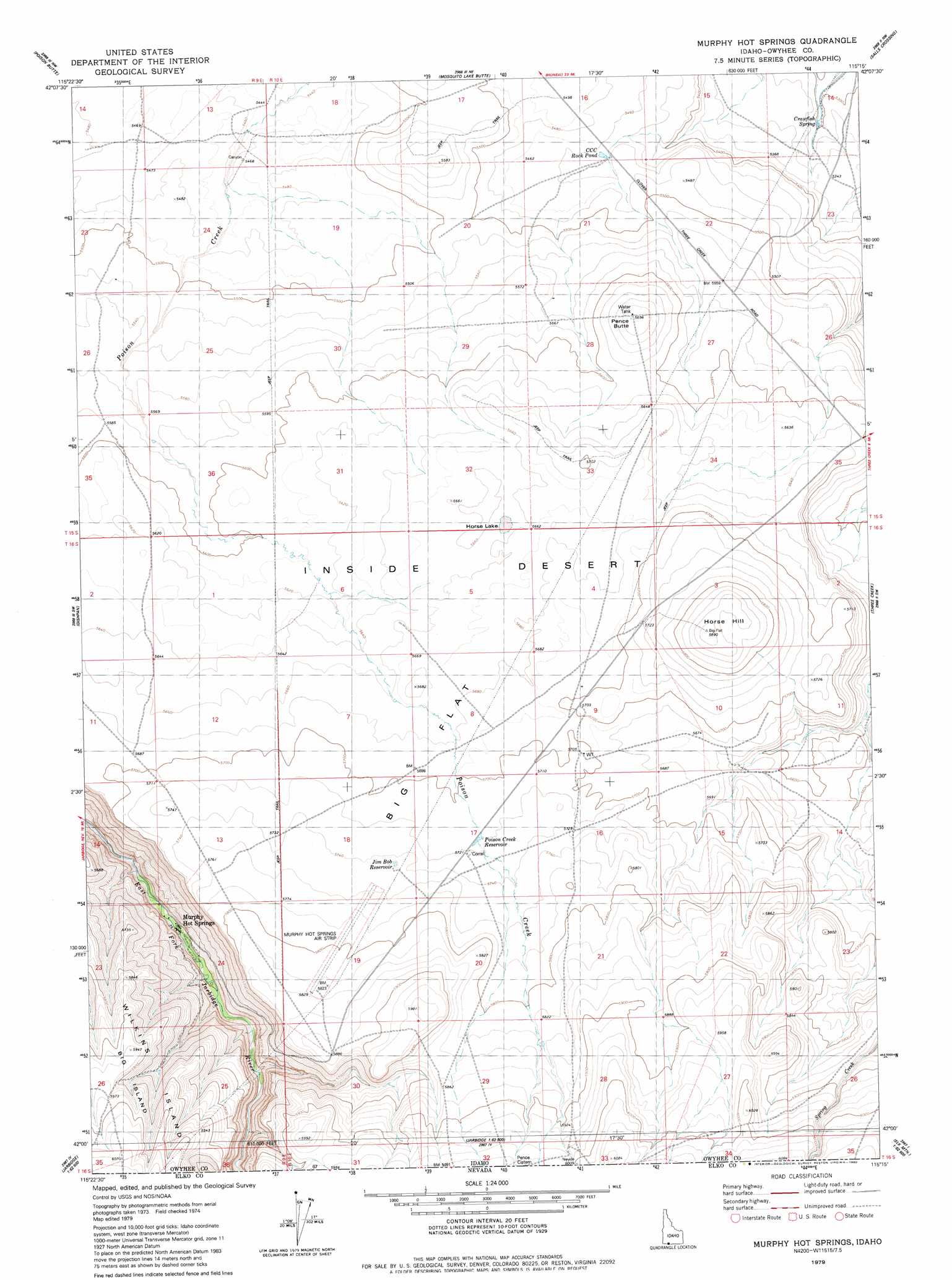
USGS Topo Quad 42115a3 - 1:24,000 scale
| Topo Map Name: | Murphy Hot Springs |
| USGS Topo Quad ID: | 42115a3 |
| Print Size: | ca. 21 1/4" wide x 27" high |
| Southeast Coordinates: | 42° N latitude / 115.25° W longitude |
| Map Center Coordinates: | 42.0625° N latitude / 115.3125° W longitude |
| U.S. State: | ID |
| Filename: | o42115a3.jpg |
| Download Map JPG Image: | Murphy Hot Springs topo map 1:24,000 scale |
| Map Type: | Topographic |
| Topo Series: | 7.5´ |
| Map Scale: | 1:24,000 |
| Source of Map Images: | United States Geological Survey (USGS) |
| Alternate Map Versions: |
Murphy Hot Springs ID 1979, updated 1980 Download PDF Buy paper map Murphy Hot Springs ID 2010 Download PDF Buy paper map Murphy Hot Springs ID 2013 Download PDF Buy paper map |
1:24,000 Topo Quads surrounding Murphy Hot Springs
Inside Lakes |
Clover Butte South |
Juniper Butte |
Coonskin Butte |
Big Bend Crossing |
The Arch |
Poison Butte |
Mosquito Lake Butte |
Salls Crossing |
Grassy Hills |
Cowan Reservoir |
Dishpan |
Murphy Hot Springs |
Three Creek |
Curtis Draw |
Bearpaw Mountain |
Jarbidge North |
Robinson Creek |
Caudle Creek |
Elk Mountain |
Coon Creek |
Jarbidge South |
Gods Pocket Peak |
Goat Creek |
Buckhorn Ridge |
> Back to 42115a1 at 1:100,000 scale
> Back to 42114a1 at 1:250,000 scale
> Back to U.S. Topo Maps home
Murphy Hot Springs topo map: Gazetteer
Murphy Hot Springs: Airports
Murphy Hot Springs Airport elevation 1766m 5793′Murphy Hot Springs: Flats
Big Flat elevation 1733m 5685′Murphy Hot Springs: Lakes
CCC Rock Pond elevation 1662m 5452′Crawfish Spring elevation 1616m 5301′
Horse Lake elevation 1726m 5662′
Jim Bob Reservoir elevation 1731m 5679′
Poison Creek Reservoir elevation 1744m 5721′
Murphy Hot Springs: Populated Places
Murphy Hot Springs elevation 1633m 5357′Murphy Hot Springs: Summits
Horse Hill elevation 1795m 5889′Pence Butte elevation 1736m 5695′
Murphy Hot Springs digital topo map on disk
Buy this Murphy Hot Springs topo map showing relief, roads, GPS coordinates and other geographical features, as a high-resolution digital map file on DVD: