Dishpan Topo Map Idaho
To zoom in, hover over the map of Dishpan
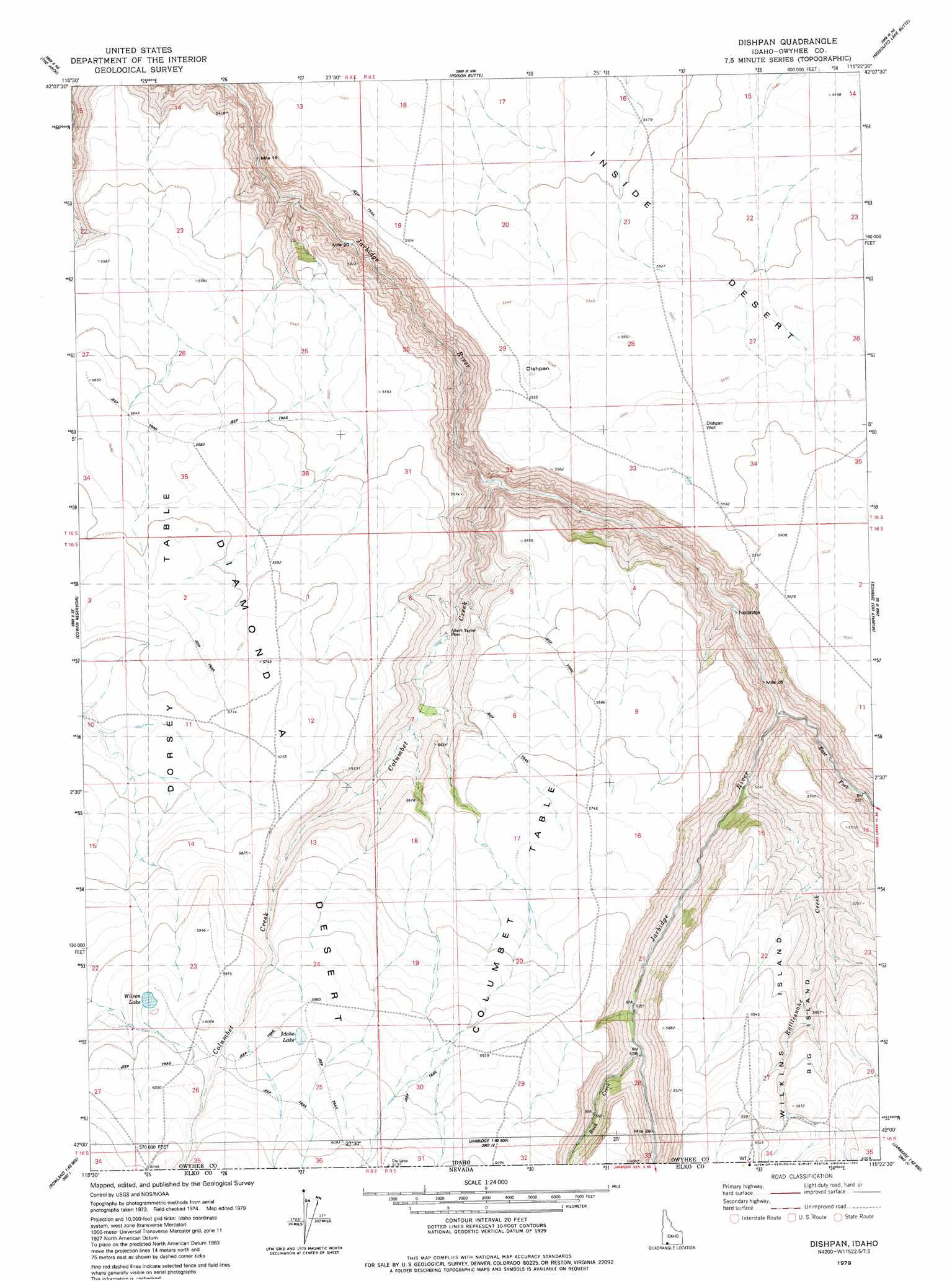
USGS Topo Quad 42115a4 - 1:24,000 scale
| Topo Map Name: | Dishpan |
| USGS Topo Quad ID: | 42115a4 |
| Print Size: | ca. 21 1/4" wide x 27" high |
| Southeast Coordinates: | 42° N latitude / 115.375° W longitude |
| Map Center Coordinates: | 42.0625° N latitude / 115.4375° W longitude |
| U.S. State: | ID |
| Filename: | o42115a4.jpg |
| Download Map JPG Image: | Dishpan topo map 1:24,000 scale |
| Map Type: | Topographic |
| Topo Series: | 7.5´ |
| Map Scale: | 1:24,000 |
| Source of Map Images: | United States Geological Survey (USGS) |
| Alternate Map Versions: |
Dishpan ID 1979, updated 1980 Download PDF Buy paper map Dishpan ID 2010 Download PDF Buy paper map Dishpan ID 2013 Download PDF Buy paper map |
1:24,000 Topo Quads surrounding Dishpan
Indian Hot Springs |
Inside Lakes |
Clover Butte South |
Juniper Butte |
Coonskin Butte |
Triguero Lake |
The Arch |
Poison Butte |
Mosquito Lake Butte |
Salls Crossing |
Triplet Butte |
Cowan Reservoir |
Dishpan |
Murphy Hot Springs |
Three Creek |
Big Table |
Bearpaw Mountain |
Jarbidge North |
Robinson Creek |
Caudle Creek |
Tennessee Mountain |
Coon Creek |
Jarbidge South |
Gods Pocket Peak |
Goat Creek |
> Back to 42115a1 at 1:100,000 scale
> Back to 42114a1 at 1:250,000 scale
> Back to U.S. Topo Maps home
Dishpan topo map: Gazetteer
Dishpan: Areas
Columbet Table elevation 1750m 5741′Dishpan: Basins
Dishpan elevation 1683m 5521′Dishpan: Lakes
Idaho Lake elevation 1829m 6000′Wilson Lake elevation 1827m 5994′
Dishpan: Streams
Buck Creek elevation 1609m 5278′Buck Creek elevation 1609m 5278′
Columbet Creek elevation 1488m 4881′
Columbet Creek elevation 1488m 4881′
East Fork Jarbidge River elevation 1589m 5213′
East Fork Jarbidge River elevation 1589m 5213′
Rattlesnake Creek elevation 1544m 5065′
Rattlesnake Creek elevation 1544m 5065′
Dishpan: Valleys
Jarbidge Canyon elevation 1556m 5104′Dishpan: Wells
Dishpan Well elevation 1706m 5597′Dishpan digital topo map on disk
Buy this Dishpan topo map showing relief, roads, GPS coordinates and other geographical features, as a high-resolution digital map file on DVD: