Buster Butte Topo Map Idaho
To zoom in, hover over the map of Buster Butte
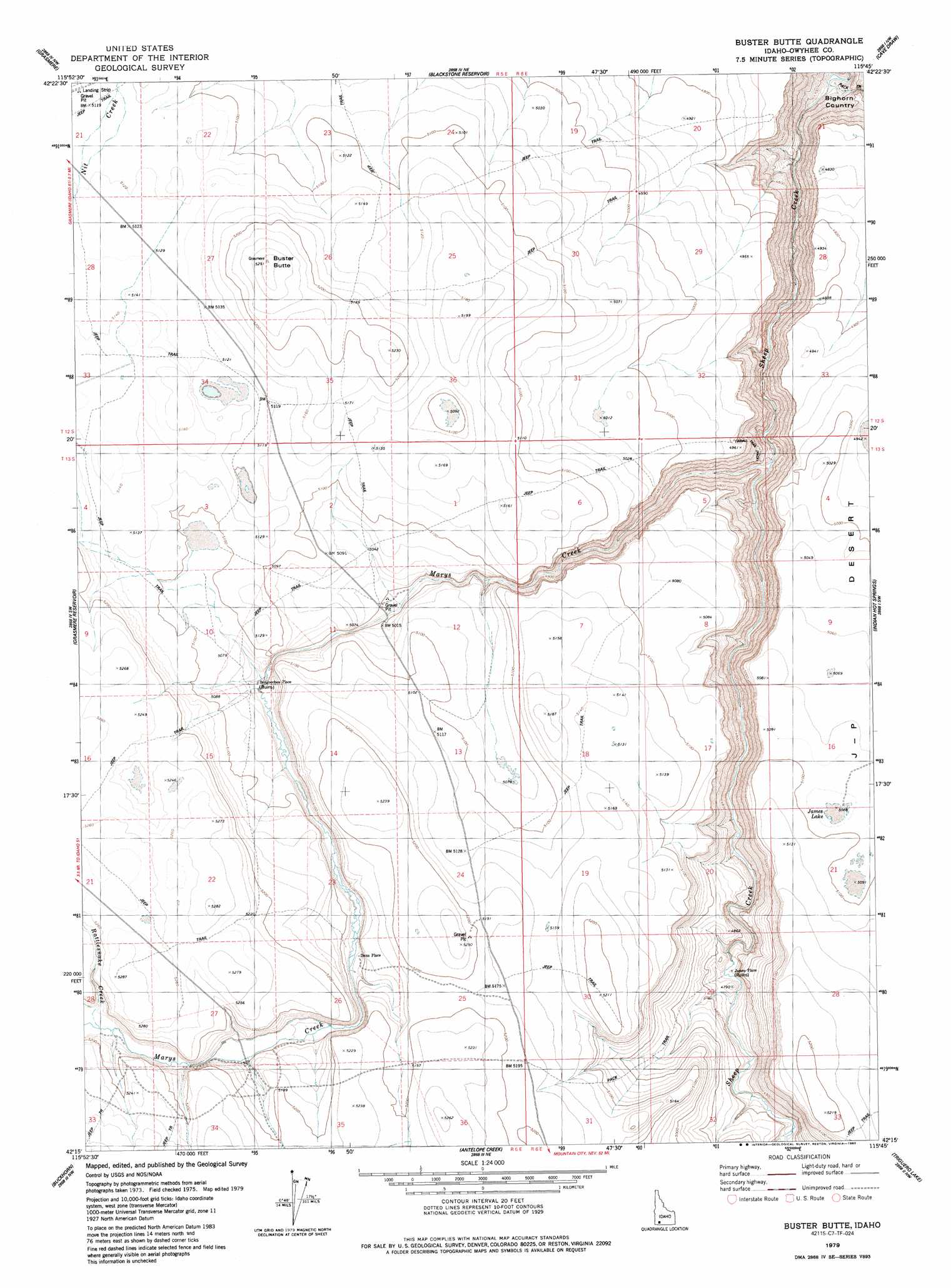
USGS Topo Quad 42115c7 - 1:24,000 scale
| Topo Map Name: | Buster Butte |
| USGS Topo Quad ID: | 42115c7 |
| Print Size: | ca. 21 1/4" wide x 27" high |
| Southeast Coordinates: | 42.25° N latitude / 115.75° W longitude |
| Map Center Coordinates: | 42.3125° N latitude / 115.8125° W longitude |
| U.S. State: | ID |
| Filename: | o42115c7.jpg |
| Download Map JPG Image: | Buster Butte topo map 1:24,000 scale |
| Map Type: | Topographic |
| Topo Series: | 7.5´ |
| Map Scale: | 1:24,000 |
| Source of Map Images: | United States Geological Survey (USGS) |
| Alternate Map Versions: |
Buster Butte ID 1979, updated 1985 Download PDF Buy paper map Buster Butte ID 2010 Download PDF Buy paper map Buster Butte ID 2013 Download PDF Buy paper map |
1:24,000 Topo Quads surrounding Buster Butte
Hill Pasture |
Wickahoney Crossing |
Table Butte |
Austin Butte |
Winter Camp |
Wickahoney Point |
Grasmere |
Blackstone Reservoir |
Cave Draw |
Stiff Tree Draw |
Little Blue Table |
Grasmere Reservoir |
Buster Butte |
Indian Hot Springs |
Inside Lakes |
Riddle |
Buckhorn |
Antelope Creek |
Triguero Lake |
The Arch |
Three Forks |
Indian Hay Meadows |
Black Leg Creek |
Triplet Butte |
Cowan Reservoir |
> Back to 42115a1 at 1:100,000 scale
> Back to 42114a1 at 1:250,000 scale
> Back to U.S. Topo Maps home
Buster Butte topo map: Gazetteer
Buster Butte: Lakes
James Lake elevation 1551m 5088′Buster Butte: Populated Places
Bengoechea Place elevation 1527m 5009′Dans Place elevation 1547m 5075′
James Place elevation 1537m 5042′
Buster Butte: Streams
Marys Creek elevation 1354m 4442′Marys Creek elevation 1354m 4442′
Rattlesnake Creek elevation 1563m 5127′
Buster Butte: Summits
Buster Butte elevation 1613m 5291′Buster Butte: Trails
Tindall Trail elevation 1433m 4701′Buster Butte digital topo map on disk
Buy this Buster Butte topo map showing relief, roads, GPS coordinates and other geographical features, as a high-resolution digital map file on DVD: