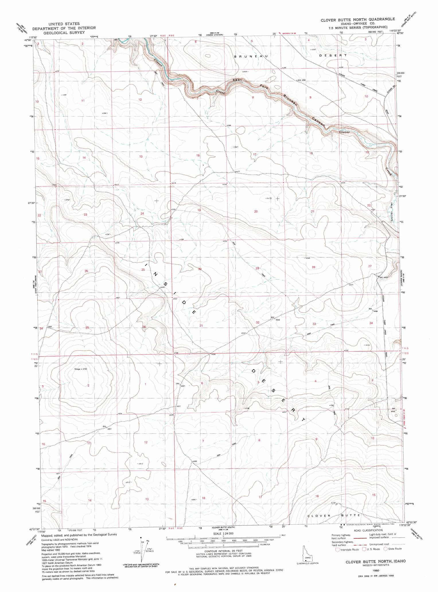
Clover Butte North Topo Map Idaho
To zoom in, hover over the map of Clover Butte North
USGS Topo Quad 42115d4 - 1:24,000 scale
| Topo Map Name: | Clover Butte North |
| USGS Topo Quad ID: | 42115d4 |
| Print Size: | ca. 21 1/4" wide x 27" high |
| Southeast Coordinates: | 42.375° N latitude / 115.375° W longitude |
| Map Center Coordinates: | 42.4375° N latitude / 115.4375° W longitude |
| U.S. State: | ID |
| Filename: | o42115d4.jpg |
| Download Map JPG Image: | Clover Butte North topo map 1:24,000 scale |
| Map Type: | Topographic |
| Topo Series: | 7.5´ |
| Map Scale: | 1:24,000 |
| Source of Map Images: | United States Geological Survey (USGS) |
| Alternate Map Versions: |
Clover Butte North ID 1980, updated 1980 Download PDF Buy paper map Clover Butte North ID 2010 Download PDF Buy paper map Clover Butte North ID 2013 Download PDF Buy paper map |
1:24,000 Topo Quads surrounding Clover Butte North
Crowbar Gulch |
Pot Hole Butte |
Black Butte West |
Black Butte East |
Notch Butte |
Austin Butte |
Winter Camp |
Hodge Station |
Crows Nest Butte |
Crows Nest |
Cave Draw |
Stiff Tree Draw |
Clover Butte North |
Juniper Ranch |
Horse Butte |
Indian Hot Springs |
Inside Lakes |
Clover Butte South |
Juniper Butte |
Coonskin Butte |
Triguero Lake |
The Arch |
Poison Butte |
Mosquito Lake Butte |
Salls Crossing |
> Back to 42115a1 at 1:100,000 scale
> Back to 42114a1 at 1:250,000 scale
> Back to U.S. Topo Maps home
Clover Butte North topo map: Gazetteer
Clover Butte North: Flats
Clover Flat elevation 1284m 4212′Clover Butte North: Summits
Clover Butte elevation 1574m 5164′Clover Butte North digital topo map on disk
Buy this Clover Butte North topo map showing relief, roads, GPS coordinates and other geographical features, as a high-resolution digital map file on DVD: