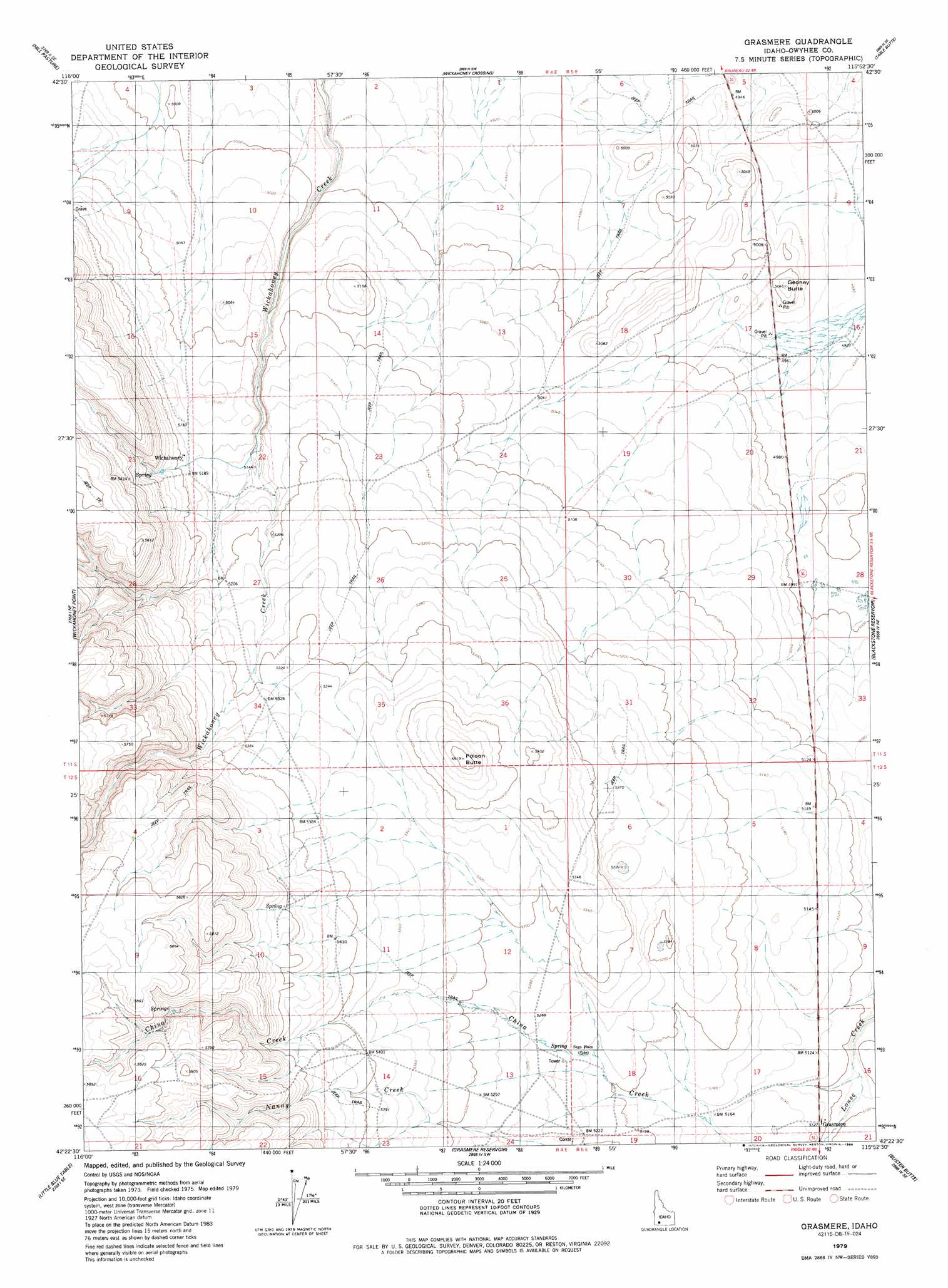
Grasmere Topo Map Idaho
To zoom in, hover over the map of Grasmere
USGS Topo Quad 42115d8 - 1:24,000 scale
| Topo Map Name: | Grasmere |
| USGS Topo Quad ID: | 42115d8 |
| Print Size: | ca. 21 1/4" wide x 27" high |
| Southeast Coordinates: | 42.375° N latitude / 115.875° W longitude |
| Map Center Coordinates: | 42.4375° N latitude / 115.9375° W longitude |
| U.S. State: | ID |
| Filename: | o42115d8.jpg |
| Download Map JPG Image: | Grasmere topo map 1:24,000 scale |
| Map Type: | Topographic |
| Topo Series: | 7.5´ |
| Map Scale: | 1:24,000 |
| Source of Map Images: | United States Geological Survey (USGS) |
| Alternate Map Versions: |
Grasmere ID 1979, updated 1986 Download PDF Buy paper map Grasmere ID 2010 Download PDF Buy paper map Grasmere ID 2013 Download PDF Buy paper map |
1:24,000 Topo Quads surrounding Grasmere
O X Lake |
Big Horse Basin Gap |
Hole In Rock |
Broken Wagon Flat |
Crowbar Gulch |
Sugarloaf |
Hill Pasture |
Wickahoney Crossing |
Table Butte |
Austin Butte |
Turner Table |
Wickahoney Point |
Grasmere |
Blackstone Reservoir |
Cave Draw |
Nichol Flat |
Little Blue Table |
Grasmere Reservoir |
Buster Butte |
Indian Hot Springs |
Flying H Ranch |
Riddle |
Buckhorn |
Antelope Creek |
Triguero Lake |
> Back to 42115a1 at 1:100,000 scale
> Back to 42114a1 at 1:250,000 scale
> Back to U.S. Topo Maps home
Grasmere topo map: Gazetteer
Grasmere: Populated Places
Grasmere elevation 1551m 5088′Wickahoney elevation 1573m 5160′
Grasmere: Summits
Gedney Butte elevation 1538m 5045′Poison Butte elevation 1682m 5518′
Grasmere digital topo map on disk
Buy this Grasmere topo map showing relief, roads, GPS coordinates and other geographical features, as a high-resolution digital map file on DVD: