Austin Butte Topo Map Idaho
To zoom in, hover over the map of Austin Butte
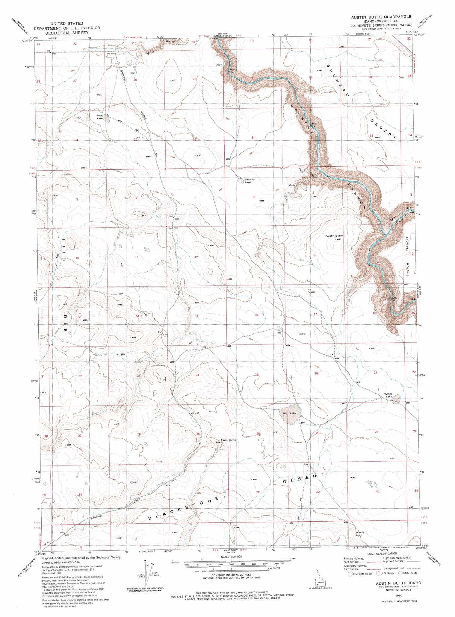
USGS Topo Quad 42115e6 - 1:24,000 scale
| Topo Map Name: | Austin Butte |
| USGS Topo Quad ID: | 42115e6 |
| Print Size: | ca. 21 1/4" wide x 27" high |
| Southeast Coordinates: | 42.5° N latitude / 115.625° W longitude |
| Map Center Coordinates: | 42.5625° N latitude / 115.6875° W longitude |
| U.S. State: | ID |
| Filename: | o42115e6.jpg |
| Download Map JPG Image: | Austin Butte topo map 1:24,000 scale |
| Map Type: | Topographic |
| Topo Series: | 7.5´ |
| Map Scale: | 1:24,000 |
| Source of Map Images: | United States Geological Survey (USGS) |
| Alternate Map Versions: |
Austin Butte ID 1980, updated 1980 Download PDF Buy paper map Austin Butte ID 2010 Download PDF Buy paper map Austin Butte ID 2013 Download PDF Buy paper map |
1:24,000 Topo Quads surrounding Austin Butte
Little Valley |
Sugar Valley |
Hot Spring |
Pence Butte |
Pot Hole Canyon |
Hole In Rock |
Broken Wagon Flat |
Crowbar Gulch |
Pot Hole Butte |
Black Butte West |
Wickahoney Crossing |
Table Butte |
Austin Butte |
Winter Camp |
Hodge Station |
Grasmere |
Blackstone Reservoir |
Cave Draw |
Stiff Tree Draw |
Clover Butte North |
Grasmere Reservoir |
Buster Butte |
Indian Hot Springs |
Inside Lakes |
Clover Butte South |
> Back to 42115e1 at 1:100,000 scale
> Back to 42114a1 at 1:250,000 scale
> Back to U.S. Topo Maps home
Austin Butte topo map: Gazetteer
Austin Butte: Cliffs
Windy Point elevation 1305m 4281′Austin Butte: Lakes
Big Lake elevation 1247m 4091′Rock Lake elevation 1163m 3815′
Salvador Lake elevation 1181m 3874′
White Lake elevation 1237m 4058′
Austin Butte: Streams
Clover Creek elevation 981m 3218′Austin Butte: Summits
Austin Butte elevation 1245m 4084′Twin Butte elevation 1306m 4284′
Austin Butte: Valleys
East Fork Bruneau Canyon elevation 980m 3215′Austin Butte digital topo map on disk
Buy this Austin Butte topo map showing relief, roads, GPS coordinates and other geographical features, as a high-resolution digital map file on DVD: