Glenns Ferry Topo Map Idaho
To zoom in, hover over the map of Glenns Ferry
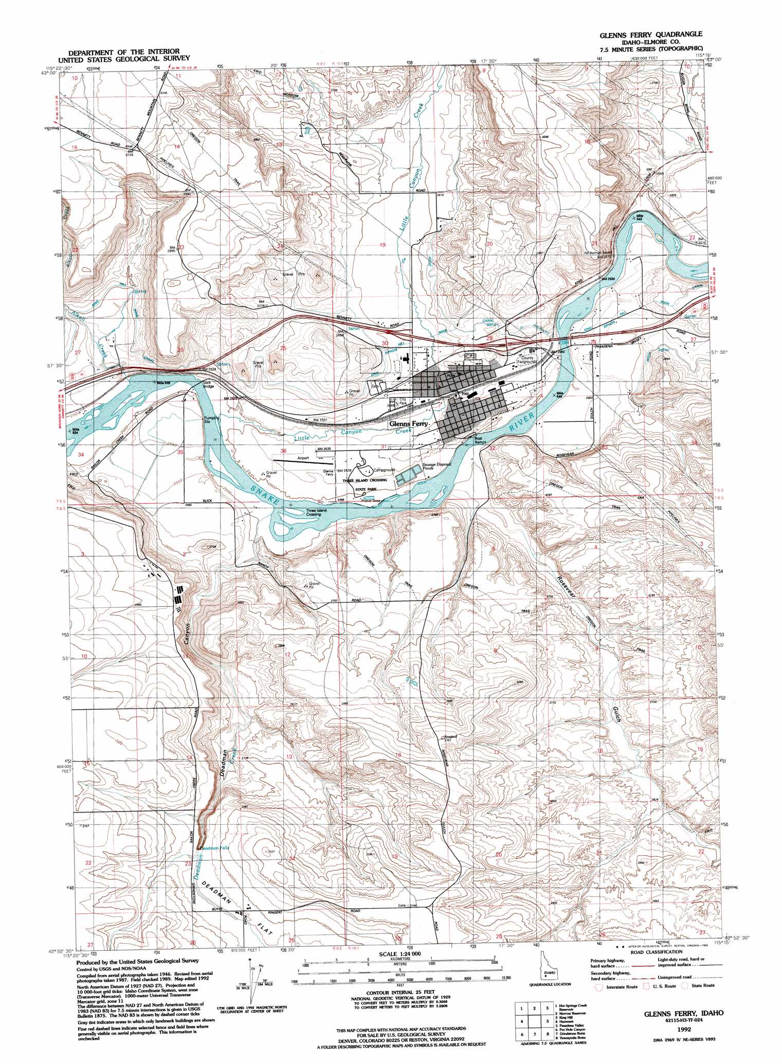
USGS Topo Quad 42115h3 - 1:24,000 scale
| Topo Map Name: | Glenns Ferry |
| USGS Topo Quad ID: | 42115h3 |
| Print Size: | ca. 21 1/4" wide x 27" high |
| Southeast Coordinates: | 42.875° N latitude / 115.25° W longitude |
| Map Center Coordinates: | 42.9375° N latitude / 115.3125° W longitude |
| U.S. State: | ID |
| Filename: | o42115h3.jpg |
| Download Map JPG Image: | Glenns Ferry topo map 1:24,000 scale |
| Map Type: | Topographic |
| Topo Series: | 7.5´ |
| Map Scale: | 1:24,000 |
| Source of Map Images: | United States Geological Survey (USGS) |
| Alternate Map Versions: |
Glenns Ferry ID 1947, updated 1968 Download PDF Buy paper map Glenns Ferry ID 1947, updated 1975 Download PDF Buy paper map Glenns Ferry ID 1948 Download PDF Buy paper map Glenns Ferry ID 1992, updated 1992 Download PDF Buy paper map Glenns Ferry ID 2010 Download PDF Buy paper map Glenns Ferry ID 2013 Download PDF Buy paper map |
1:24,000 Topo Quads surrounding Glenns Ferry
Teapot Dome |
Bennett Mountain |
Goodman Flat |
Deer Haven Mountain |
Dempsey Meadows |
Reverse |
Hot Springs Creek Reservoir |
Morrow Reservoir |
King Hill |
Hog Creek |
Indian Cove |
Hammett |
Glenns Ferry |
Pasadena Valley |
Ticeska |
Pence Butte |
Pot Hole Canyon |
Grindstone Butte |
Twentymile Butte |
Indian Butte |
Pot Hole Butte |
Black Butte West |
Black Butte East |
Notch Butte |
Crows Nest Ne |
> Back to 42115e1 at 1:100,000 scale
> Back to 42114a1 at 1:250,000 scale
> Back to U.S. Topo Maps home
Glenns Ferry topo map: Gazetteer
Glenns Ferry: Airports
Glenns Ferry Municipal Airport elevation 772m 2532′Glenns Ferry: Bridges
Slick Bridge elevation 755m 2477′Glenns Ferry: Crossings
Three Island Crossing elevation 759m 2490′Glenns Ferry: Falls
Deadman Falls elevation 886m 2906′Glenns Ferry: Flats
Deadman Flat elevation 903m 2962′Glenns Ferry: Lakes
Indian Hole Pond elevation 761m 2496′Glenns Ferry: Parks
Three Island Crossing State Park elevation 760m 2493′Three Island State Park elevation 835m 2739′
Glenns Ferry: Populated Places
Glenns Ferry elevation 783m 2568′Glenns Ferry: Streams
Alkali Creek elevation 758m 2486′Deadman Creek elevation 759m 2490′
Little Canyon Creek elevation 755m 2477′
Glenns Ferry: Valleys
Deadman Canyon elevation 769m 2522′Rosevear Gulch elevation 767m 2516′
Glenns Ferry digital topo map on disk
Buy this Glenns Ferry topo map showing relief, roads, GPS coordinates and other geographical features, as a high-resolution digital map file on DVD: