Hammett Topo Map Idaho
To zoom in, hover over the map of Hammett
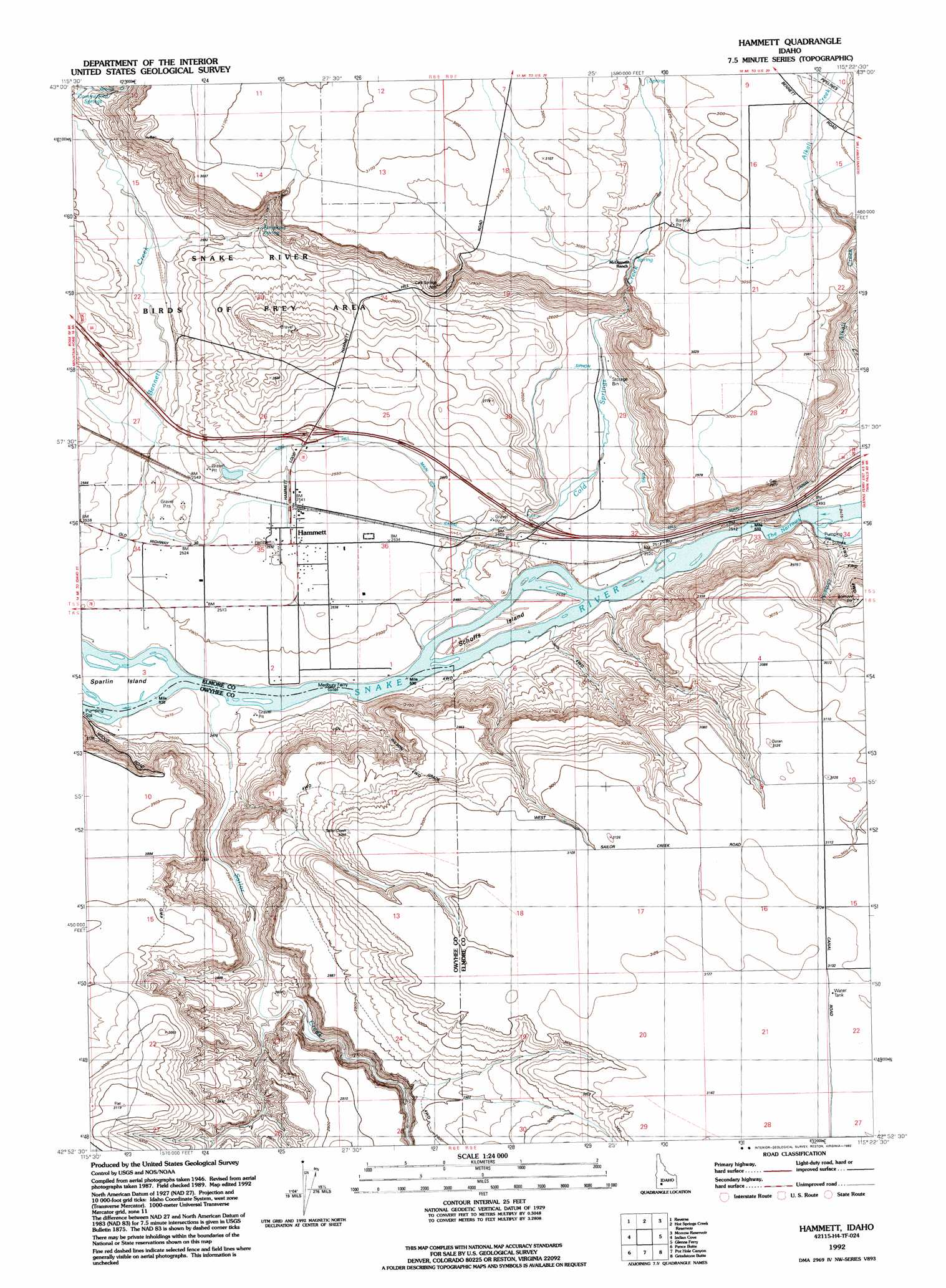
USGS Topo Quad 42115h4 - 1:24,000 scale
| Topo Map Name: | Hammett |
| USGS Topo Quad ID: | 42115h4 |
| Print Size: | ca. 21 1/4" wide x 27" high |
| Southeast Coordinates: | 42.875° N latitude / 115.375° W longitude |
| Map Center Coordinates: | 42.9375° N latitude / 115.4375° W longitude |
| U.S. State: | ID |
| Filename: | o42115h4.jpg |
| Download Map JPG Image: | Hammett topo map 1:24,000 scale |
| Map Type: | Topographic |
| Topo Series: | 7.5´ |
| Map Scale: | 1:24,000 |
| Source of Map Images: | United States Geological Survey (USGS) |
| Alternate Map Versions: |
Hammett ID 1947, updated 1966 Download PDF Buy paper map Hammett ID 1947, updated 1975 Download PDF Buy paper map Hammett ID 1948 Download PDF Buy paper map Hammett ID 1992, updated 1992 Download PDF Buy paper map Hammett ID 2010 Download PDF Buy paper map Hammett ID 2013 Download PDF Buy paper map |
1:24,000 Topo Quads surrounding Hammett
Mountain Home North |
Teapot Dome |
Bennett Mountain |
Goodman Flat |
Deer Haven Mountain |
Mountain Home South |
Reverse |
Hot Springs Creek Reservoir |
Morrow Reservoir |
King Hill |
Bruneau Dunes |
Indian Cove |
Hammett |
Glenns Ferry |
Pasadena Valley |
Hot Spring |
Pence Butte |
Pot Hole Canyon |
Grindstone Butte |
Twentymile Butte |
Crowbar Gulch |
Pot Hole Butte |
Black Butte West |
Black Butte East |
Notch Butte |
> Back to 42115e1 at 1:100,000 scale
> Back to 42114a1 at 1:250,000 scale
> Back to U.S. Topo Maps home
Hammett topo map: Gazetteer
Hammett: Channels
The Narrows elevation 752m 2467′Hammett: Islands
Schoffs Island elevation 755m 2477′Sparlin Island elevation 753m 2470′
Hammett: Populated Places
Hammett elevation 773m 2536′Hammett: Springs
Simpkins Spring elevation 822m 2696′Hammett: Streams
Cold Springs Creek elevation 755m 2477′Sailor Creek elevation 752m 2467′
Hammett digital topo map on disk
Buy this Hammett topo map showing relief, roads, GPS coordinates and other geographical features, as a high-resolution digital map file on DVD: