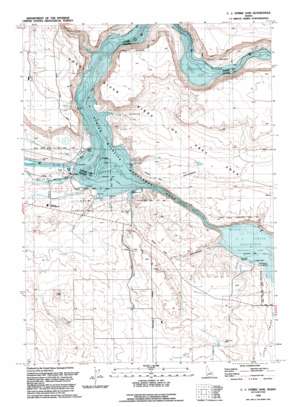
C J Strike Dam Topo Map Idaho
To zoom in, hover over the map of C J Strike Dam
USGS Topo Quad 42115h8 - 1:24,000 scale
| Topo Map Name: | C J Strike Dam |
| USGS Topo Quad ID: | 42115h8 |
| Print Size: | ca. 21 1/4" wide x 27" high |
| Southeast Coordinates: | 42.875° N latitude / 115.875° W longitude |
| Map Center Coordinates: | 42.9375° N latitude / 115.9375° W longitude |
| U.S. State: | ID |
| Filename: | o42115h8.jpg |
| Download Map JPG Image: | C J Strike Dam topo map 1:24,000 scale |
| Map Type: | Topographic |
| Topo Series: | 7.5´ |
| Map Scale: | 1:24,000 |
| Source of Map Images: | United States Geological Survey (USGS) |
| Alternate Map Versions: |
Mouth of Bruneau ID 1946, updated 1967 Download PDF Buy paper map C.J. Strike Dam ID 1946, updated 1979 Download PDF Buy paper map C.J. Strike Dam ID 1946, updated 1986 Download PDF Buy paper map Mouth of Bruneau ID 1949, updated 1949 Download PDF Buy paper map C.J. Strike Dam ID 1992, updated 1992 Download PDF Buy paper map C J Strike Dam ID 2010 Download PDF Buy paper map C J Strike Dam ID 2013 Download PDF Buy paper map |
1:24,000 Topo Quads surrounding C J Strike Dam
> Back to 42115e1 at 1:100,000 scale
> Back to 42114a1 at 1:250,000 scale
> Back to U.S. Topo Maps home
C J Strike Dam topo map: Gazetteer
C J Strike Dam: Channels
Narrows elevation 749m 2457′C J Strike Dam: Dams
C J Strike Dam elevation 750m 2460′C J Strike Dam: Lakes
Borden Lake elevation 755m 2477′C J Strike Dam: Parks
Locust Park elevation 728m 2388′C J Strike Dam: Rapids
Ninefoot Rapids (historical) elevation 749m 2457′C J Strike Dam: Reservoirs
C J Strike Reservoir elevation 750m 2460′C J Strike Dam: Streams
Bruneau River elevation 749m 2457′Canyon Creek elevation 749m 2457′
C J Strike Dam: Valleys
Bruneau Valley elevation 749m 2457′C J Strike Dam digital topo map on disk
Buy this C J Strike Dam topo map showing relief, roads, GPS coordinates and other geographical features, as a high-resolution digital map file on DVD:


